All features
From the evening loop to the trip around the world, piece by piece.
What Pedalglobe can do, by area. Everything is calculated on your device, nothing needs an account. Where Pro is needed, it says so, everything else is free.
Plan
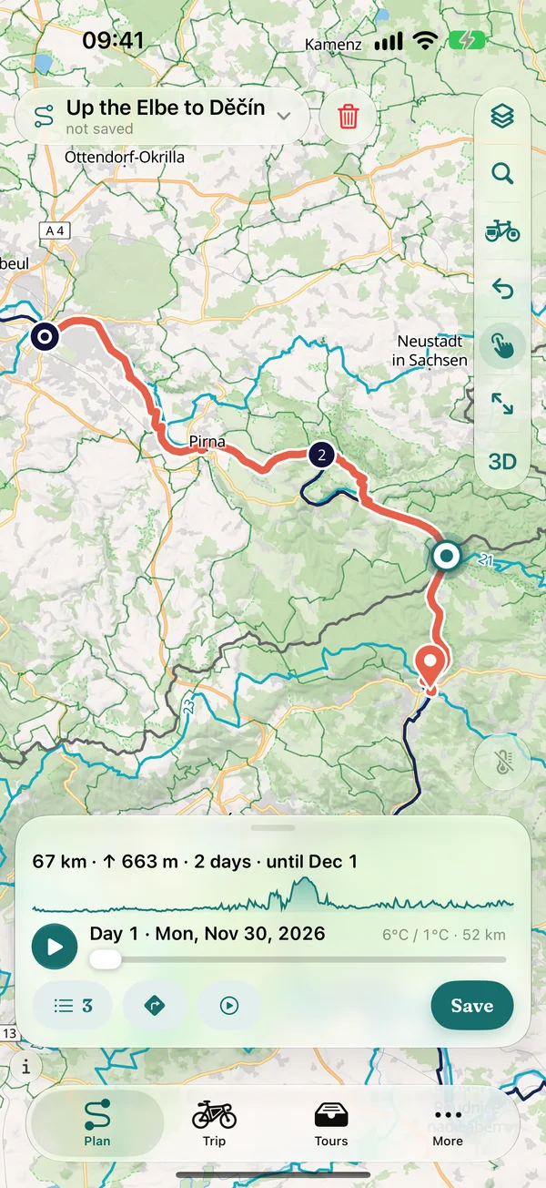
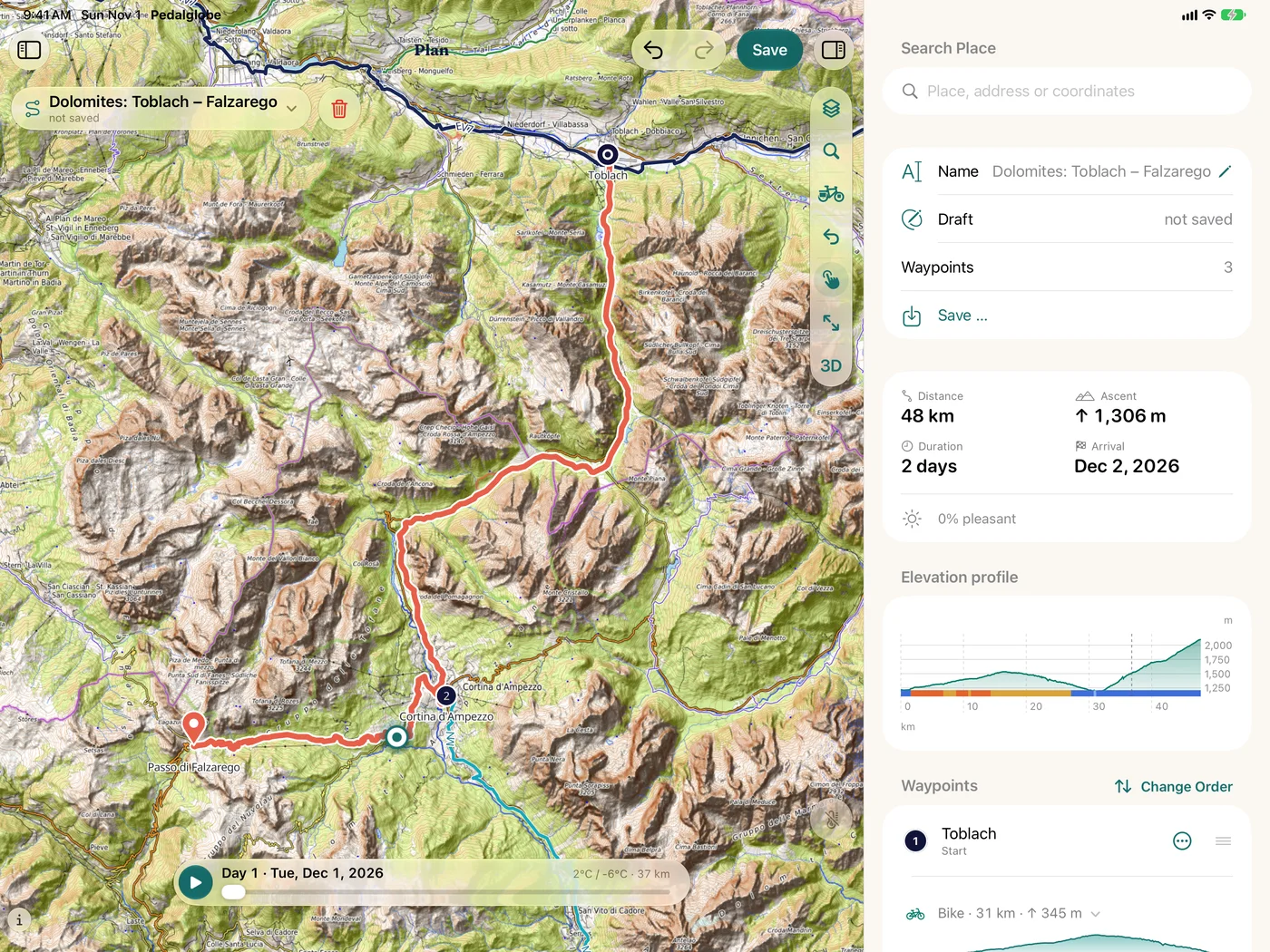
Set start and finish, and Pedalglobe builds the bike route on your device. You see the result with elevation profile and surfaces before you set off.
Building routes
Bike routing worldwide, calculated on your device
- Set start, finish and via points on the globe or map, by tapping or searching, and reorder them
- Routing along cycle paths, long-distance cycle routes and quiet roads, calculated on iPhone, iPad or Mac
- Means of transport per section: bike, train, bus, ferry or plane, so gaps don't stay gaps
- The draft is saved continuously, saving with a name puts it under “Tours”
- Without routing data the app shows an estimated distance with “≈” and offers the download
Bike types and routing options
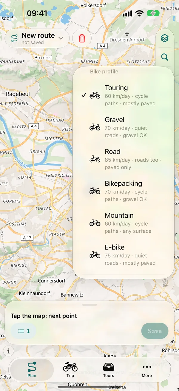
Six bike types, your own options with Pro
- Touring
- Gravel
- Road
- Bikepacking
- Mountain
- E-bike
- Every bike type with its own pace and preferences for ways and surfaces: the road bike stays on asphalt, the mountain bike takes any trail
- The bike applies to the whole trip, with pace and rest days
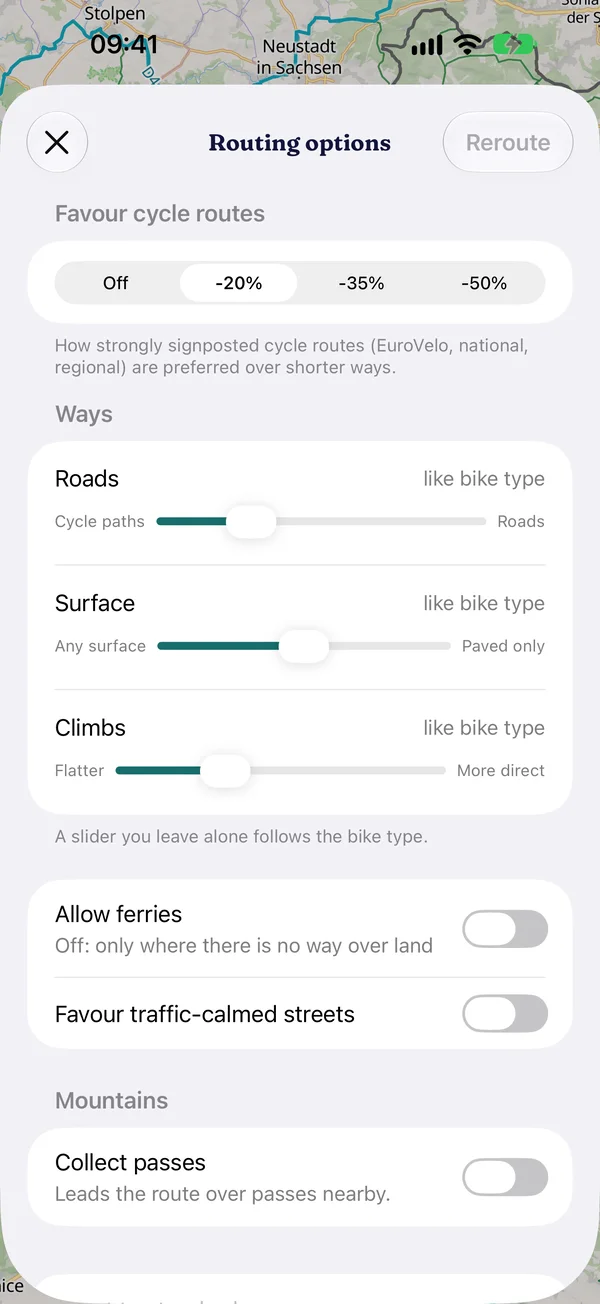
- With Pro: routing options and your own bike types, for example avoid gravel, limit gradients or collect passes (the route leads over passes nearby)
Elevation profile and surfaces
See what's coming before it comes
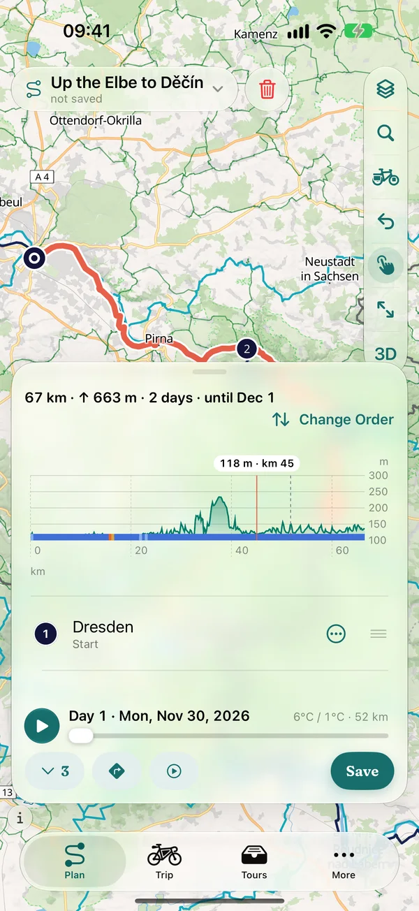
- Elevation profile while planning, also on iPhone: a profile line in the panel, expanded the whole profile with day boundaries
- One tap on the profile shows elevation and kilometre, and the map jumps there
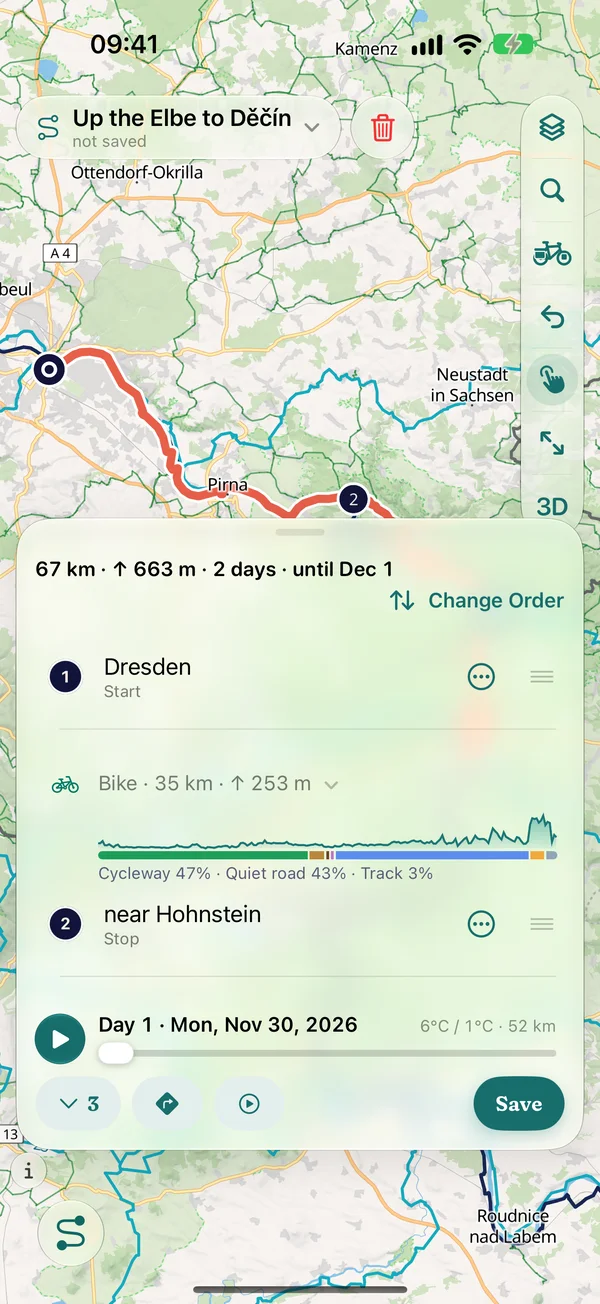
- Surface band under the profile and at every section: asphalt, gravel and path in colours, paving, compacted and loose surfaces with their own patterns, expandable by type of way
- Every climb with length, gradient and metres of ascent, surfaces also for whole trips
- With Pro: gradients in smoothly blended colours on map, elevation profile, navigation and 3D, easy to tell apart with red-green colour blindness too
Variants, search, GPX
Compare, find, take over
- Compare variants: several routes between the same points side by side, with length, ascent, surfaces and climate
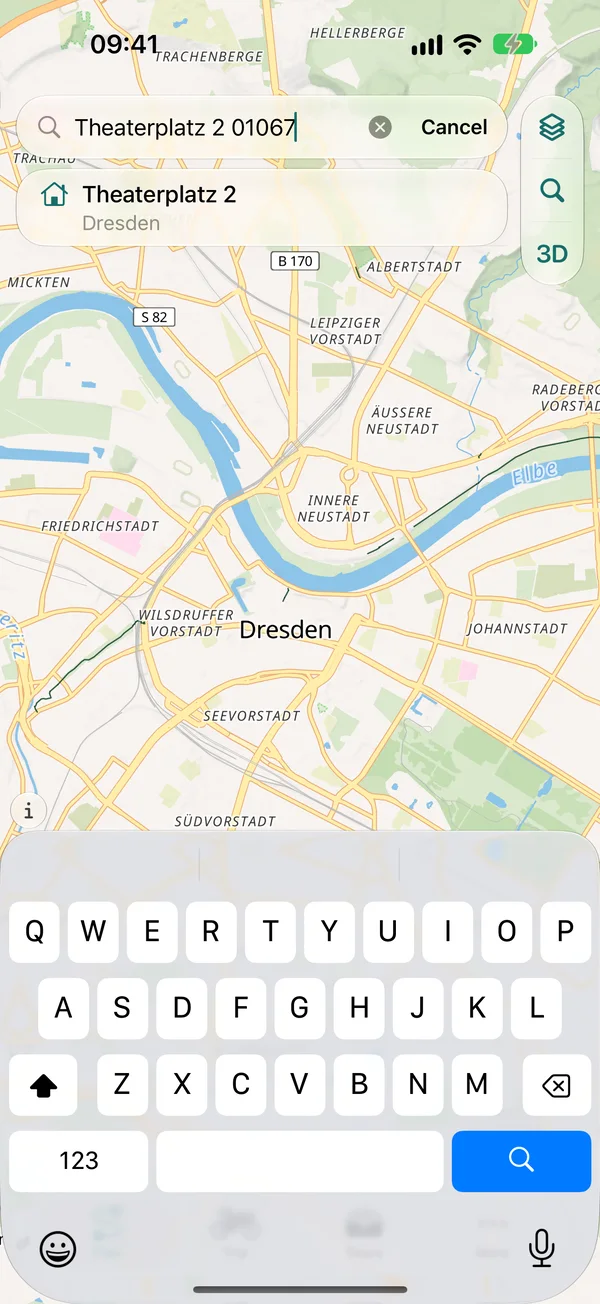
- Search for places, regions, mountains and rivers on your device, also offline. Addresses with house numbers are found by Apple Maps, only when you enter an address
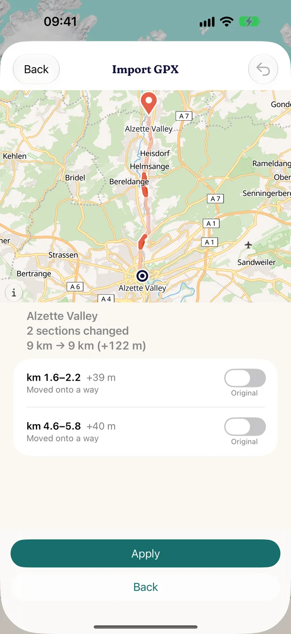
- Import GPX: keep exactly (1:1), match to ways or align to a cycle route nearby, both lines on the map to compare, also several files and multi-day tracks
- Export GPX: the whole route or trip for free, per daily stage with Pro
Climate
Long-term averages instead of gut feeling: how warm, wet and windy will it be on the road, day by day? Not a weather forecast, but the climate of the years 1995–2024 (cloud cover and wind 1981–2010).
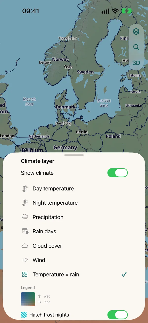
Climate layers and timeline
The world on every day of the year
- Climate map on the globe and on the flat map, over every map type
- Layers: temperature × rain, day temperature, night temperature, precipitation, rain days, cloud cover, wind
- Timeline across the year with playback, frost nights and heavy rain hatched
- Climate works offline, the data is built into the app
Climate limits and departure window
Your limits, your best start
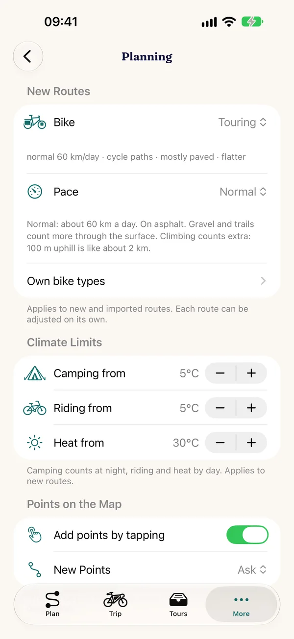
- Every day of your trip is rated against your limits: temperature for cycling, temperature for camping at night, heat from, adjustable under “More › Planning › Climate Limits”
- Share of pleasant days per route and trip, with the difficult days in the day list
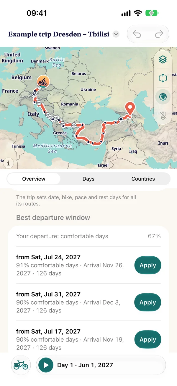
- Best departure window: for every departure week, Pedalglobe works out how many days would be pleasant and shows the best weeks
- Climate per day in the trip, at the section and in “Today”
- “Climate along the way” follows your finger, and the map shows the place
Trips
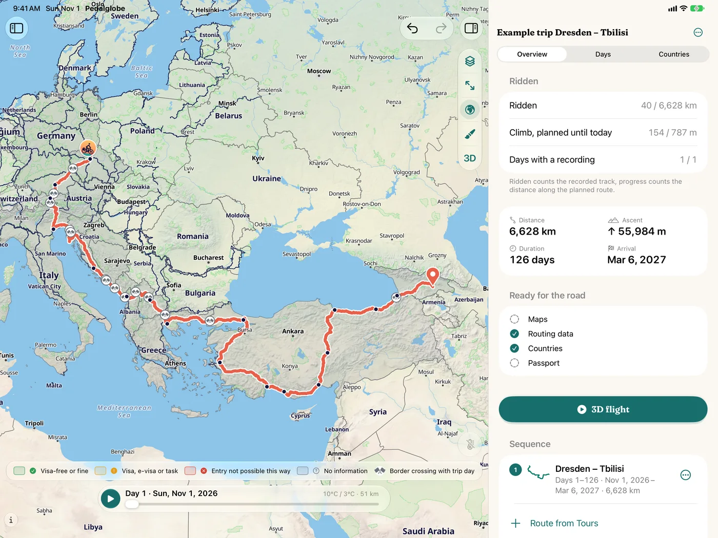
Routes become a trip: with daily stages, rest days, connections and everything that lives together under “Tours”.
Daily stages and rest days
One trip, many routes
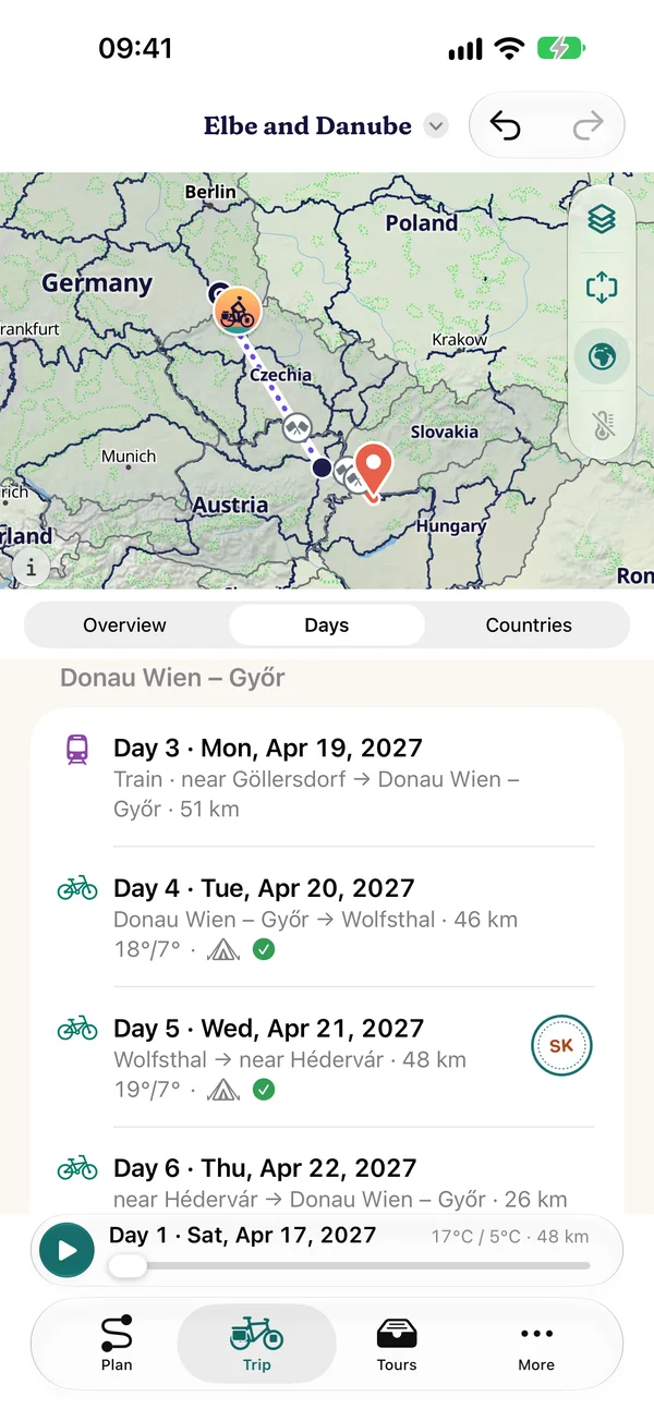
- Combine routes into a trip, change the order, reverse routes
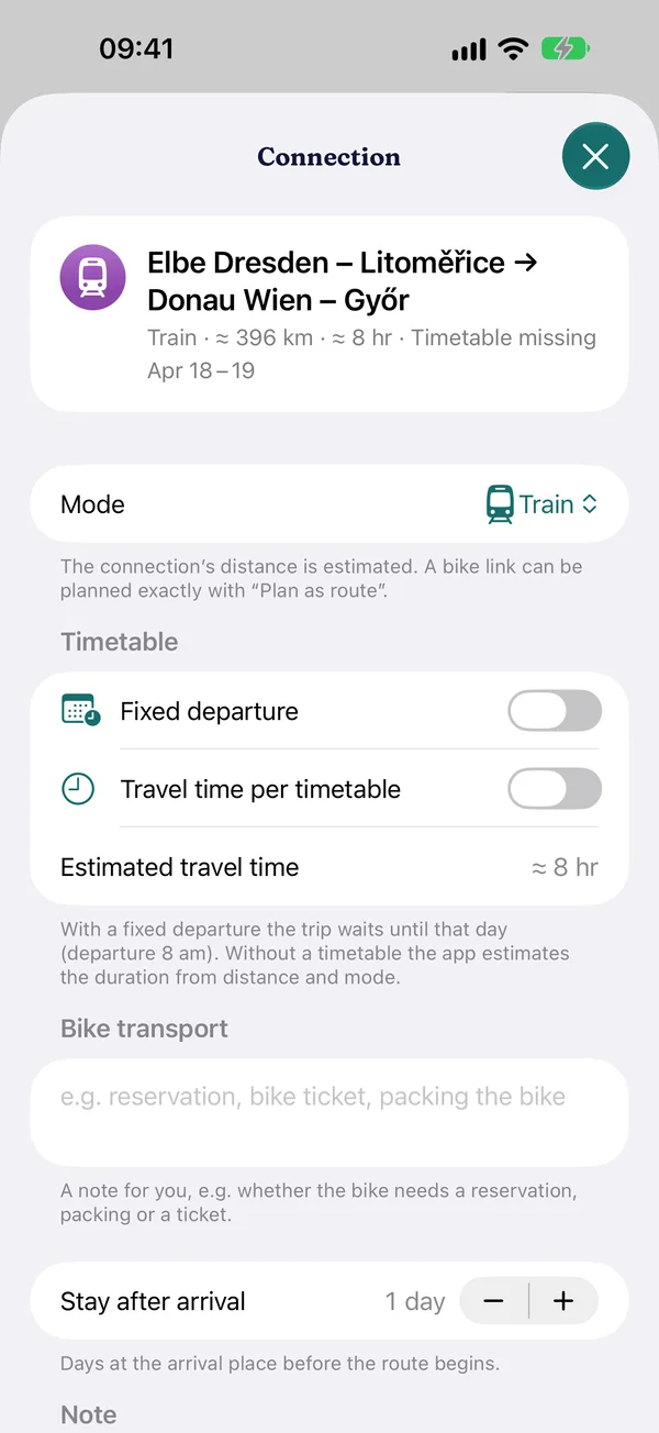
- Daily stages from pace and bike, rest days and stays per place, “Continue no earlier than” for fixed dates
- Connections between routes by train, bus, ferry or plane, with timetable anchor and gap hint
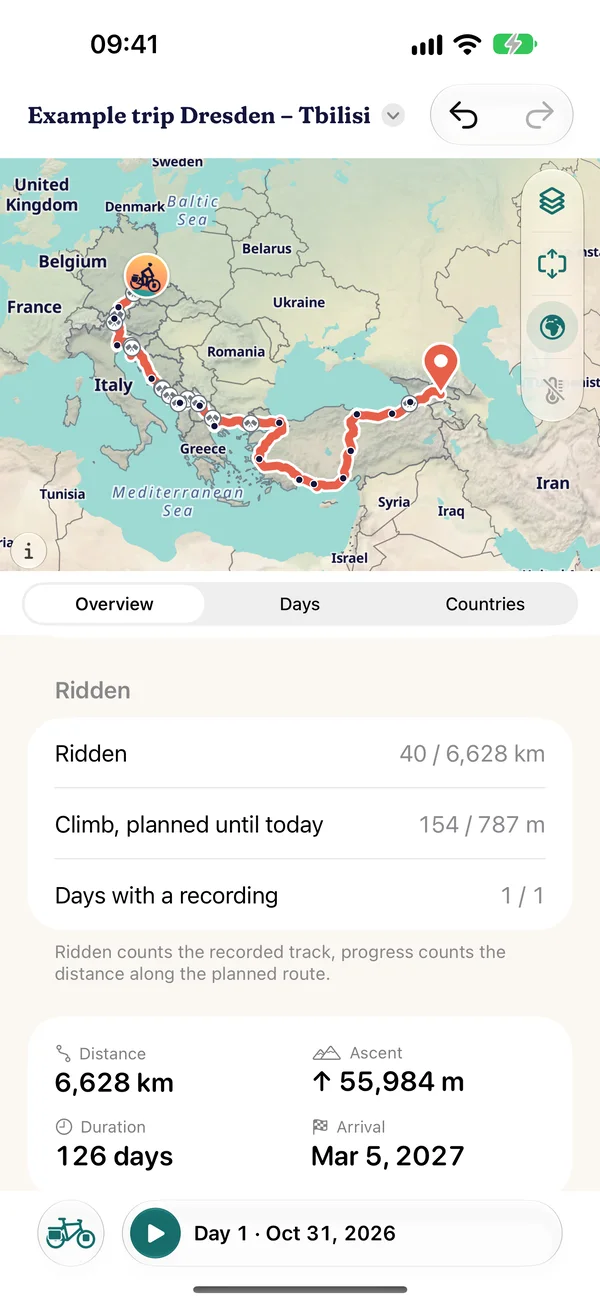
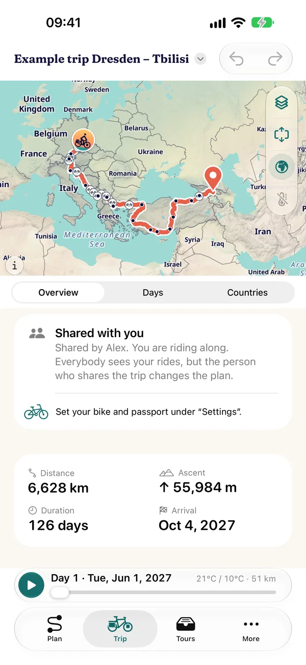
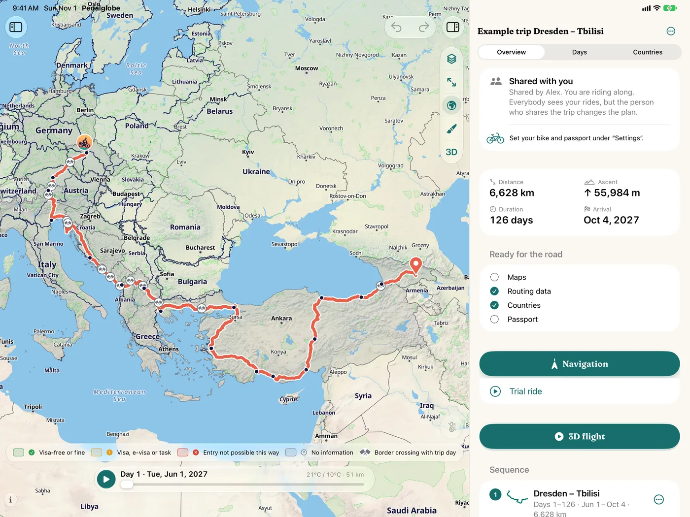
- Overview with distance, ascent, duration and arrival, days with climate and the stamps of the countries
Tours
Everything saved in one place
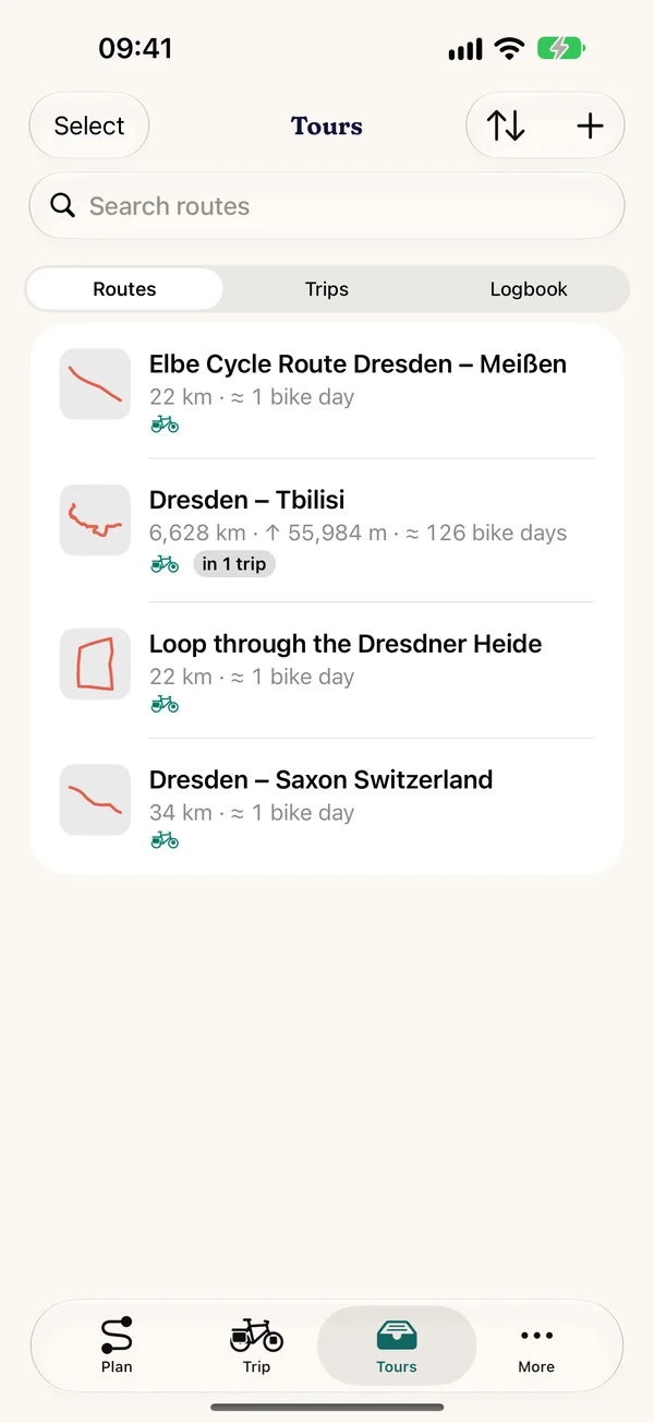
- Routes, trips and the logbook under “Tours”, with search and filter, multiple selection for new trips
- Your rides as entries in the logbook: save as a route, share as GPX, delete
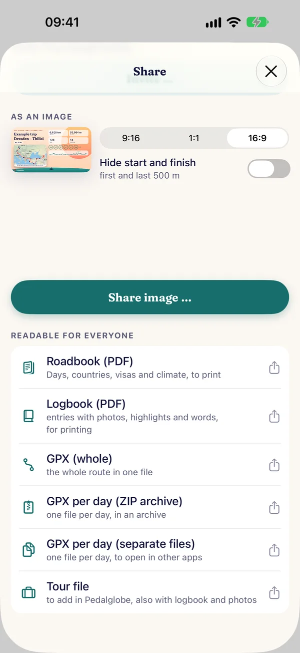
- Through “Share”: GPX of the whole route or trip, with Pro GPX per day and a roadbook as PDF
- Recently Deleted: restore within 30 days
Countries and visas
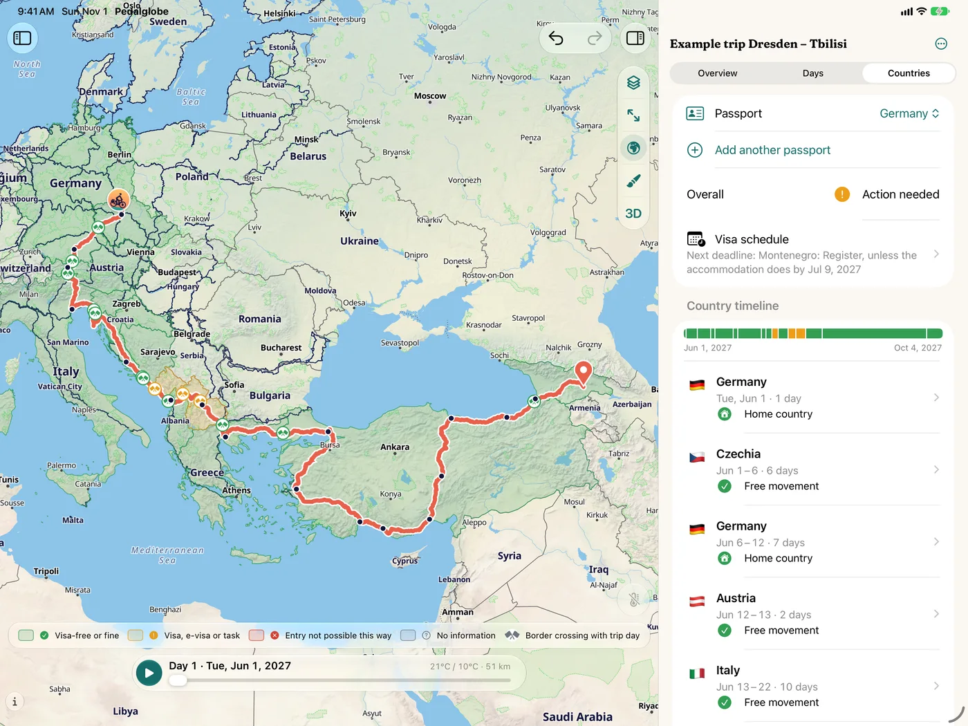
What applies at the next border? For more than 180 destinations worldwide, about 600 rules from official sources, each with source and check date.
Entry and stay
Warning levels for every country of the trip
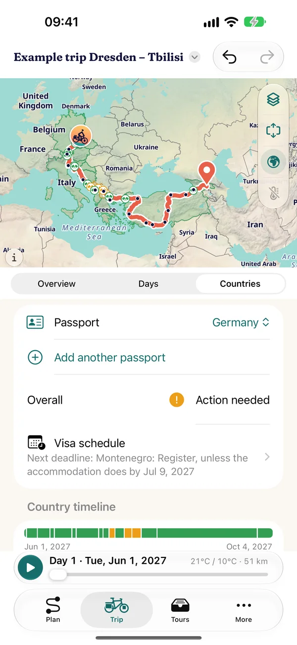
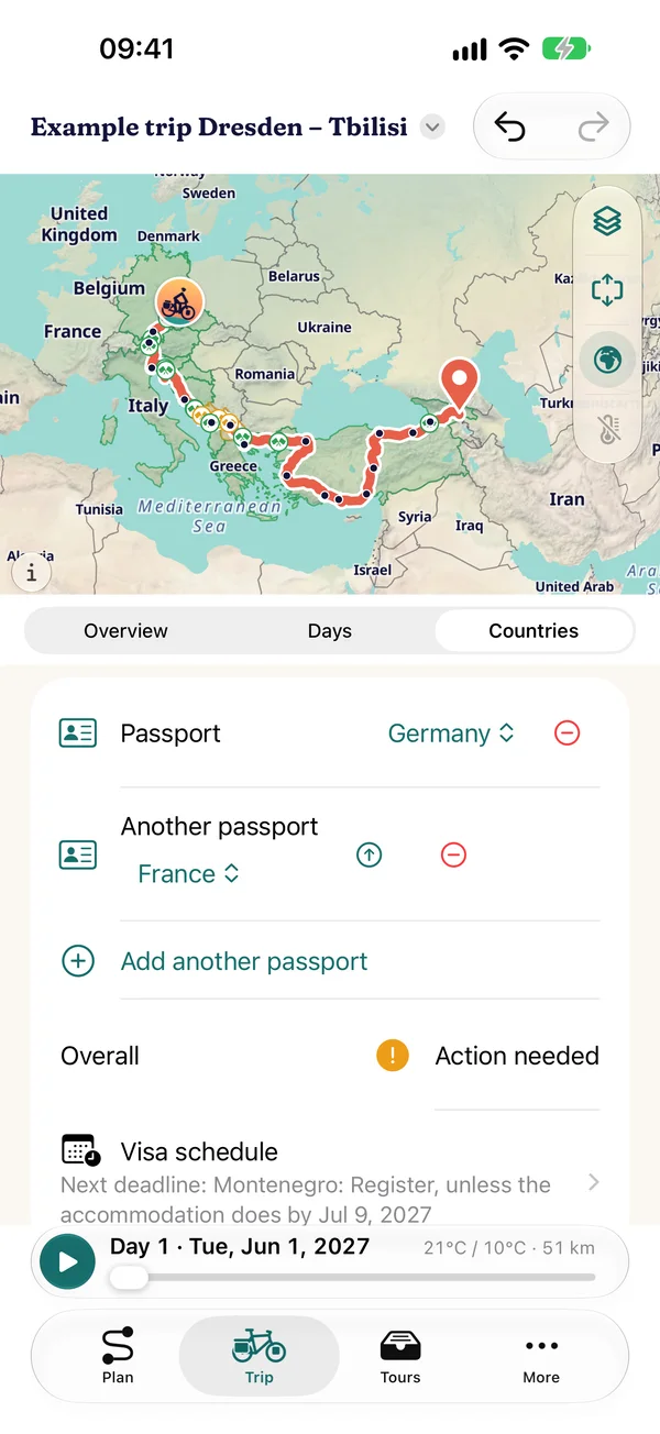
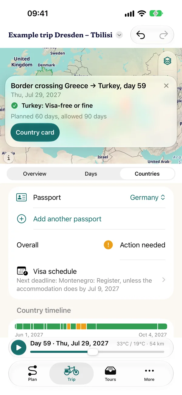
- Three levels per country: visa-free or fine, visa, e-visa or task, entry not possible this way, plus “no information” where we are still checking
- Permitted length of stay against the planned days, country timeline and visa schedule with deadlines as a calendar file
- Border crossings with trip day on the map and in the day list
- For EU, Swiss, Norwegian, UK, US and Canadian passports, partly Australian and New Zealand. Several passports at once, with links to the foreign ministries
Country information
The essentials for every country
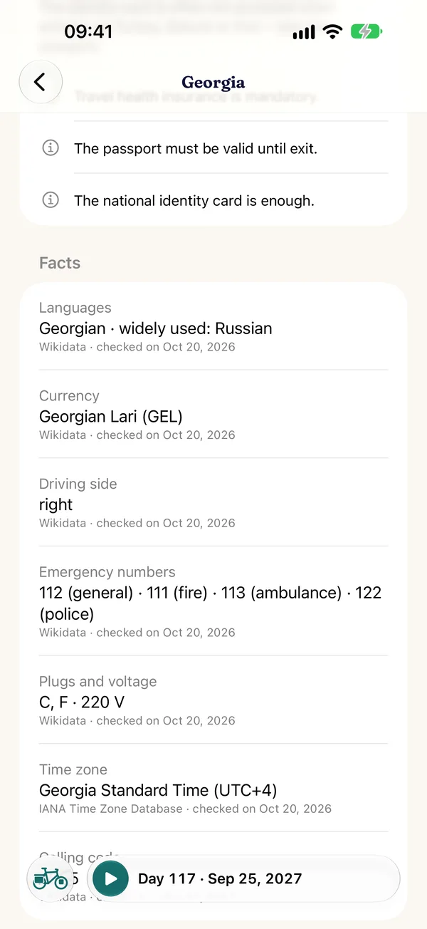
- Languages, currency, emergency numbers, plugs, time zone, driving side and links to official bodies for more than 200 countries and territories
- Countries on the map coloured by entry rules, with an expandable legend
- All offline, the data is built into the app and delivered checked with updates
Every entry names its source and date. No guarantee, only the authorities of the destination country are binding.
On the road
Navigation with voice guidance, the recording of your ride and the travel mode “Today”, which brings plan and reality together.
Navigation
Turn by turn to your destination
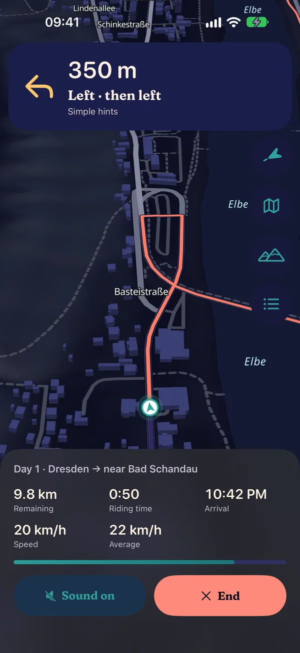
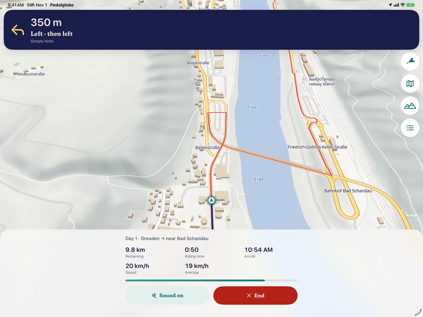
- Turn-by-turn directions with voice guidance in eleven languages, mute with one tap
- “Navigation” as a fixed button on the route and at the top of “Today”
- Tilted map facing your direction of travel with relief and buildings, a calm camera without jumps, dark at night
- “Overview” shows the whole remaining route and returns with one tap, “Profile” the elevation profile with surfaces and the next climbs
- Keeps running while your iPhone is locked, with the next turn on the lock screen
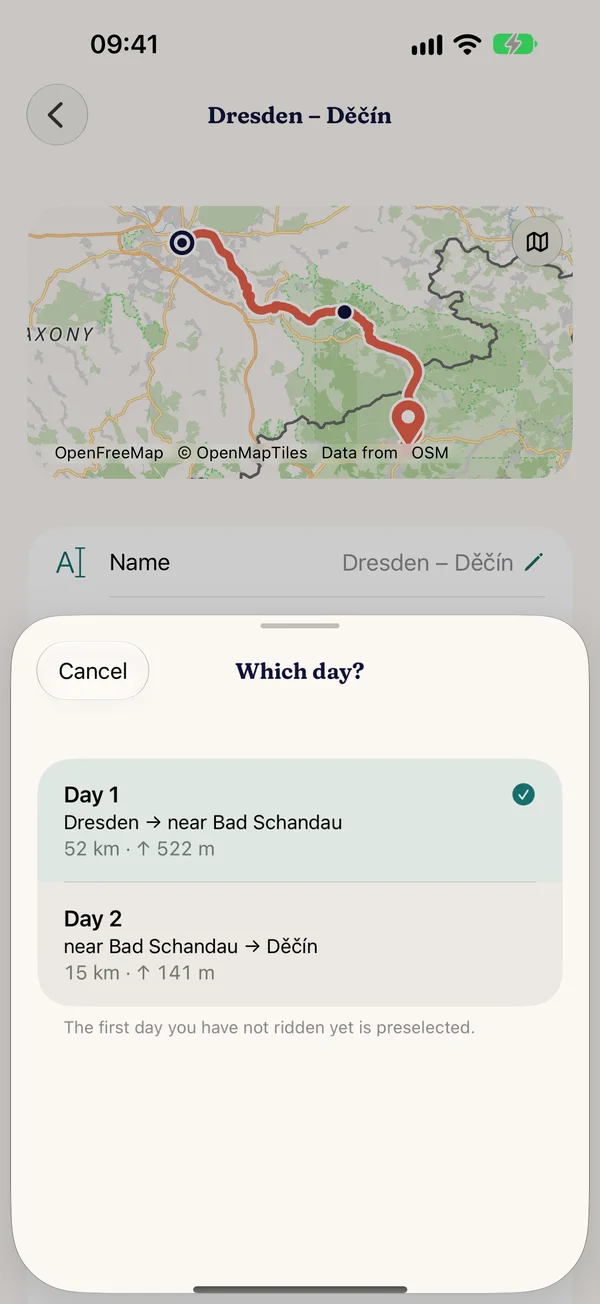
- Day by day through your stages: a one-day tour starts straight away, for several days you pick the day, with the first one not yet ridden preselected. In a trip you start each day on its own, and after you arrive you carry on with the next day
- Picks up where you were after a crash. Start with a fixed button on the route, at the top of “Today” or straight from the planner
- Routes with intermediate destinations keep their turns and street names, and arrival works via a side street too
- Trial ride: play through the navigation without location
Recording and “Today”
Plan vs. actual, day by day
- “Record track” stores every navigation as a ridden track with times and elevation, on your device and encrypted in your iCloud
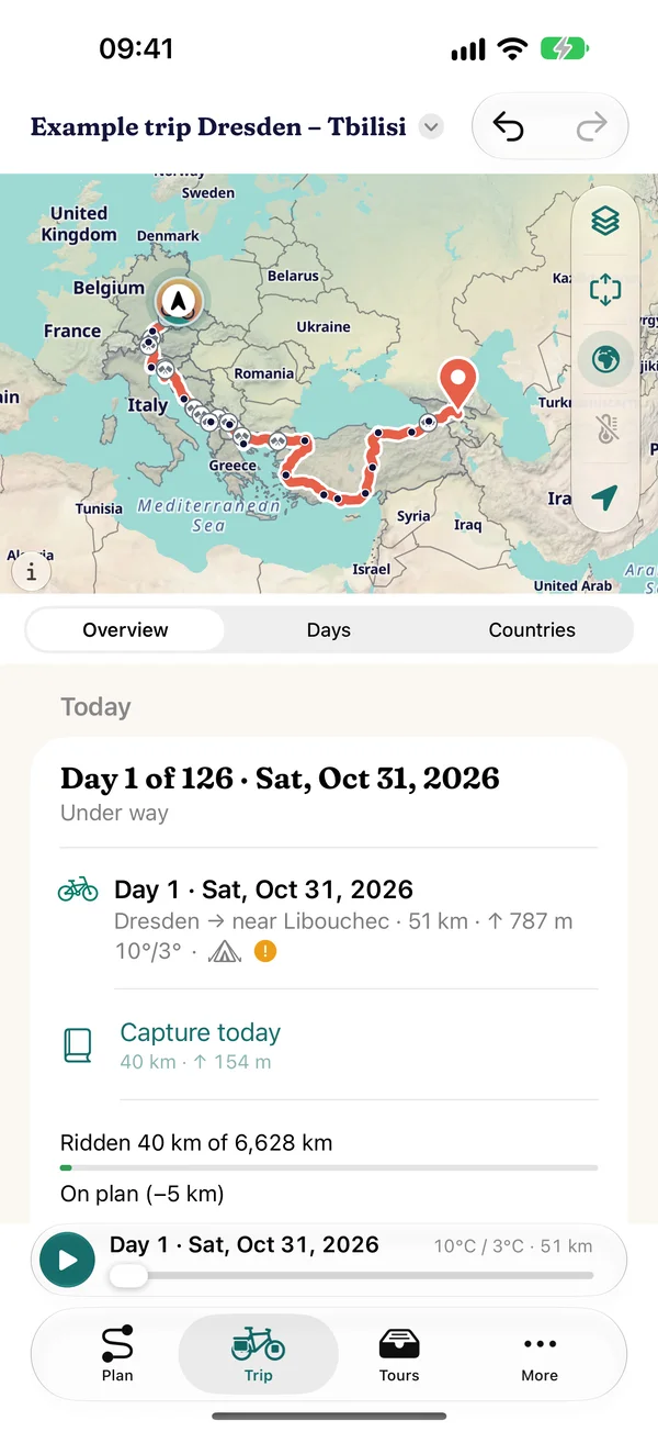
- Travel mode “Today”: stage of the day, ridden against planned, visa countdown, next border crossing
- Ridden track on the trip map next to the plan, actual values in the days and the overview
- “Re-plan from today”: the rest of the trip is recalculated from where you are, with preview and undo
- Stamps of the countries and passes you have really ridden
Sharing and logbook
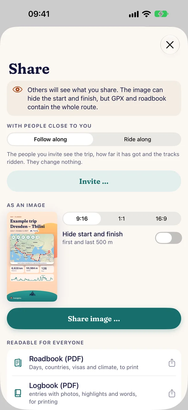
What you have ridden gathers in the logbook. You share through iCloud with people close to you, as an image for your status and story, as a PDF or as a tour file. All of it is free.
Logbook
Every ride becomes an entry
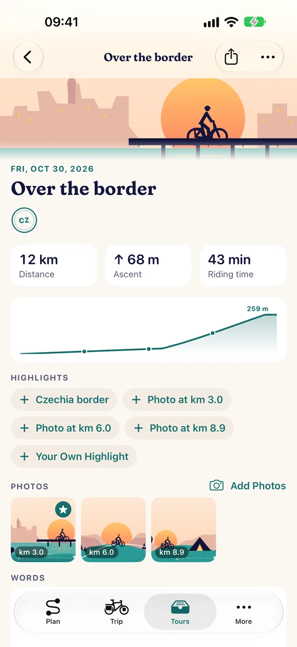
- Logbook in “Tours”: an entry for every ride with stamps, distance, ascent, riding time, elevation profile with surfaces, your words, photos and highlights, as a book per trip
- Entries are created at the end of a navigation with recording or in a running trip with “Capture today”
- Photos from your library or the camera, up to 30 per entry, as reduced copies in your iCloud
- Highlights with suggestions: passes, borders, breaks and the places of your photos, plus your own
- Stamps of the countries and passes you have ridden
Sharing through iCloud
With people close to you
- You share a trip with friends and family, without an account with us. Everyone needs Pedalglobe with iCloud
- Follow along: route, days, countries, elevation profile, progress, ridden tracks and the logbook with photos, with a notification for new entries if you like
- Ride along: the same trip on several devices, each person with their own bike and pace, their own rides and entries, each person’s tracks in their own colour. Only you change the plan
- Invite under “Along for the ride”, separate from sharing: by message, mail or link, only the people you invite. Change roles, remove people and stop sharing at any time
- No live location: whether others see your position is up to you with “Share position”. Then the trip shows the latest point every 10 minutes or 2 km while navigating, no history
Image, PDF and tour file
For everyone else
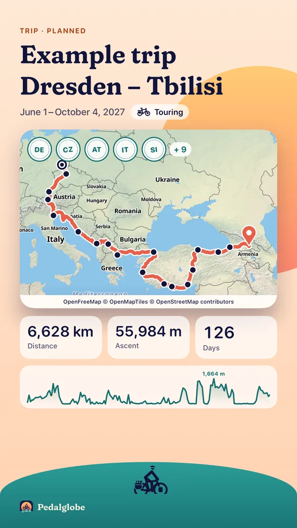
- As an image in 9:16, 1:1 or 16:9 for your status and story: map, elevation profile with surfaces, figures and stamps, with photos for a logbook entry
- “Hide start and finish” leaves out at least 200 m at each end (choose from 100 m to 1 km), preset for distances under 1,500 km
- Logbook as a PDF for people without the app and for printing: a title page, then a page per entry with profile, photos, highlights and your words
- Tour file for people with Pedalglobe: take over a route, trip or logbook as their own copy, also without iCloud
What you share, others see. Anyone following or riding along sees your ridden tracks. The image hides start and finish if you like, GPX, roadbook and the flight video contain the whole route.
Maps and 3D
Four map types, cycle network, relief and contour lines worldwide, a tilted map in navigation and a 3D flight in two worlds.
Map types
The map you need
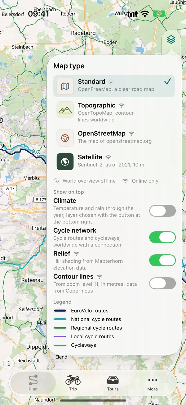
- Standard, topographic, OpenStreetMap and satellite
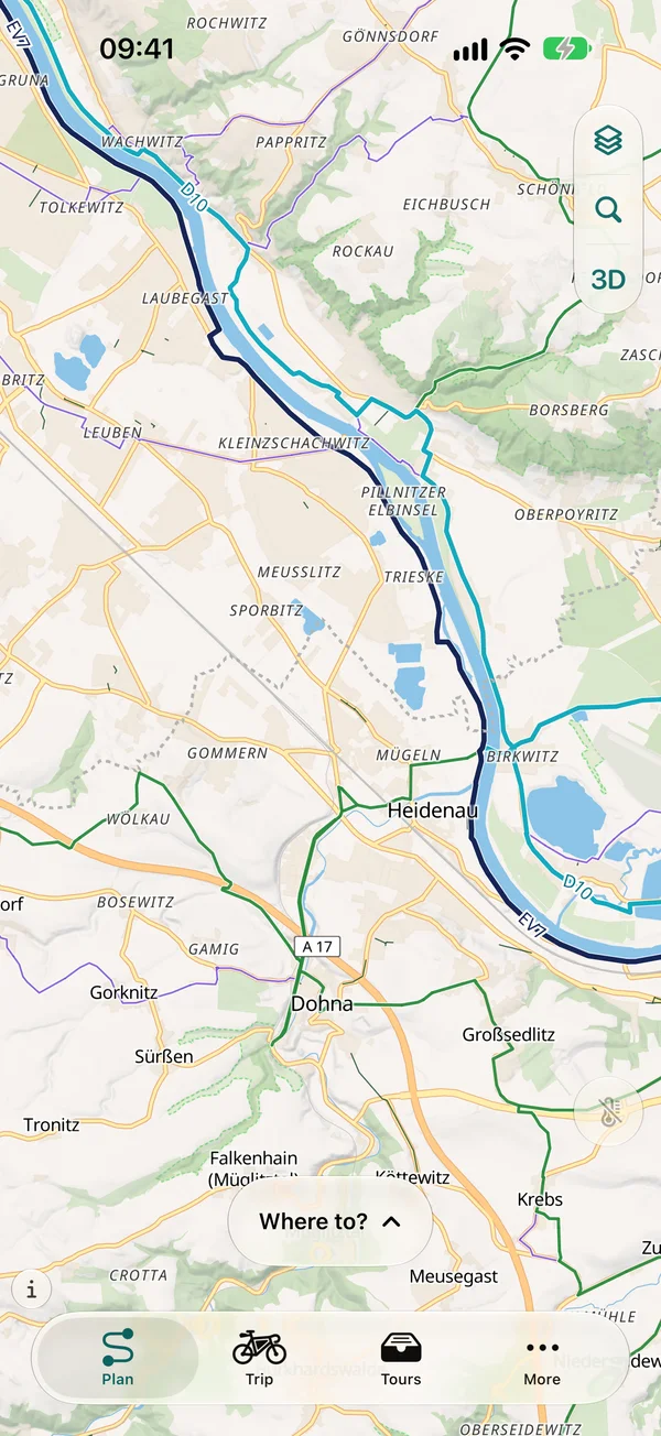
- Cycle network overlay: cycle routes and paths worldwide, with numbers on long-distance routes
- Worldwide relief, contour lines from the Copernicus elevation model over every map type
- Tilted map with relief and buildings in navigation
- Globe or flat map, the globe at launch in the light of the time of day, with the moon and its real surface above it
- A brighter night map with stronger relief and clearly visible borders
3D view and 3D flight
Fly along the route
- 3D view over satellite imagery and terrain with an info box for place and elevation
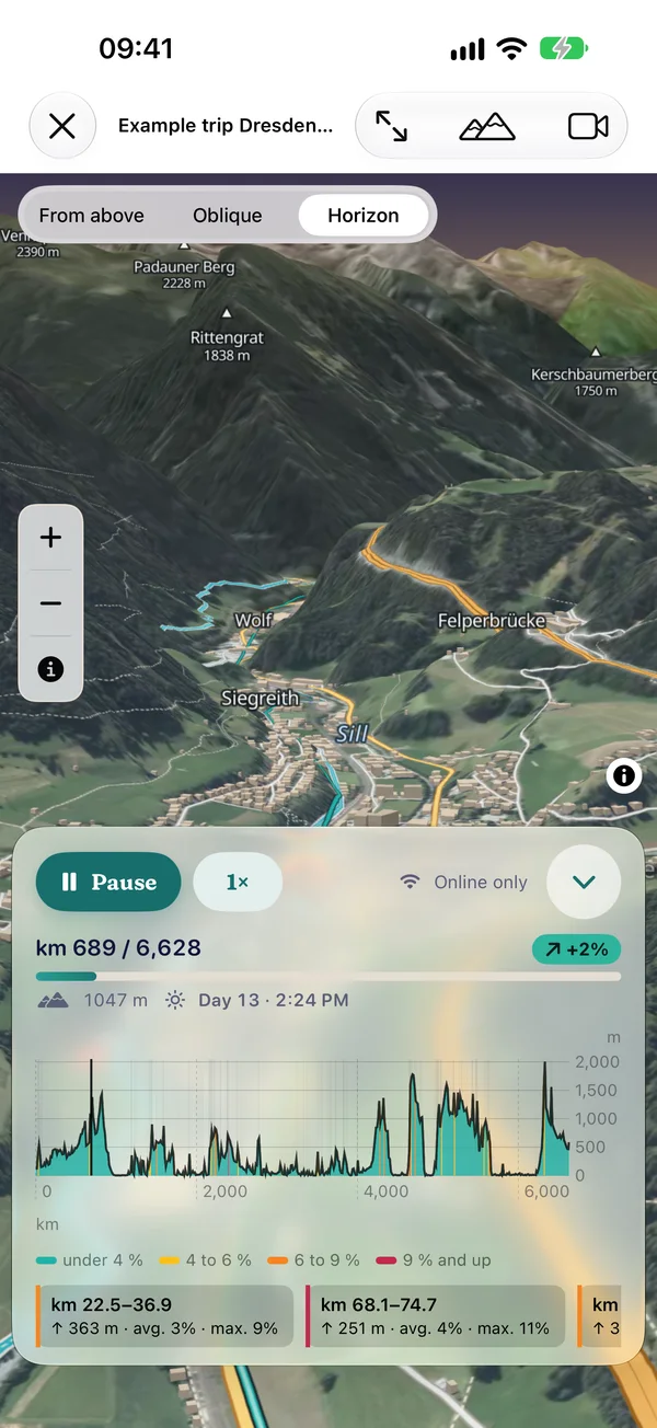
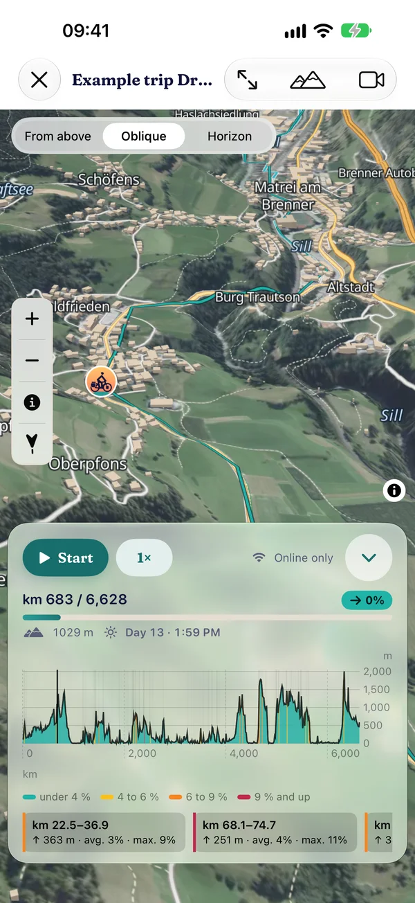
- 3D flight along the route or trip: open 3D map with horizon and sky or “Apple 3D”, switchable during the flight, camera from above, oblique or towards the horizon
- A day of the trip lasts as long as you like, from 8 minutes to 2 seconds. Pause, jump to any day, the elevation profile guides the camera
- Buildings with roofs, your route shines through behind them
- Record the flight as a video: free in 720p up to 60 seconds with watermark, with Pro 1080p in full length
- Free up to 1,500 km and on the example trip, with Pro over any distance
Landscapes in 3D
In large parts of the Alps, Germany and Czechia the open 3D map shows high-resolution aerial photos. The 3D view needs an internet connection.
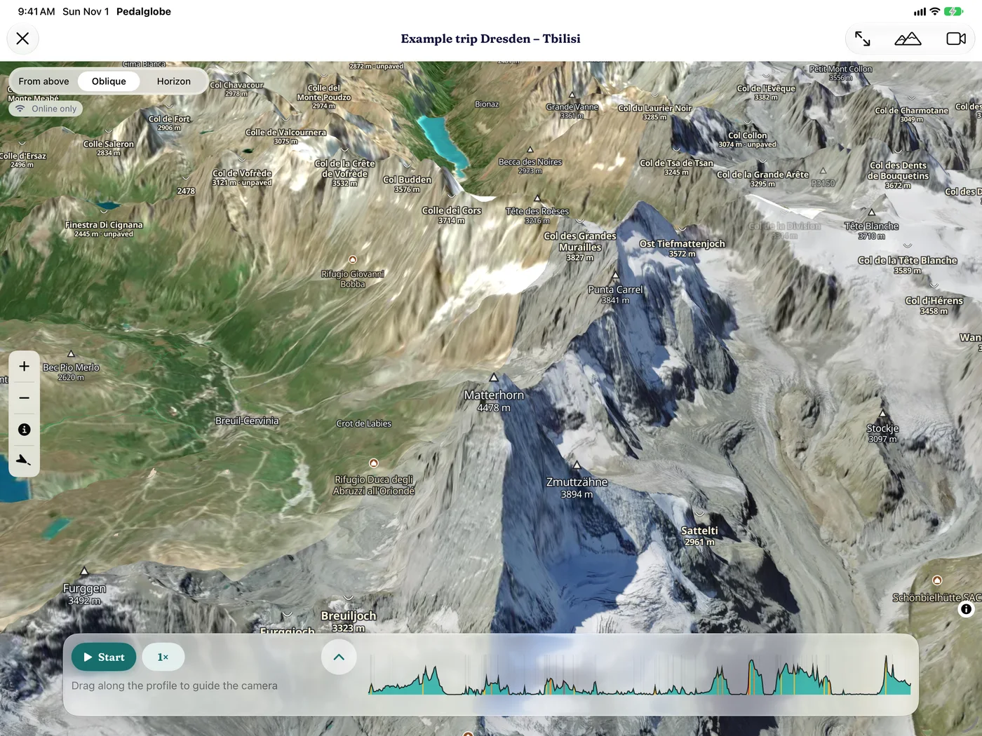
Matterhorn 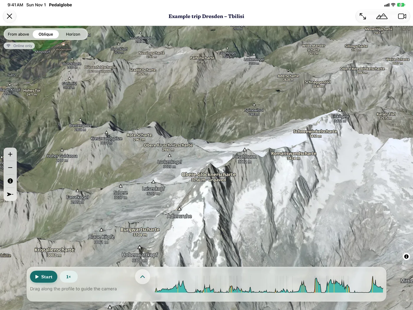
Grossglockner 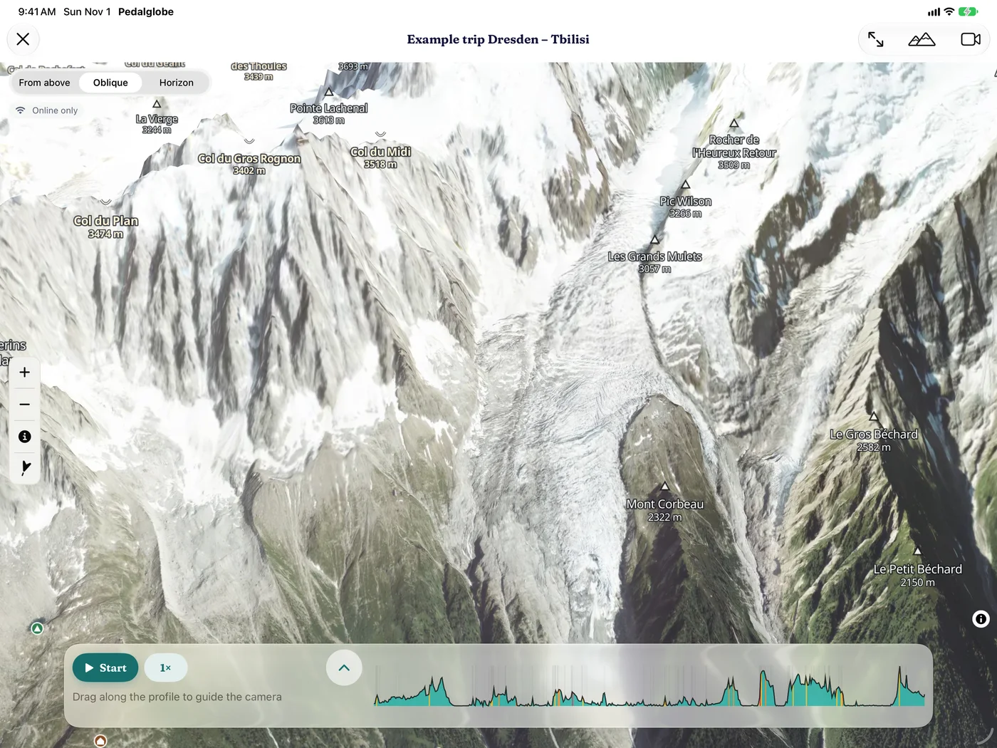
Mont Blanc massif 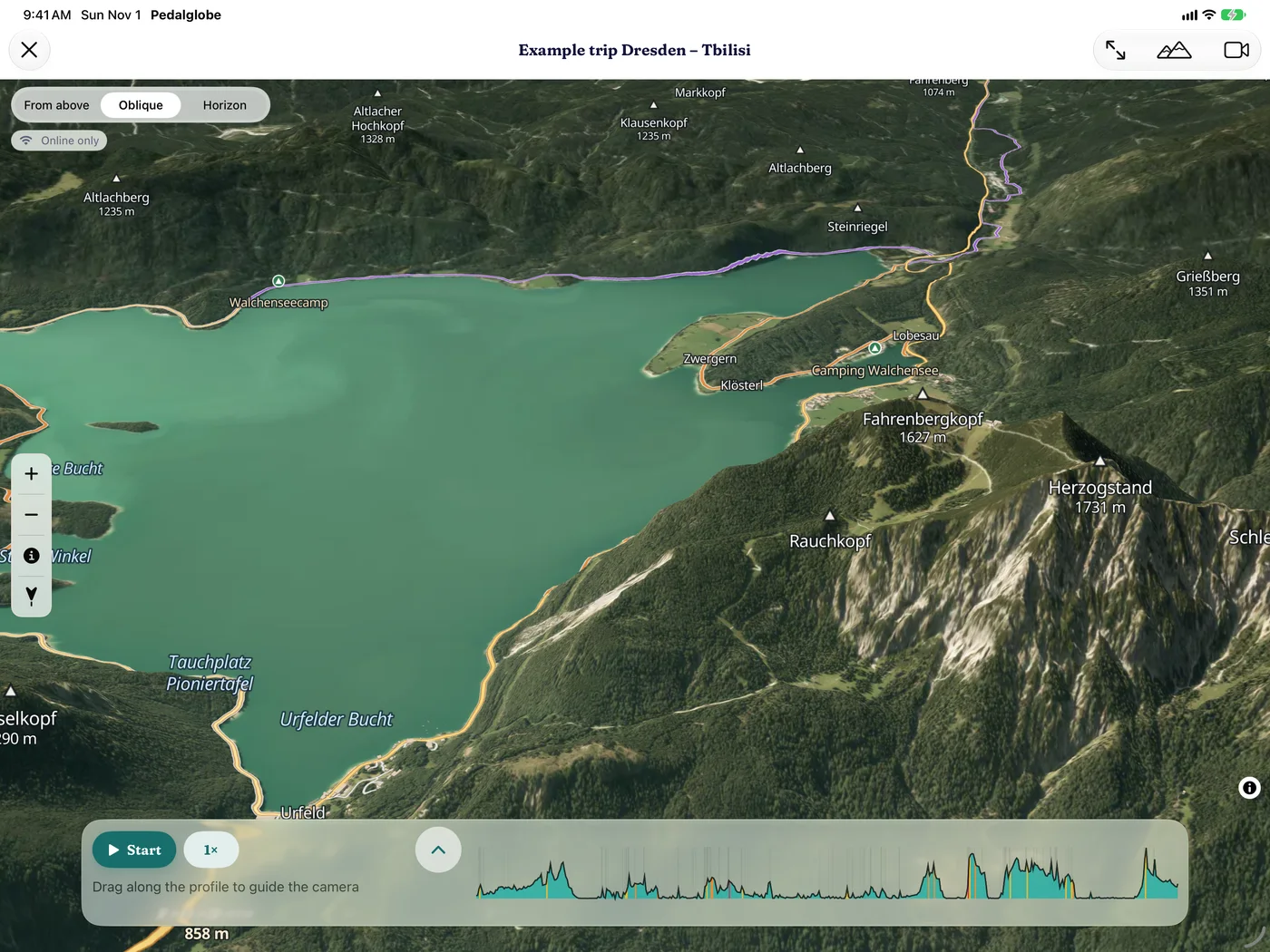
Walchensee 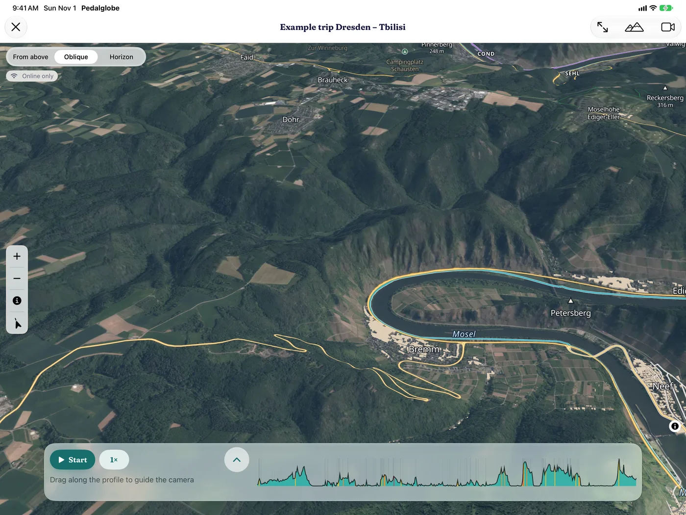
Moselle loop at Bremm 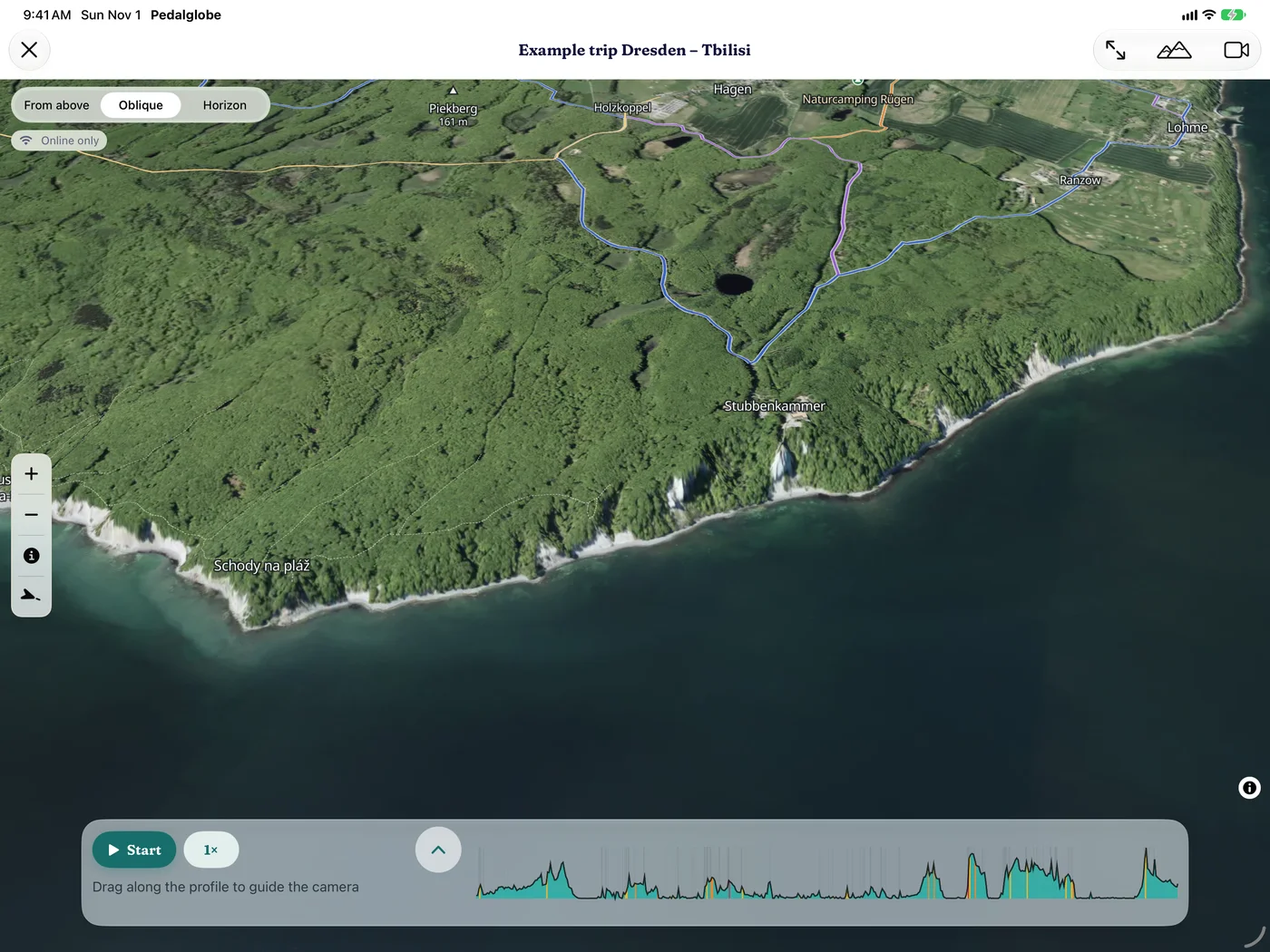
Chalk cliffs on Rügen 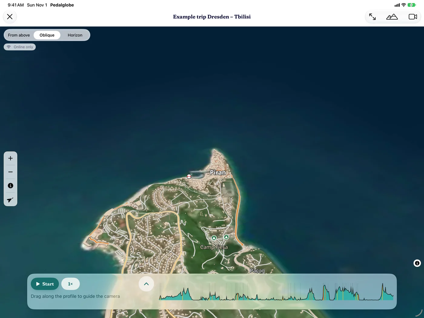
Piran 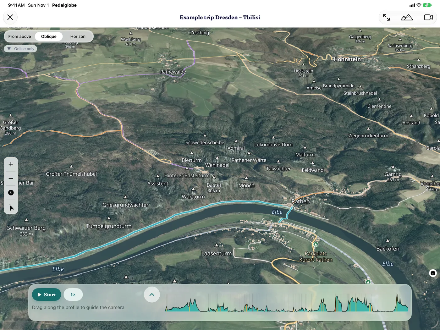
Bastei, Saxon Switzerland 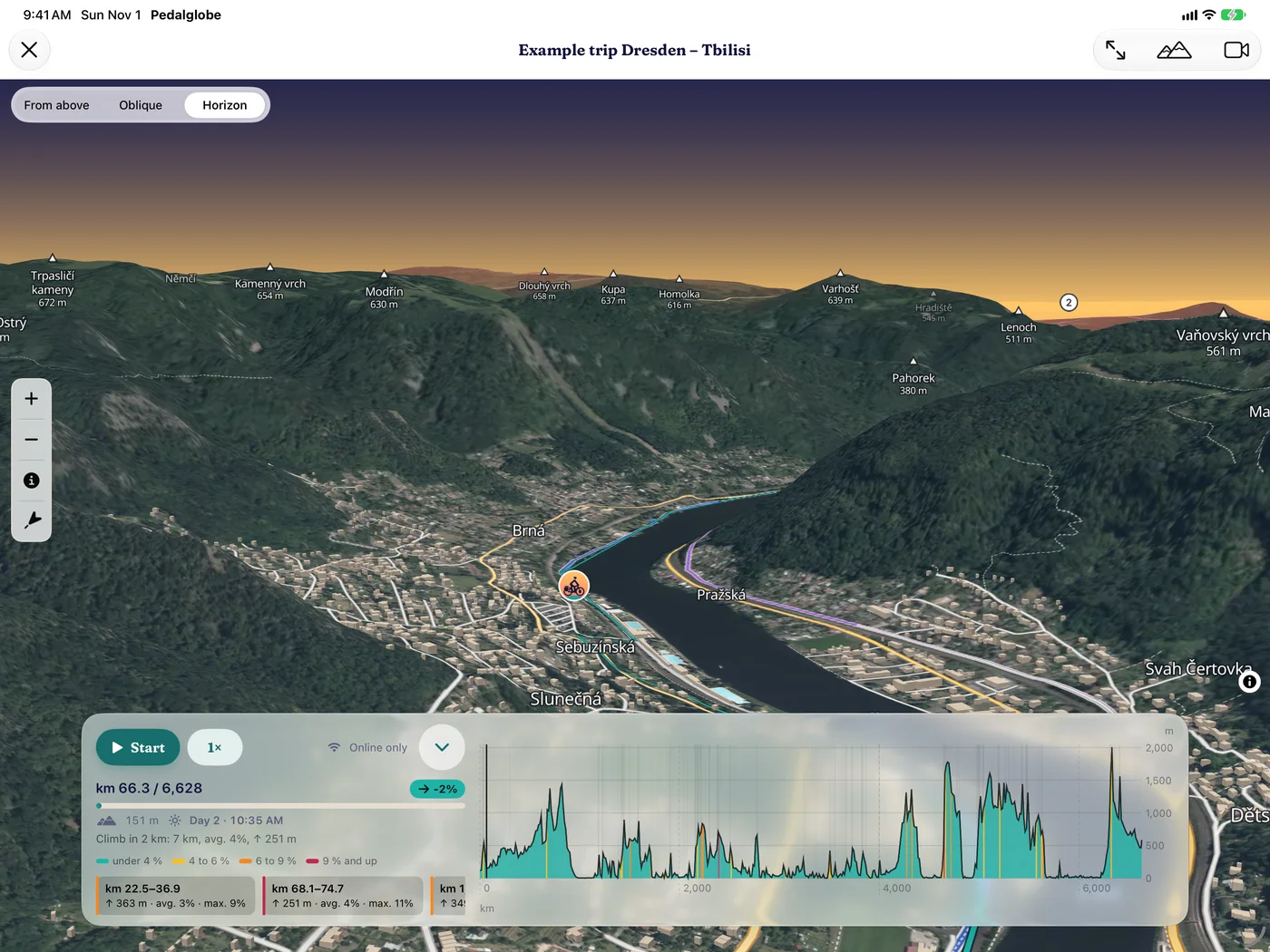
Elbe valley in Bohemia 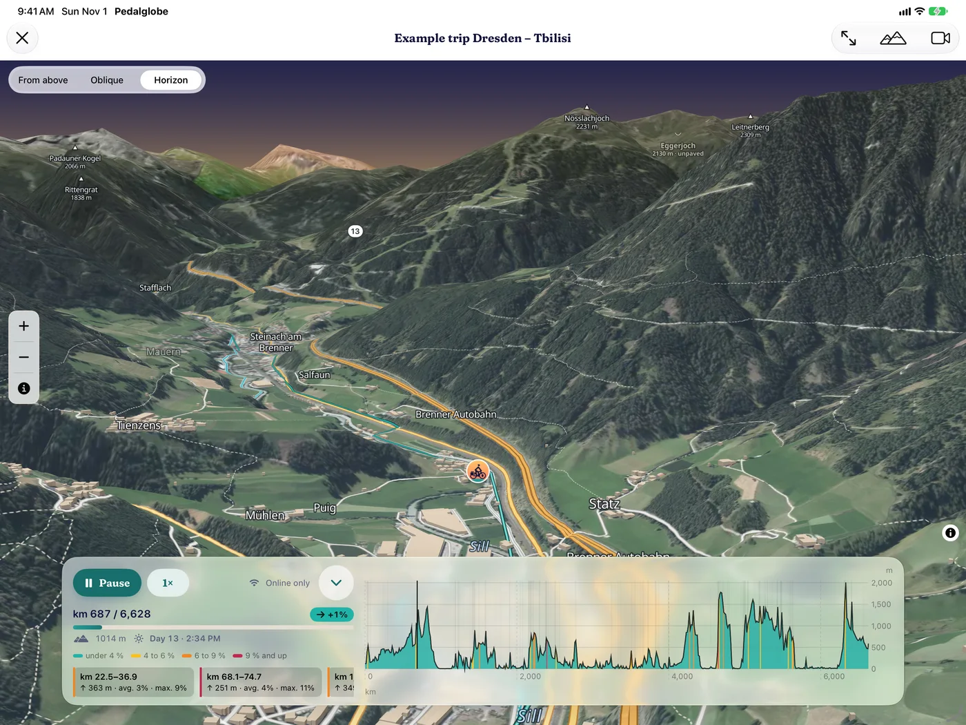
3D flight at the Brenner
Offline and data
What you have downloaded works without a connection: map, routing, climate, search, countries, routes and trips. Large downloads only over Wi-Fi, if that is what you want.
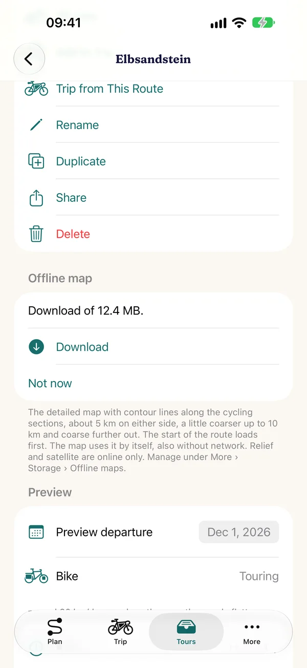
Country packs and offline maps
A country in your pocket
- Load countries: a whole country with routing and offline map, up to about 5 km beyond the border, with the size first. The USA, Canada and Australia by state or province
- Or just the map along your trip or route, in trip order, with pause and resume
- The cycle network and contour lines come along for the same area, a world overview with terrain relief is built into the app
- “For the road” in the trip downloads everything one after the other and carries on even days later, “Pause all” stops every download
- Paths: sections along your route that the planner offers, view and delete under “More › For the road”
Cellular data and tidying up
You decide when to download
- Small downloads also over cellular data, before larger ones the app asks or waits for Wi-Fi (“More › For the road › Cellular data”)
- Under “More › For the road” you see what is on the device. “Tidy up” shows what you no longer need and deletes several at once
- Before a download the app checks that enough space is free
- Satellite, relief and the 3D view load online, what you recently viewed stays on the device for a while
Devices and iCloud
The same trip on iPhone, iPad and Mac. Your data stays with you: on the device and, if you like, in your private iCloud.
iPhone, iPad, Mac
On all your devices
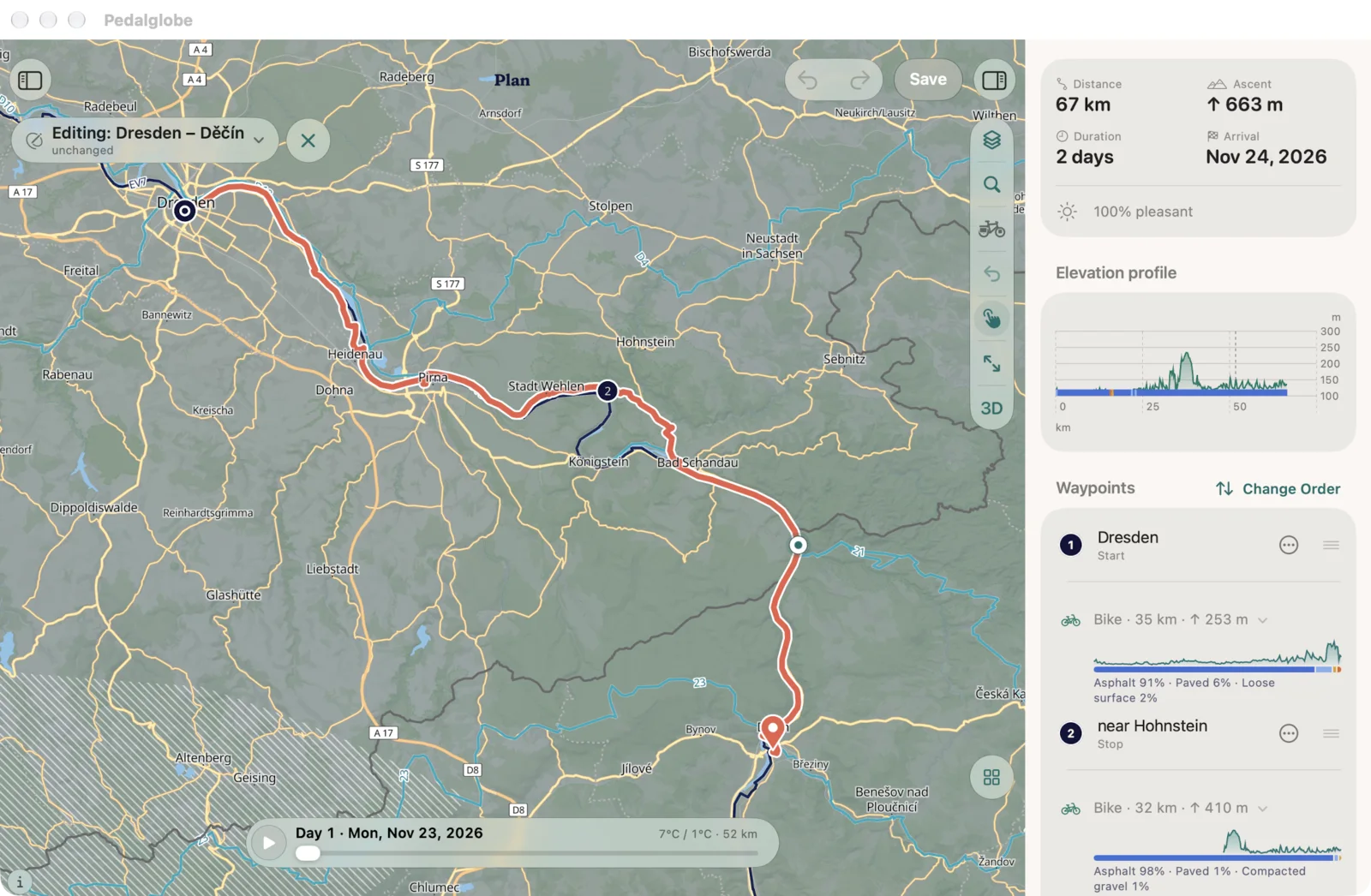
- Compact on iPhone with four tabs, on iPad with sidebar, map and inspector in two columns
- On the Mac as an iPad app on Macs with Apple silicon, with menu bar and window
- Sync through your private iCloud, can be turned off, encrypted, including the ridden tracks. We can't read anything
- Backup file without iCloud: all routes, trips and settings as a file, to move to a new device
- Conflicts are never overwritten silently: both versions stay, you decide
- Kilometres or miles, Celsius or Fahrenheit, in navigation and PDF too
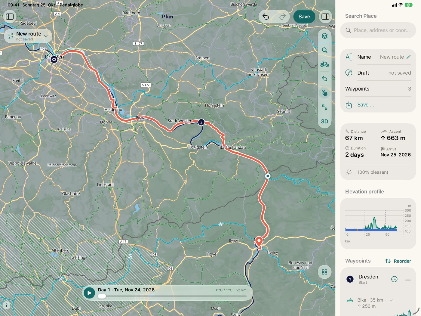
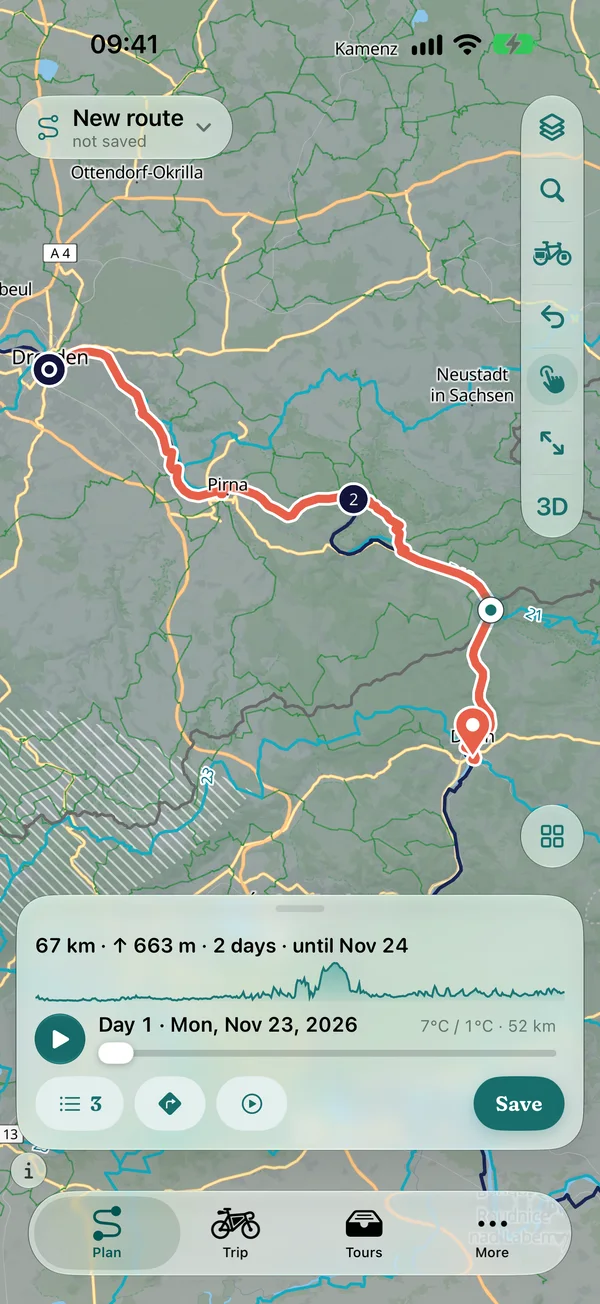
Help and more
A short tour to start, instructions and a glossary in the app, what’s new with every version and open data with sources.
Tour and instructions
Help when you need it
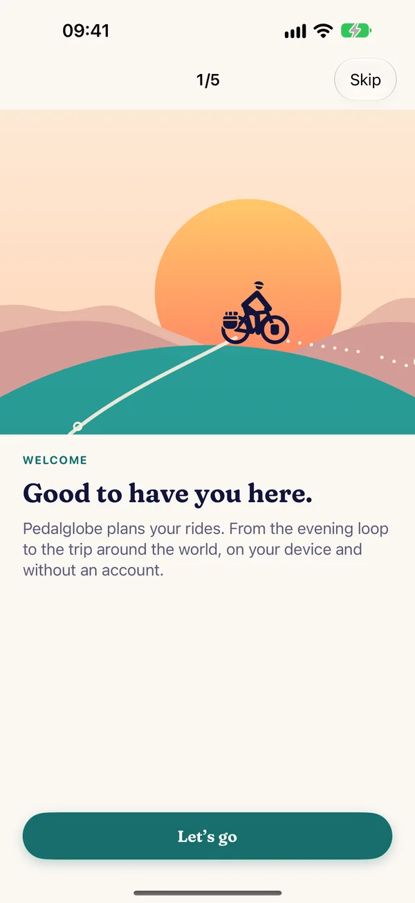
- Tour to start: five pages from the evening loop to the trip around the world, then passport, location and routing for your area. Again at any time under “More › Help”
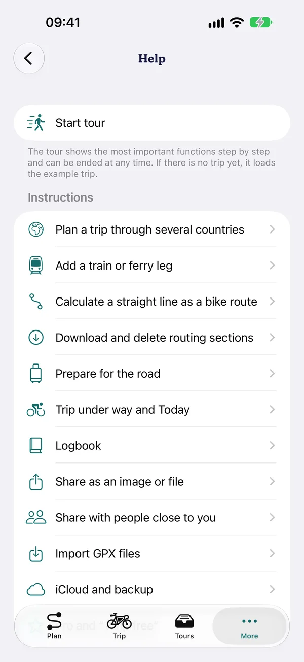
- Instructions step by step through planning, trips, offline and on the road
- Legends and glossary: map, climate and countries explained, terms to look up
- What’s NewWhat is new with every version, once as a card after an update and any time under “More › What’s New”. When a new version is on the App Store, a quiet line under “More” tells you.
- What’s nextWhat we are working on after the launch, in the planned order and without dates: What’s next.
- Data sources and licencesMap, routing, climate, elevation, countries: every source with its licence in the app and on the licences page.
- PrivacyNo account, no ads, no tracking. What the app loads when is in the privacy policy.
- Eleven languagesGerman, English, French, Spanish, Italian, Dutch, Polish, Czech, Danish, Swedish and Norwegian, voice guidance included.
Free and Pro
Free, you use all features with one trip and any number of routes up to 1,500 km. Pedalglobe Pro is a one-time purchase, not a subscription: any number of trips of any length, roadbook as PDF, GPX per day, 3D flight over any distance, video without watermark, routing options and your own bike types.