Diese Seite gibt es auch auf Deutsch.

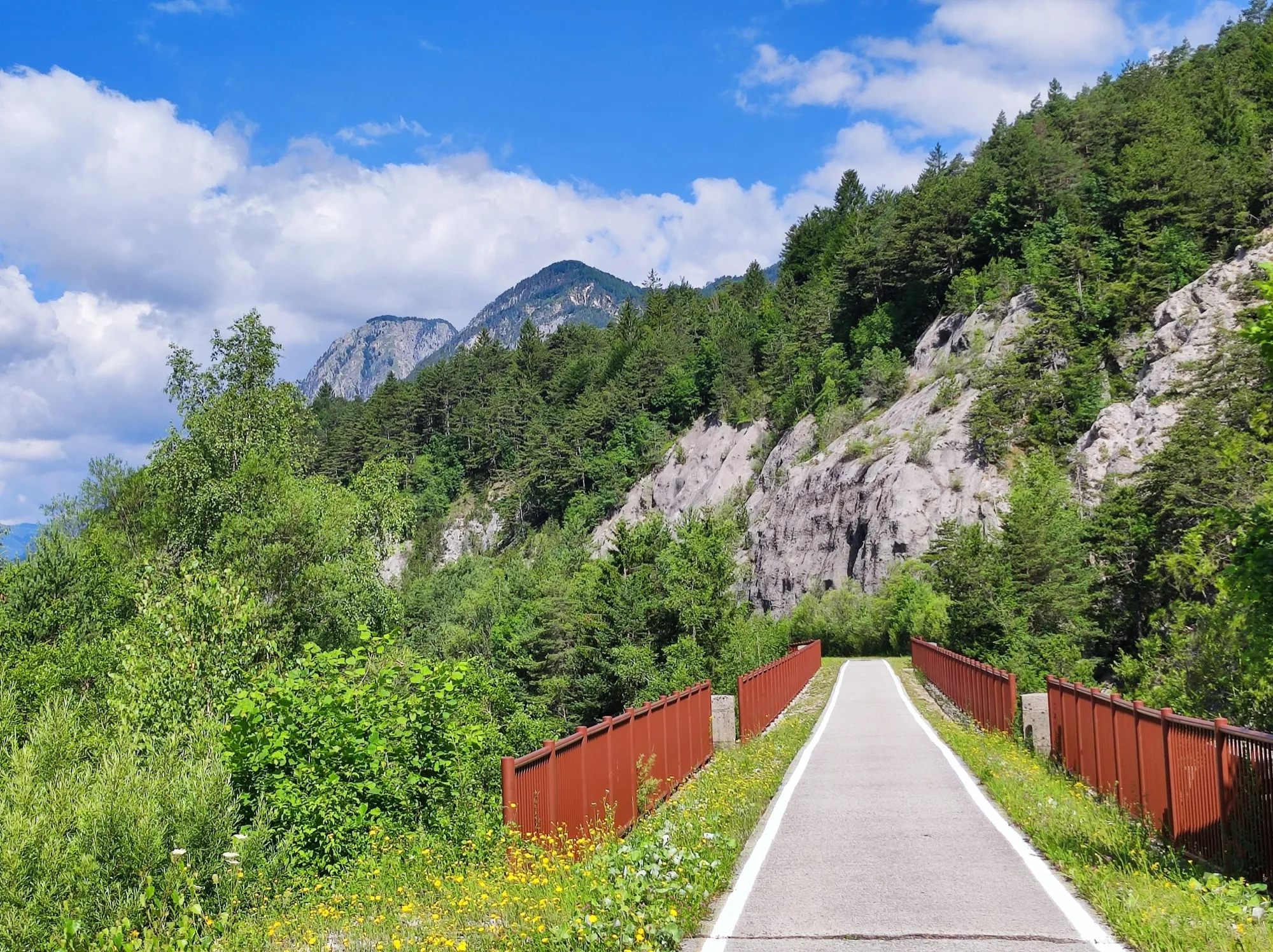
A paved cycle path leads over a bridge with red railings towards a rock face and forest, with blue sky and clouds above

Your next bike trip?

Alpe-Adria cycle route Salzburg – Grado

374 km and 8 days from Salzburg over the Tauern to the sea, with one train ride through the mountain.

  • Trekking bike or touring bikeBike
  • Austria, ItalyCountries

Photo: Ajznponar, CC0 1.0, cropped, with text

  • 374 kmDistance
  • 2,026 mClimbing
  • 8Days
  • 47 kmper riding day
  • 86 %Paved
  • June, SeptemberBest months

The route

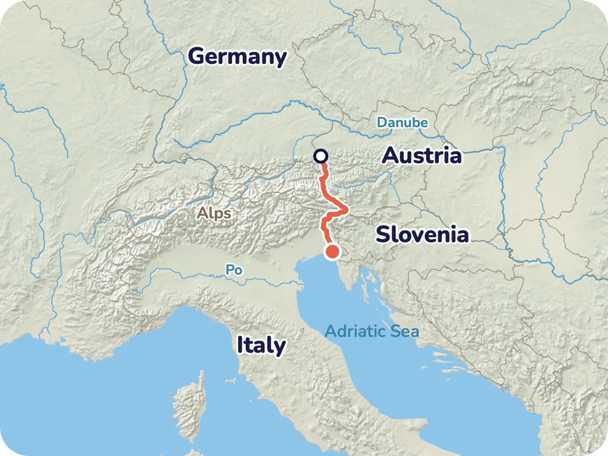
Map of the route from Salzburg via Bad Gastein, Villach, Tarvisio and Udine to Grado
Locator map: the Alpe Adria Cycle Path from Salzburg across the Alps to Grado on the Adriatic.
  • Asphalt 321 km
  • Compacted gravel 47 km
  • Paved 2 km
  • Loose surface 2 km
  • Cobblestones 0.3 km

Map © OpenStreetMap contributors, OpenFreeMap, OpenMapTiles. Relief: Mapterhorn. Locator map: Natural Earth

From Salzburg's old town you ride up the Salzach, through Hallein and Werfen to St. Johann im Pongau and on into the Gastein Valley to Bad Hofgastein and Bad Gastein. At Böckstein you load your bike onto the train through the Tauern tunnel and roll on from Mallnitz through the Möll valley to Spittal an der Drau. Via Villach and Arnoldstein you reach Tarvisio, then follow the old railway line through the Canal Valley to Venzone, and on through Udine, Palmanova and Aquileia to the sea at Grado.

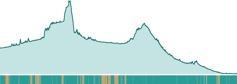
Beyond the Tauern it is downhill on the whole, and only between Villach and Tarvisio do you climb 360 m once more. The highest point of the route is 1,188 m near Mallnitz, the hardest day is the second with 633 m of climbing.

Length and climbing come from the route calculation in Pedalglobe: 374 km, 2,026 m up and 2,518 m down, with heights from a terrain model. Other sources give around 2,400 or around 5,400 m of climbing and differ widely, and why is not clear. The route's own website gives 415 km for the whole route, our route comes to 374 km, and we have not resolved the difference. There is no guarantee that the route is passable. Read the notes on the route before you plan.

Plan it yourself: This trip and everything here: planned in Pedalglobe in a few minutes, with elevation profile, climate for every day and what applies at each border.

Pedalglobe on the App Store

Stage by stage

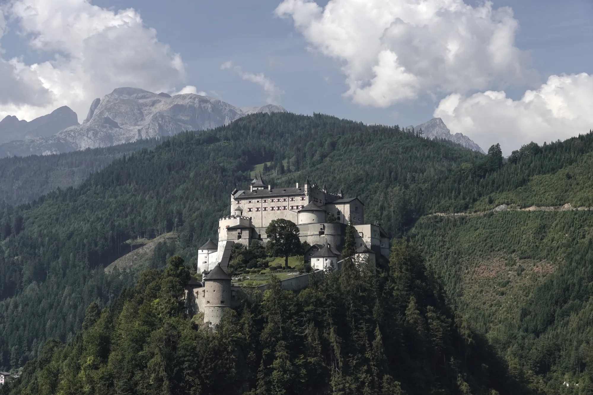
  • Hohenwerfen Castle on a wooded hill, behind it rocky mountains and clouds
    Photo: DmitTrix, CC BY 4.0

    Day 1: Salzburg – Werfen

    46 km · 308 m of climbing

    578 m
    • Asphalt 39 km
    • Compacted gravel 5 km
    • Loose surface 1 km
    • Paved 0.5 km

    From Salzburg's old town you ride up the Salzach, through Hallein to Werfen. The path climbs gently and is mostly asphalt, with about 6 km of gravel in between, of which around 1 km is loose. Hohenwerfen Castle towers above Werfen.

  • Day 2: Werfen – Bad Gastein

    57 km · 633 m of climbing

    1012 m
    • Asphalt 44 km
    • Compacted gravel 12 km
    • Loose surface 0.2 km
    • Cobblestones 0.2 km
    • Paved 0.1 km

    The day with the most climbing: on through the Salzach valley past St. Johann im Pongau, then uphill into the Gastein Valley to Bad Hofgastein and Bad Gastein, ending at around 1,000 m. The map shows about 12 km of firm gravel. In Bad Gastein the Gastein Ache plunges 341 m in three steps right in the middle of the town.

  • Day 3: Bad Gastein – Spittal an der Drau

    47 km · 304 m of climbing

    Train1188 m
    • Asphalt 42 km
    • Compacted gravel 5 km

    Here the train takes over. First you roll 5 km to Böckstein (109 m of climbing), then the car shuttle train of the Tauern railway takes you to Mallnitz, and the ride under the Tauern takes 11 minutes. The trains run hourly, from Böckstein at 20 minutes past the hour (first 6:20, last 23:20), from Mallnitz-Obervellach at 50 minutes past (first 5:50, last 22:50). Loading starts 5 minutes before departure. There is no reservation, you only get on if there is room. According to the railways the price is 13 euros with the bike including the person, on the spot, cheaper online (as of 10 November 2026).

    From Mallnitz 41.6 km follow through the Möll valley via Obervellach to Spittal, 828 m downhill. Here the route only goes through the mountain by train, and we have not checked an alternative over the road passes. In 2027 the loading service is out until 9 July, see notes.

  • Day 4: Spittal an der Drau – Villach

    41 km · 0 m of climbing

    560 m
    • Asphalt 22 km
    • Compacted gravel 19 km
    • Loose surface 0.4 km
    • Cobblestones 0.1 km
    • Paved 0.1 km

    A quiet day along the Drau, with almost no climbing. The map shows about 19 km of firm gravel, the most gravel of any day.

  • Day 5: Villach – Tarvisio

    32 km · 360 m of climbing

    748 m
    • Asphalt 29 km
    • Compacted gravel 2 km
    • Paved 0.2 km

    The shortest day. Via Arnoldstein you climb towards the border, 360 m of climbing. The border to Italy is at Tarvisio and is open, there is no fixed border post.

  • Day 6: Tarvisio – Venzone

    56 km · 288 m of climbing

    827 m
    • Asphalt 56 km
    • Paved 0.3 km

    Now you roll along the old Pontebbana railway line through the Canal Valley, paved with asphalt, with 799 m of descent over 56 km. There are tunnels on the line. The section is closed from early November to about mid April, see notes. Near Venzone about 2 km on a country road with a wide shoulder follow.

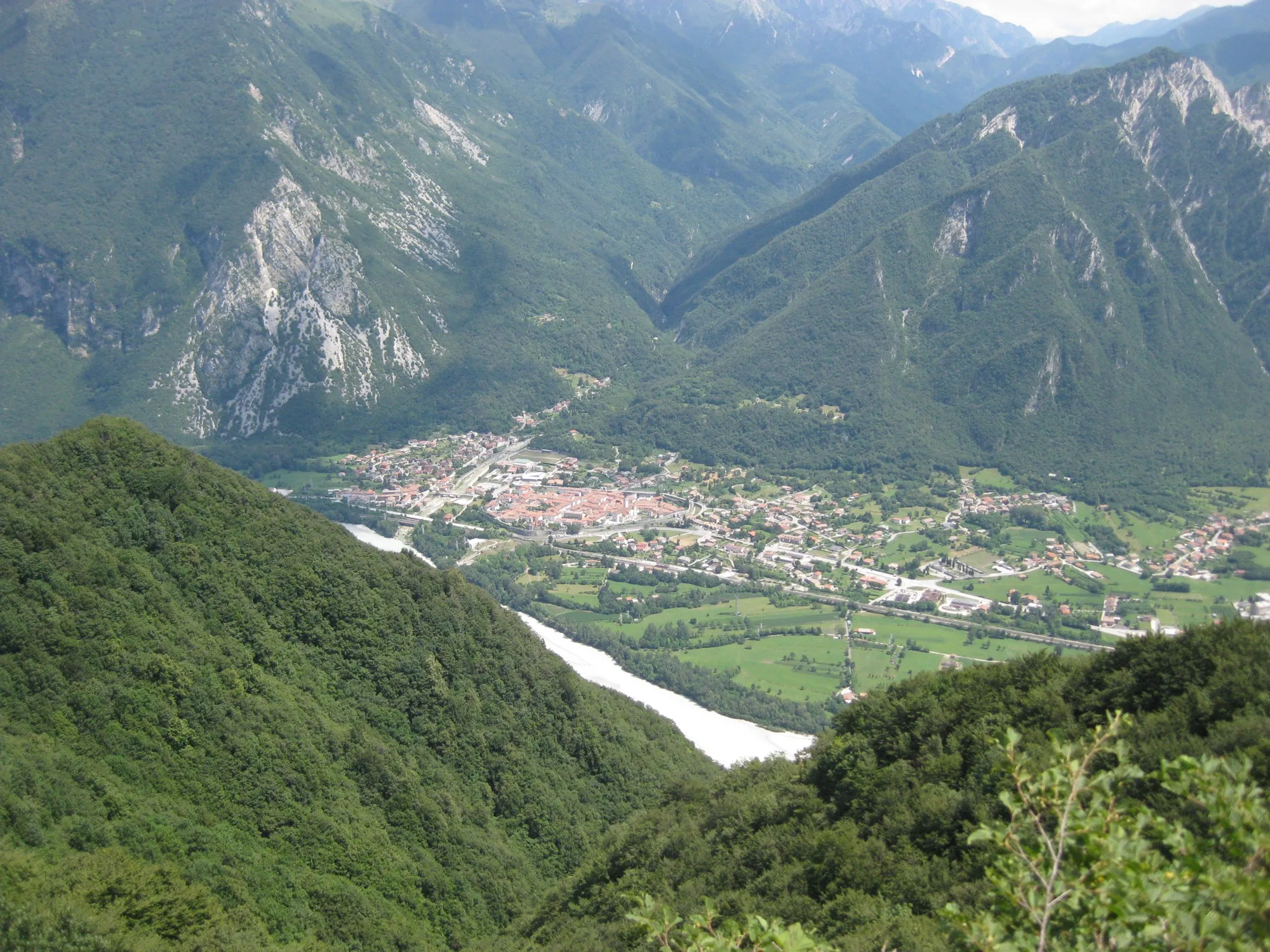
  • View from above of Venzone in the valley, surrounded by steep wooded mountains
    Photo: MichaelXXLF, CC BY-SA 3.0

    Day 7: Venzone – Udine

    43 km · 134 m of climbing

    241 m
    • Asphalt 41 km
    • Paved 0.8 km
    • Loose surface 0.6 km

    The valley opens into the plain of Friuli. Venzone lies in the Tagliamento valley, and via Gemona you reach Udine. The path is almost all asphalt.

  • Day 8: Udine – Grado

    52 km · 0 m of climbing

    118 m
    • Asphalt 47 km
    • Compacted gravel 4 km
    • Paved 0.5 km
    • Loose surface 0.1 km

    Flat and almost all asphalt: through Palmanova and Aquileia to the sea. The basilica in Aquileia is worth a stop. Grado has no station, for the way back see rail.

The ground under your tyres

Elevation profile, from Salzburg at 424 m over the Tauern at around 1,190 m and down to the sea at Grado

According to the map (OpenStreetMap), you ride 86 % on asphalt and 13 % on firm gravel or grit, and a small remainder is cobbles, smooth paving or loose ground. That fits the description by the Austrian railways for Carinthia: mostly asphalt, partly firm grit.

The map shows the most gravel between Spittal and Villach, about 19 of 41 km, and on the second day between Werfen and Bad Gastein, about 12 of 57 km. Between Tarvisio and Venzone the path on the old railway line is paved with asphalt and, according to the Friuli Venezia Giulia tourist board, also suitable for beginners. Near Venzone, about 2 km on a country road with a wide shoulder follow.

On traffic: according to the map, 44 % of the route is on cycle paths, 28 % on quiet roads, 9 % on tracks and paths, and 19 % on roads (11 %) and busy roads (8 %). 83 % of the route follows signposted cycle routes. What the surface is really like changes with the season and roadworks.

Difficulty and who it suits

Overall: easy. Eight days averaging 47 km and at most 633 m of climbing a day, the train ride and the closures call for planning.

  • Distance47 km per riding day
  • Climbingaround 540 m per 100 km, moderate
  • Surface87 % firm surface on the map
  • Traffic81 % on cycle paths, tracks and quiet roads
  • Self-sufficiencyplaces close together along the way

The Pedalglobe scale: the same five features and levels 1 to 5 for every trip.

A trip for anyone who wants to ride several days in a row with luggage: eight days averaging 47 km, with at most 633 m of climbing in a day. The Friuli Venezia Giulia tourist board and the Austrian motoring club rate the route as medium, by the values on this page it comes out as easy. The planning is the demanding part: the train ride through the Tauern tunnel, the 2027 closure and the winter break in the Canal Valley.

There is no reservation for the loading service. You only get on if there is room, and a particular train is not guaranteed. Leave some slack on day 3.

Who it suits

  • anyone riding several days in a row with luggage for the first time
  • cyclists who like cycle paths and old railway lines, because almost half the route is on cycle paths
  • not for anyone who wants to set off without a look at timetables and closures

When to go

Best months: June, September

×Jan×Feb×Mar×Apr!May✓Jun!Jul!Aug✓Sep!Oct×Nov×Dec3°6°12°17°21°25°27°27°21°15°8°3°-5°-4°0°5°9°13°15°15°10°6°2°-4°
  • ✓good
  • !marginal
  • ×poor
  • Day °C
  • Night °C
  • Precipitation (mm)

It is best to ride in June or September. Then the daytime highs in Salzburg and Villach are 20 to 25 degrees on long-term average, and the nights at the Tauern stay mild, in Mallnitz 8.5 degrees on average in June and 6.5 degrees in September. May is green, but still fresh in the Alps and already wet in Salzburg with 135 mm.

July and August are the warmest, in Villach 27 degrees on average by day, but also the wettest months: Salzburg gets 147 and 161 mm in July and August, Mallnitz 141 and 150 mm. It gets hotter in the south, in Udine the July average is around 30 degrees (rough guide, normals of the Rivolto station).

The table shows the Villach station (493 m, long-term average 1991 to 2020, source: GeoSphere Austria, official monthly values). It lies about halfway, after 191 of 374 km. It is cooler in the north: in Mallnitz (1,197 m) the average night temperature in May is 5.2 degrees.

Two things do not depend on the climate. The section Tarvisio – Venzone is closed every year from November to April, and in 2027 the Tauern railway is closed until 9 July, so June 2027 only works with the announced bike shuttle (see notes). The values are long-term averages, not a weather forecast.

All values as a table

Climate by month (long-term average)

MonthDayNightPrecipitationFor cycling
January3 °C-5 °C41 mmpoor
February6 °C-4 °C52 mmpoor
March12 °C0 °C58 mmpoor
April17 °C5 °C79 mmpoor
May21 °C9 °C96 mmmarginal
June25 °C13 °C116 mmgood
July27 °C15 °C132 mmmarginal
August27 °C15 °C143 mmmarginal
September21 °C10 °C122 mmgood
October15 °C6 °C119 mmmarginal
November8 °C2 °C118 mmpoor
December3 °C-4 °C74 mmpoor
  • Summer rain on the north side: from June to August Salzburg gets 147 to 161 mm a month, Mallnitz 120 to 150 mm. These are the wettest months.
  • Heat in the south: Villach averages 27 degrees by day in July, Udine around 30.
  • Cool nights at the Tauern: in Mallnitz the average low is 5.2 degrees in May, 8.5 in June and 6.5 in September. Pack a warm jacket.
  • The train ride through the Tauern tunnel: without a reservation you only get on if there is room, and in 2027 the loading service is out until 9 July.
  • Winter break in the Canal Valley: the path on the old railway line is closed from November to April.
Month by month

January

Winter. In Villach 3 degrees by day and minus 5 at night on average, the Canal Valley is closed.

February

Winter, the Canal Valley is closed. In Villach 6 degrees by day on average, in Mallnitz 3.

March

Still winter at the Tauern: in Mallnitz 7 degrees by day and minus 2 at night on average. The Canal Valley stays closed.

April

The Canal Valley is expected to open from mid to late April, in 2026 it was 18 April. In Mallnitz 11 degrees by day and 1 at night on average.

May

Green, but still fresh in the Alps: in Mallnitz 16 degrees by day and 5 at night on average. Salzburg gets 135 mm.

June

Best time. Mostly 20 to 25 degrees by day, in Mallnitz 8.5 at night on average. In June 2027 the Tauern railway is still closed.

July

The warmest, in Villach 27 degrees by day on average, around 30 in the south. Also one of the wettest months, Salzburg gets 147 mm.

August

Warm and wet: in Villach 27 degrees by day on average, Salzburg gets 161 mm of rain, the wettest month of the year.

September

Best time. By day 20 to 21 degrees on average in Salzburg and Villach, 6.5 at night in Mallnitz. The Canal Valley is still open.

October

Cooler and damp: in Villach 15 degrees by day and 6 at night on average, 119 mm of rain. The Canal Valley is open until the end of October.

November

The Canal Valley is closed. In Villach 8 degrees by day, 2 at night and 118 mm of rain on average.

December

Winter. In Villach 3 degrees by day and minus 4 at night on average, the Canal Valley stays closed.

Getting there and back by train

Getting there

Salzburg is the start. On long-distance trains of the Austrian railways you need a bike ticket and a reservation for your bike. According to the railways the reservation costs 3 euros online and 3.50 euros at the counter, the bike ticket about 10 percent of the fare, at least 1.40 euros (as of 10 November 2026). The Railjet has eight bike spaces.

Getting back

Grado has no station, the train ends at Cervignano-Aquileia-Grado. A bike bus (BiciBus) links Udine, Palmanova, Cervignano and Grado, with a trailer for 40 bikes. It runs on weekends in spring and summer, and daily in July and August (Friuli Venezia Giulia tourist board).

From Udine to Villach the bike train MiCoTra runs, with room for 70 to 200 bikes depending on the train. Reservations are compulsory and go with the ticket via the Austrian railways, in Friuli Venezia Giulia the bike ticket costs 1.70 euros. The Sprinter also runs from Tarvisio to Villach. The timetable changes from 28 September to 11 December 2026, so check it before you travel.

From Villach back to Salzburg the same applies as on the way in, a bike ticket and reservation are compulsory. We have not checked a connection with times. If you ride back during the Tauern closure from 8 February to 9 July 2027, find out beforehand how your bike gets along: in the replacement buses it is limited and only with a reservation according to one sentence of the railways, and not possible at all according to another.

Your bike on the train

In Carinthia bikes can be taken on trains with bike spaces, up to 24 per train, and up to 100 or 200 spaces in the Sprinters through the Tauern and the Gail valley. It is only guaranteed with a bike reservation (Austrian railways, Rail & Bike Carinthia, 2026).

Food and places to sleep

Between the places named on this page there are at most about 40 route kilometres, the largest gap is Spittal – Villach. There are more villages in between, but the research did not check where exactly there are shops. It also did not check whether wild camping is allowed, so ask locally.

Along the way

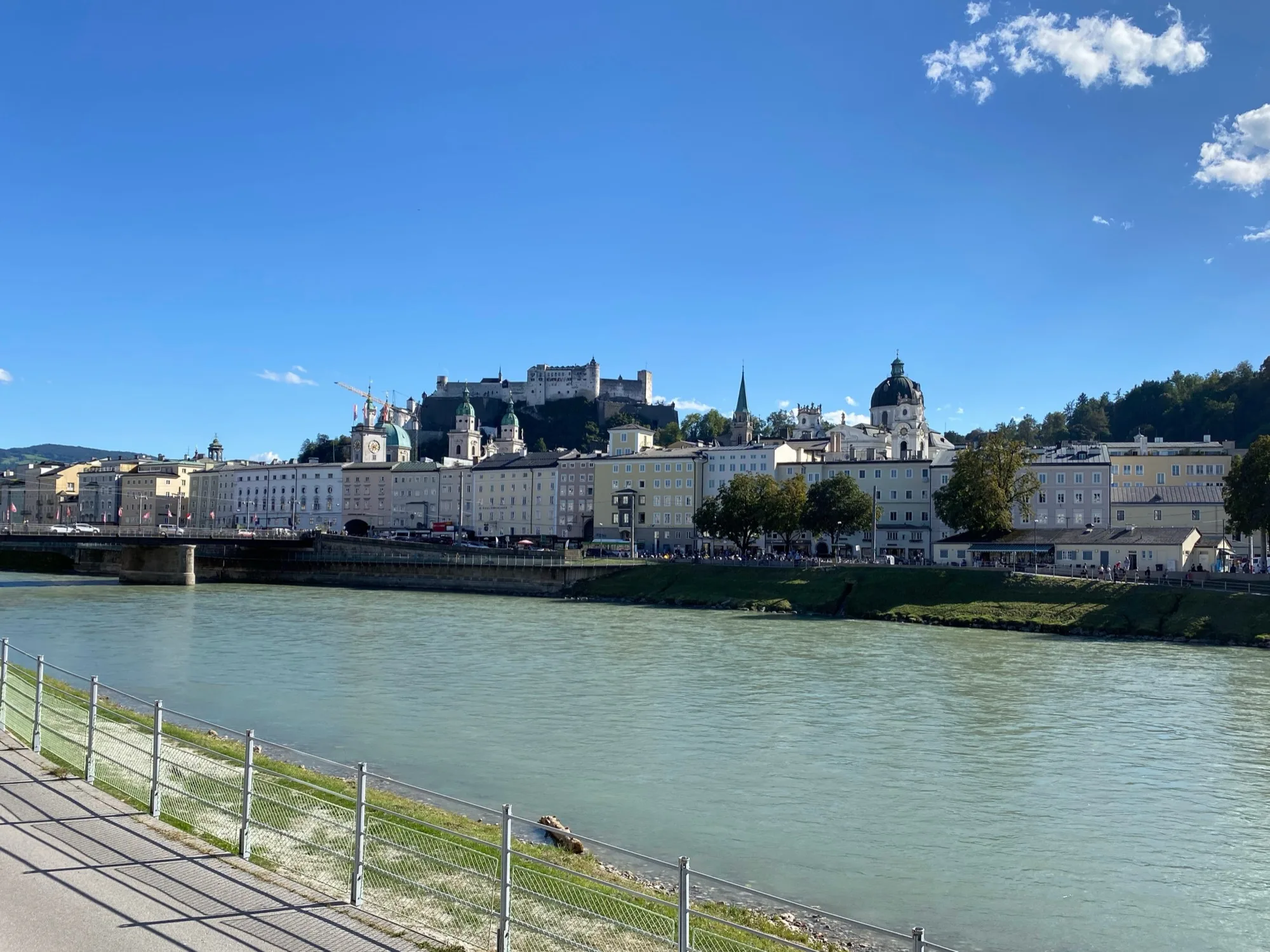
  • The Salzach with a riverside path, behind it the old town and Hohensalzburg Fortress under a blue sky
    Photo: -wuppertaler, CC BY 4.0
    Salzburg

    The old town has been on the UNESCO World Heritage list since 1996 and, with about 1,000 historic buildings on around 236 hectares, is the starting point of the trip.

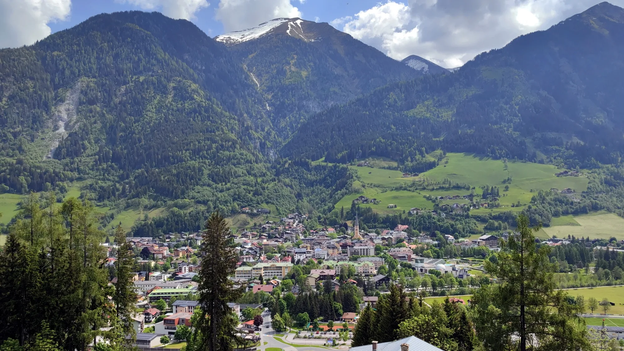
  • View over Bad Hofgastein in the Gastein Valley, behind it wooded mountains and a peak with patches of snow
    Photo: Helmlechner, CC0 1.0
    Gastein Valley

    In Bad Gastein the Gastein Ache plunges 341 m in three steps right in the middle of the town. The photo shows Bad Hofgastein further down the valley.

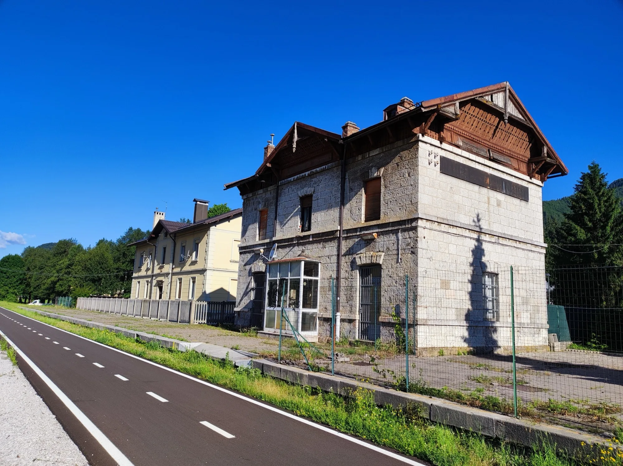
  • A dark cycle path runs past an old stone station building under a deep blue sky
    Photo: Ajznponar, CC0 1.0
    Canal Valley and old railway line

    Between Tarvisio and Venzone you roll along the line of the disused Pontebbana railway. Since 13 July 2024 the path has followed the old railway embankment as far as Carnia station near Venzone.

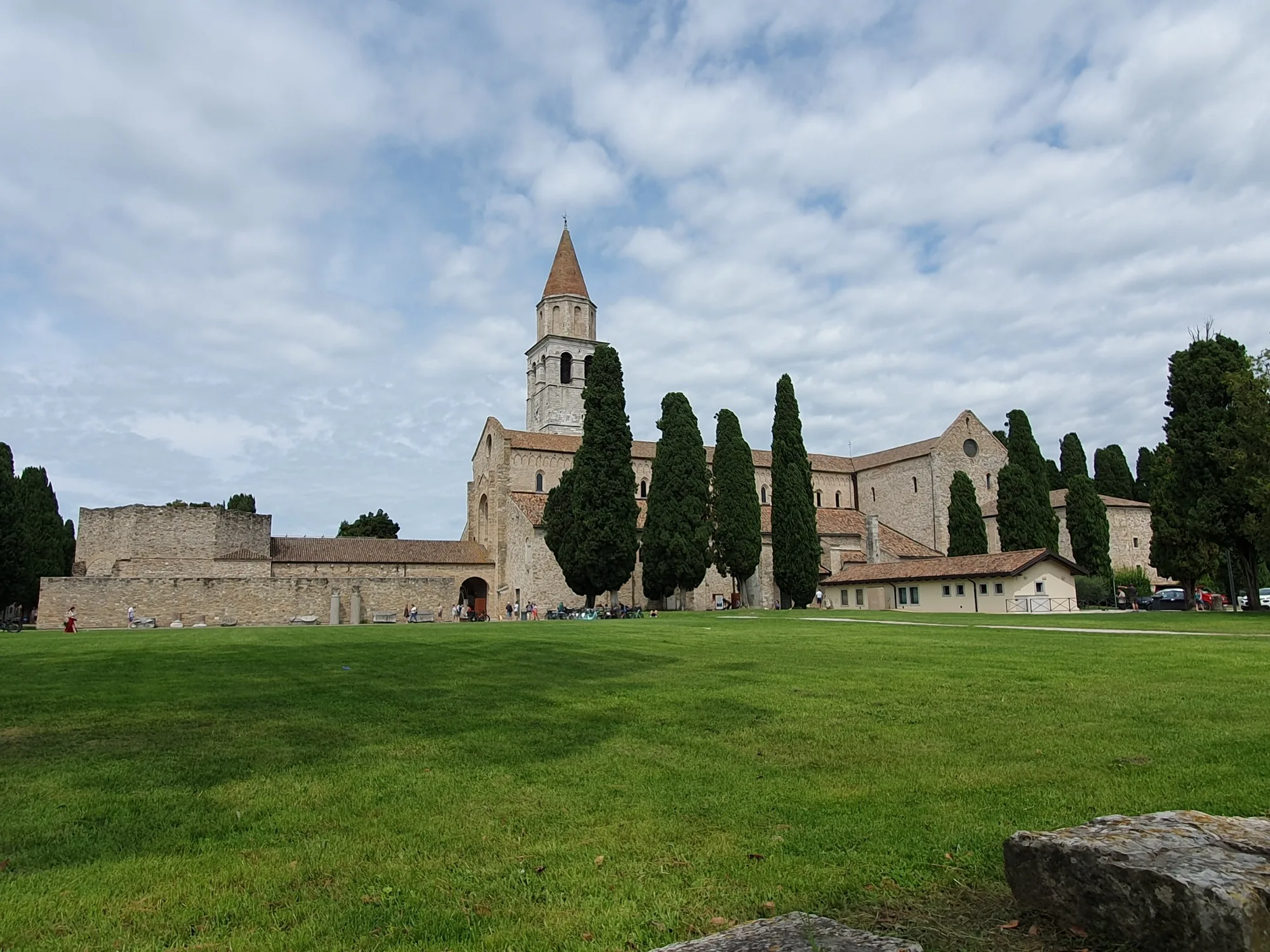
  • The basilica of Aquileia with its bell tower and cypresses behind a lawn under a cloudy sky
    Photo: Qasinka, CC0 1.0
    Aquileia

    With about 750 square metres, the basilica has one of the largest early Christian mosaic floors in the western world.

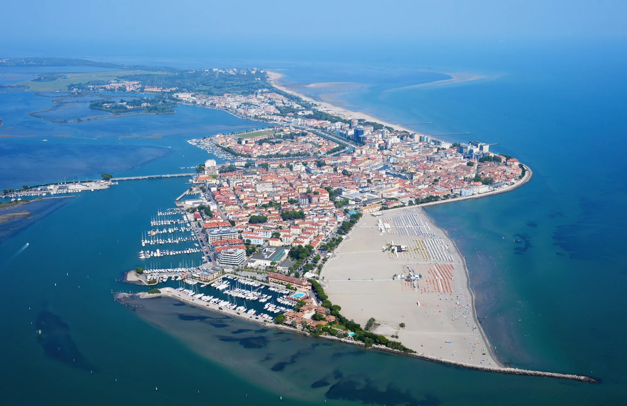
  • Aerial view of Grado, an island with an old town, harbour and beach between lagoon and sea
    Photo: Carsten Steger, CC BY-SA 4.0
    Grado

    The former fishing village lies on an island in the lagoon, with buildings from the Habsburg era and a long south-facing beach.

Across the borders

  • Austria: No visa for German passports, Austria is part of the Schengen area. Travel with a passport, ID card or child passport, the provisional documents count too. There are no compulsory vaccinations. Customs rules can change at short notice. As of 7 November 2026, without guarantee. (as of 7 November 2026)
  • Italy: No visa for German passports, Italy is part of the Schengen area. Travel with a passport, ID card or child passport and always carry your ID. Checks at internal borders are meant to be exceptional, at Tarvisio there is no fixed border post. As of 7 November 2026, without guarantee. (as of 7 November 2026)

No guarantee. What applies at a border can change. Check with the official sources before you set off.

Notes on the route

  • The announced bike shuttle is an on-demand bus and costs 10 euros per direction according to the railways, paid in cash to the staff. The annual pass of the car shuttle train is meant to be valid. The state of Carinthia gives 10 July 2027 as the expected date for the car shuttle train to resume, and the railways give no date. In the replacement buses bikes are limited and only with a reservation according to one sentence of the railways, and not possible at all according to another (as of 10 November 2026).
  • Canal Valley in winter: Tarvisio – Venzone is closed every year from November to April according to the Friuli Venezia Giulia tourist board, and another page of the same provider warns of heavy snow from November to May. According to announcements by the route, the section opened on 18 April in 2026 and has been closed again since early November. For 2027 expect it to open from mid to late April. Check the news on the route's website.
  • No guarantee that the route is passable. All details as of 10 November 2026, timetables, prices and closures change.
  • Loading service in 2026 and after: the ride takes 11 minutes, the trains run hourly. The railways give the price as 13 euros for the bike including the person, cheaper online (as of 10 November 2026). There is no reservation.
  • Tunnels: there are tunnels on the route, around 20 or more according to the Austrian motoring club and the Austrian tourist board. According to an announcement by the route in November 2025, the tunnels on the old railway line were to get new lighting after the winter break.

No guarantee. Roadworks, closures and ferries change, current notes are published by the cycle route's operators.

Ride it yourself

Open in Pedalglobe Download route as GPX

“Open in Pedalglobe” takes you to the trip in the app. If you stay in Safari, tap “Open” in the banner at the top or download the tour file. The app splits the days by your pace, so the daily stops may differ from the stages here.

Open the GPX file with Pedalglobe and choose “Keep exactly (1:1)”. The route is then under “Tours”. With “Add to Trip …” you turn it into your own trip with days, climate and entry rules for your travel dates.

Plan it yourself: This trip and everything here: planned in Pedalglobe in a few minutes, with elevation profile, climate for every day and what applies at each border.

Pedalglobe on the App Store

You can also find new bike trips and short videos about them on Instagram, TikTok and YouTube.

Sources

Sources and check dates
  1. Alpe-Adria cycle route, the route's website, checked on 10 November 2026
  2. ÖAMTC, Alpe-Adria cycle route, checked on 10 November 2026
  3. Austrian tourist board, Alpe-Adria cycle route, checked on 10 November 2026
  4. Friuli Venezia Giulia tourist board, Alpe-Adria cycle route (FVG1), checked on 10 November 2026
  5. Friuli Venezia Giulia tourist board, Tarvisio – Venzone, checked on 10 November 2026
  6. Austrian railways, Tauern railway car shuttle, checked on 10 November 2026
  7. Austrian railways, closure of the Tauern railway Schwarzach – Mallnitz-Obervellach 2027, checked on 10 November 2026
  8. State of Carinthia, Tauern tunnel closure, checked on 10 November 2026
  9. Gastein tourism, loading Böckstein – Mallnitz, checked on 10 November 2026
  10. Gastein tourism, waterfall Bad Gastein, checked on 10 November 2026
  11. Austrian railways, leaflet Rail & Bike Carinthia 2026, checked on 10 November 2026
  12. Austrian railways, taking bikes on trains, checked on 10 November 2026
  13. GeoSphere Austria, climate data Villach Stadt 1991 to 2020, checked on 10 November 2026
  14. Normals Udine-Rivolto 1991 to 2020 (table on Wikipedia, rough guide), checked on 10 November 2026
  15. Salzburg tourism, World Heritage Salzburg, checked on 10 November 2026
  16. Friuli Venezia Giulia tourist board, Basilica of Aquileia, checked on 10 November 2026
  17. italia.it, beach of Grado, checked on 10 November 2026
  18. German Federal Foreign Office, Austria: travel and safety advice, checked on 7 November 2026
  19. German Federal Foreign Office, Italy: travel and safety advice, checked on 7 November 2026

Photos

Checked on 10 November 2026. Maps © OpenStreetMap contributors. Relief: © Mapterhorn and its sources

All trip ideas

More cycling trips

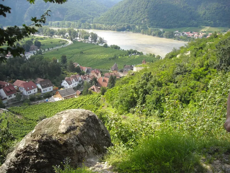
Vineyards above Weißenkirchen and the Danube in the Wachau

Difficulty: easyNew

Danube Cycle Path: Passau – Vienna

  • 317 kmDistance
  • 5 daysDays
  • May, June, SeptemberBest months
  • Germany, AustriaCountries

317 km downstream, from the City of Three Rivers through the Wachau to Vienna, in five days.

Photo: planola, CC BY 3.0, cropped, text added

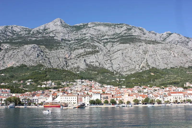
Houses with red roofs on the waterfront of Makarska, boats on calm water in front, behind them the steep grey rock face of Biokovo under a blue sky

Difficulty: moderateNew

Dalmatia: Split – Dubrovnik

  • 254 kmDistance
  • 6 daysDays
  • May, SeptemberBest months
  • CroatiaCountry

254 km in six riding days along the Adriatic, from Split by ferry across the Pelješac peninsula to Dubrovnik.

Photo: NH53, CC BY 2.0, cropped, with text

See all cycling trips

ContentsOpen in Pedalglobe