


Difficulty: moderateNew
Dalmatia: Split – Dubrovnik
- 254 kmDistance
- 6 daysDays
- May, SeptemberBest months
- CroatiaCountry
Your next bike trip?
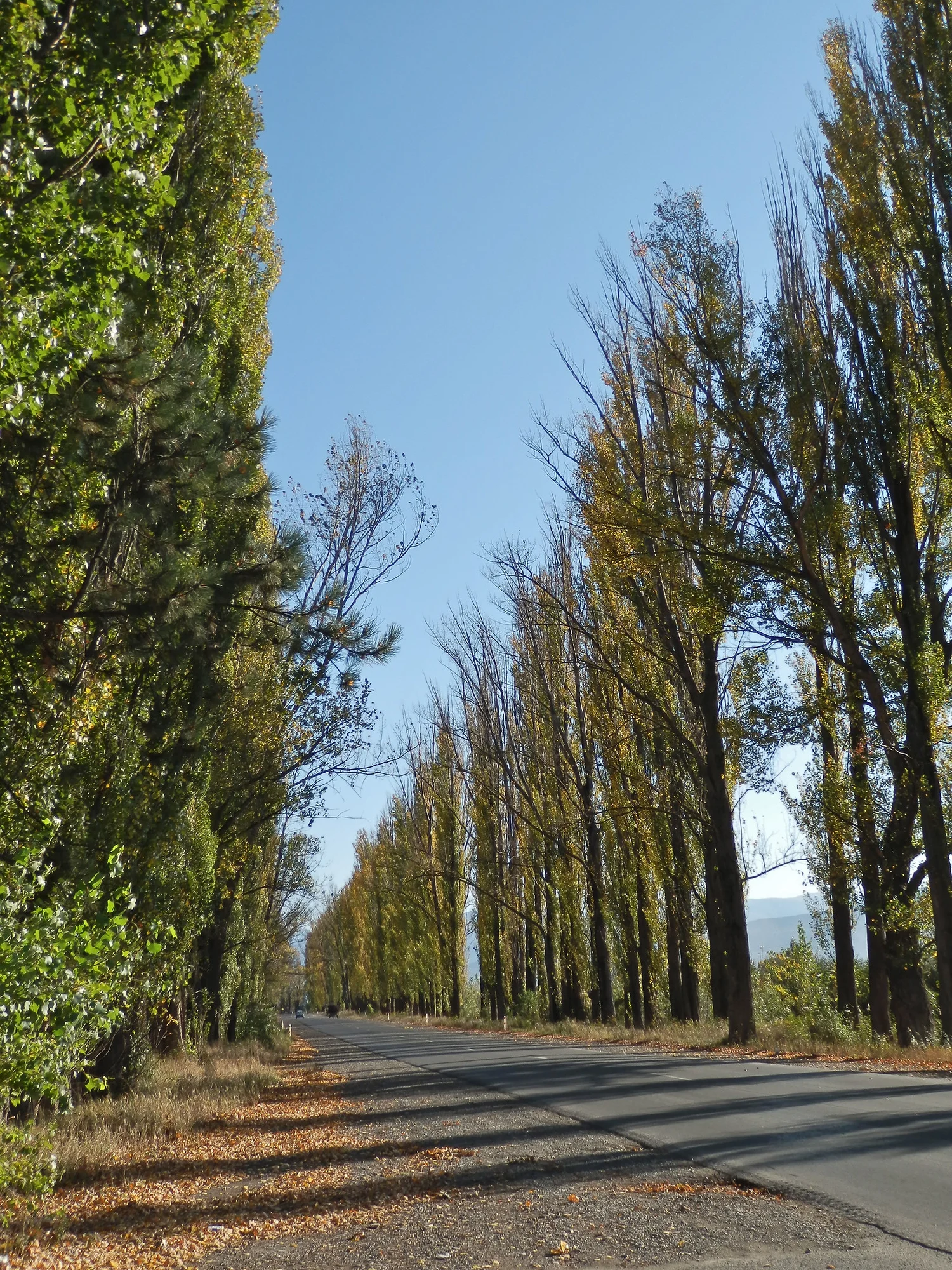
417 km in seven riding days from the Black Sea over the Rikoti Pass to Tbilisi.
Photo: John Crane, CC BY 2.0, cropped, with text

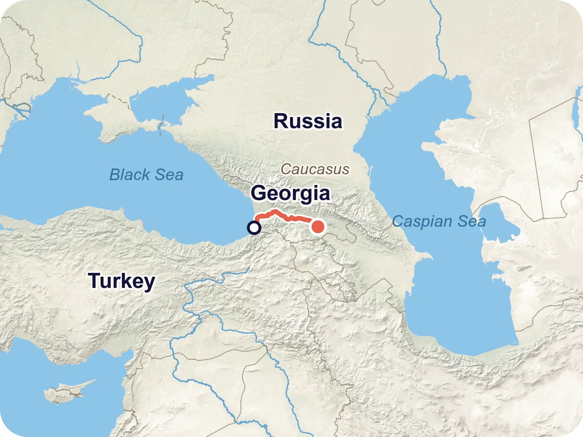
Map © OpenStreetMap contributors, OpenFreeMap, OpenMapTiles. Relief: Mapterhorn. Locator map: Natural Earth
From the beach promenade in Batumi you ride north along the Black Sea coast to Kobuleti and then turn inland. Via Lanchkhuti and Samtredia the road to Kutaisi is almost flat. After Zestaponi it climbs into the Likhi Range to the Rikoti Pass, where western and eastern Georgia meet. Then you roll via Surami and Khashuri to Gori and via Mtskheta to Tbilisi. The highest point is the pass, 1,004 m in the elevation profile.
There is no official cycle route for this trip, and no body in the country gives length, ascent or surface for cyclists. This route is our own planning along the main axis from the coast via Kutaisi to Tbilisi. Over the pass it takes the old pass road, not the tunnel and not the new expressway.
Length and ascent come from the route calculation in Pedalglobe, the elevations from a terrain model. There is no guarantee that the road is passable. Read the route notes before you plan.
Plan it yourself: This trip and everything here: planned in Pedalglobe in a few minutes, with elevation profile, climate for every day and what applies at each border.
80 km · 327 m of climbing
Leaving Batumi you first ride about 9 km on a busy road, then along the coast to Kobuleti. There you turn inland to Lanchkhuti. Almost all asphalt, hardly any climbing, the highest point is at about 140 m.
77 km · 174 m of climbing
Flat via Samtredia to Kutaisi. This day has most of the heavy traffic: 12 km on the main road near Lanchkhuti, about 22 km in total between Samtredia and Kutaisi, plus the passage through Kutaisi. Finish at about 150 m.
38 km · 260 m of climbing
A short day of 38 km that leaves time for Gelati Monastery or Prometheus Cave. After about 14 km the map shows a long gravel stretch, and a good quarter of the day is unsealed.
72 km · 1,291 m of climbing
The pass day. From about 160 m in Zestaponi you climb the old pass road to 1,004 m and then roll down to Surami at about 730 m. Whether the old road is open is not confirmed, ask beforehand. The new expressway and its tunnels are not an alternative.
57 km · 127 m of climbing
Just after Surami you ride through Khashuri, with about 4 km on the main road. Then it goes gently downhill to the east. A good 10 km before Gori the map shows about 7 km of gravel. Finish at about 590 m.
65 km · 268 m of climbing
Between Gori and Mtskheta the map shows two gravel stretches of 7 and 8 km, and a good fifth of the day is unsealed. Finish at about 470 m.
28 km · 384 m of climbing
The last day is short but not flat: after about 9 km you reach the day's highest point at about 800 m, then it goes down to Tbilisi at about 420 m. City traffic at the end.
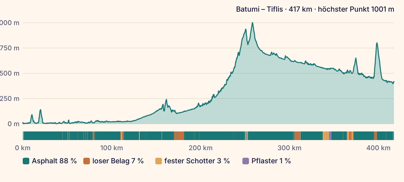
According to the map (OpenStreetMap) you ride 88 % on asphalt, 7 % on loose gravel and 3 % on compacted tracks, with a small rest of paving. The map shows longer unsealed stretches in three places: about 9 km on day 3 after Kutaisi, about 7 km between Khashuri and Gori, and two stretches of 7 and 8 km between Gori and Mtskheta.
On traffic: there is no signposted cycle route anywhere on the trip. According to the map 17 % runs on quiet roads, 11 % on tracks and paths, 59 % on roads and 13 % on busy roads. These roughly 53 km with heavy traffic come in several pieces: the way out of Batumi (9 km), the main road near Lanchkhuti (12 km), several stretches between Samtredia and Kutaisi (about 22 km in total), the passage through Kutaisi (5 km) and the main road near Khashuri (4 km). Ride there with lights and stay visible.
Over the Rikoti Pass the route follows the old pass road. What this road is like today is not confirmed, see the route notes. What the surface is really like changes with weather and roadworks.
Overall: moderate. The days are medium length and only one pass is in the way. About 53 km run on busy roads, where you need a calm head and good visibility.
The Pedalglobe scale: the same five features and levels 1 to 5 for every trip.
A trip for anyone who rides confidently in traffic with luggage. Seven days averaging 60 km, the longest with 80 km. It only gets steep on day 4 with 1,291 m of climbing to the Rikoti Pass. What makes it hard is mainly the traffic: about 71 % of the route runs on roads with car traffic, 53 km of it on busy ones.
The route is our own planning, not a designated cycle route. Neither the German Foreign Office nor the tourism administration gives official advice for cyclists. Leave some slack for the pass day and ask about the state of the old pass road beforehand.
Best months: May, June
The best start is mid-May, and until early June it works well. The west is mild then and drier than at almost any other time of year, and Tbilisi is not hot yet. July and August work too if you can handle heat: in Tbilisi and around Kutaisi the monthly mean is 24 to 26 degrees, and afternoons are much warmer.
The west is wet, the east is dry. Batumi gets about 2,300 mm of rain a year, 240 to 300 mm a month from September to December, and 140 to 190 mm even in summer. Kutaisi gets about 1,290 mm, Tbilisi about 370 mm. From September the coast gets the most rain.
The table shows Kutaisi, the end of day 2 after 156 of 417 km. Daily highs and lows come from our own analysis in Pedalglobe (CHELSA V2.1, CC0, and CRU TS 4.09, Climatic Research Unit, University of East Anglia, Open Government Licence v3.0, mean 1995 to 2024). Precipitation comes from Kutaisi airport (mean of the years 2011 to 2019, source: Georgian air navigation service). The two series agree well, about 0.3 degrees apart in the annual mean.
Winter is not cycling season. At the Rikoti Pass vehicles got stuck after light snow in February 2023. The values are means over several years and say nothing about a single day.
| Month | Day | Night | Precipitation | For cycling |
|---|---|---|---|---|
| January | 9 °C | 1 °C | 132 mm | poor |
| February | 11 °C | 2 °C | 103 mm | poor |
| March | 15 °C | 5 °C | 140 mm | poor |
| April | 20 °C | 9 °C | 92 mm | marginal |
| May | 24 °C | 13 °C | 66 mm | good |
| June | 28 °C | 17 °C | 103 mm | good |
| July | 30 °C | 20 °C | 66 mm | marginal |
| August | 31 °C | 20 °C | 60 mm | marginal |
| September | 27 °C | 16 °C | 135 mm | marginal |
| October | 22 °C | 12 °C | 122 mm | poor |
| November | 16 °C | 7 °C | 126 mm | poor |
| December | 11 °C | 3 °C | 145 mm | poor |
Winter, not cycling season. In Kutaisi a mean of about 7 degrees, Batumi gets 236 mm of rain.
Winter. A mean of 4 degrees in Tbilisi and 8 in Batumi. At the Rikoti Pass even a little snow can block the road.
Still cool and wet in the west, Kutaisi 140 mm and Batumi 168 mm. A mean of 8 to 10 degrees.
Drier, Batumi 86 mm. A mean of 13 to 14 degrees, cooler at the pass.
Best time. The west is drier than almost any other month, Batumi 73 mm and Kutaisi 66 mm, with a mean of 17 to 19 degrees. Tbilisi gets its most rain of the year, 63 mm.
Good, though wetter on the coast: Batumi 187 mm. A mean of 22 to 23 degrees.
Hot in the Kutaisi basin and in Tbilisi, a mean of 24 to 26 degrees, more during the day. Batumi 139 mm.
The warmest month, a mean of 26 degrees in Tbilisi. Batumi 165 mm.
Pleasant in the east, Tbilisi with a mean of 21 degrees and 29 mm. On the coast the wet season begins, Batumi 288 mm.
Very wet in the west, Batumi 289 mm and Kutaisi 122 mm. A mean of 14 to 18 degrees.
The wettest month in Batumi with 298 mm. A mean of 8 to 12 degrees.
Winter, not cycling season. A mean of 4 to 9 degrees, Batumi 243 mm.
The easiest way in is to land in Kutaisi. The airport is a hub of a low-cost airline, and its list of destinations includes flights from Berlin, Dortmund, Hamburg and Memmingen, among others, plus Vienna, Prague and Budapest (as of 14 November 2026). On day 2 the route passes about 1 km from the airport, 26 km before Kutaisi.
If you want to start at the sea, there is a station 1.8 km from the terminal in Kutaisi, served by a free shuttle bus. Trains run between Kutaisi and Batumi. Whether your bike can come along on the bus and the train is not settled, see below.
For Batumi the airport operator lists no direct flight from Germany, so you change planes, for example in Istanbul or Riga. The airport is about 5 km from the start on the beach promenade.
The simplest way home is to fly from Tbilisi. According to the tourism administration there are flights from there to 26 countries, including Germany, Austria and Poland. So book your outbound flight to Kutaisi or Batumi and your return from Tbilisi. The airport lies 17 km south-east of the city.
If you need to get back to Kutaisi or Batumi, Georgian Railway serves both cities from Tbilisi. Tbilisi central station is close to the route, and Batumi station lies right on it. The research did not check ferries across the Black Sea.
Georgian Railway does not say on its website whether bikes can travel on its trains. Reports contradict each other: according to some, a bike only travels taken apart and packed, and according to an older report not at all on the double-decker train Tbilisi – Batumi. Ask at the ticket counter before you travel and pack your bike.
For the flight, check the fee and packaging with the airline. The research did not check this.
Along the way lie cities such as Kutaisi, Gori and Tbilisi, with many villages in between. According to the map (OpenStreetMap) you find shops close to the route almost everywhere. The longest stretches without a shop are a little over 20 km, for example on the climb to the Rikoti Pass and between Khashuri and Gori.
According to the German Foreign Office, cash machines and card payment are available in many places, and euros are easy to exchange.
The German Foreign Office advises drinking only water from a safe source, never tap water. Buy bottled water in the shops along the way, and carry a water filter as a backup. On the pass day it's best to take enough water and food with you from Zestaponi.
The map shows places to stay in every overnight stop, plenty in Batumi, Kutaisi, Gori, Mtskheta and Tbilisi, only a few in Lanchkhuti, Zestaponi and Surami. Book ahead there. According to the tourism administration wild camping is allowed, but on private land only with permission and in national parks only at designated sites. Take your rubbish with you.
According to the map there are bike shops in Batumi, Kutaisi and Tbilisi, plus single ones near Kobuleti and Gori. Between Kutaisi and Gori, about 170 km including the pass, the map shows none. Carry a tube, a patch kit and the most important spare parts.
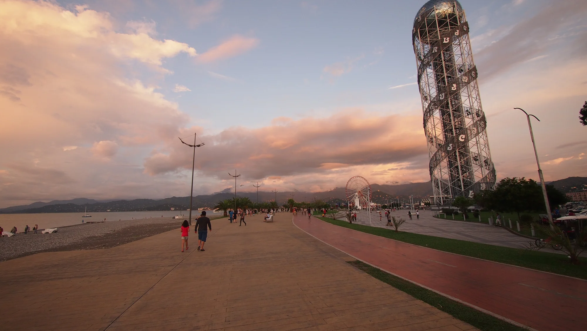
The start is on the beach promenade by the Black Sea. Above the sea near Batumi the Botanical Garden spreads over about 111 hectares of hillside, a quiet place before the first day.
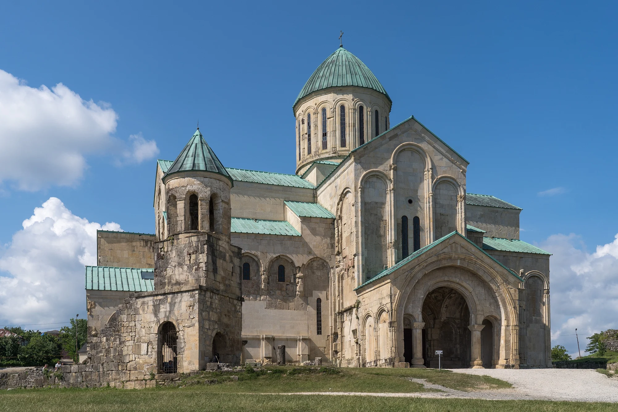
At the end of day 2. About 11 km outside the city stands Gelati Monastery, begun in the early 12th century and a UNESCO World Heritage Site. Near Tskaltubo lies Prometheus Cave, six of its halls are open and the walk ends with a boat ride.
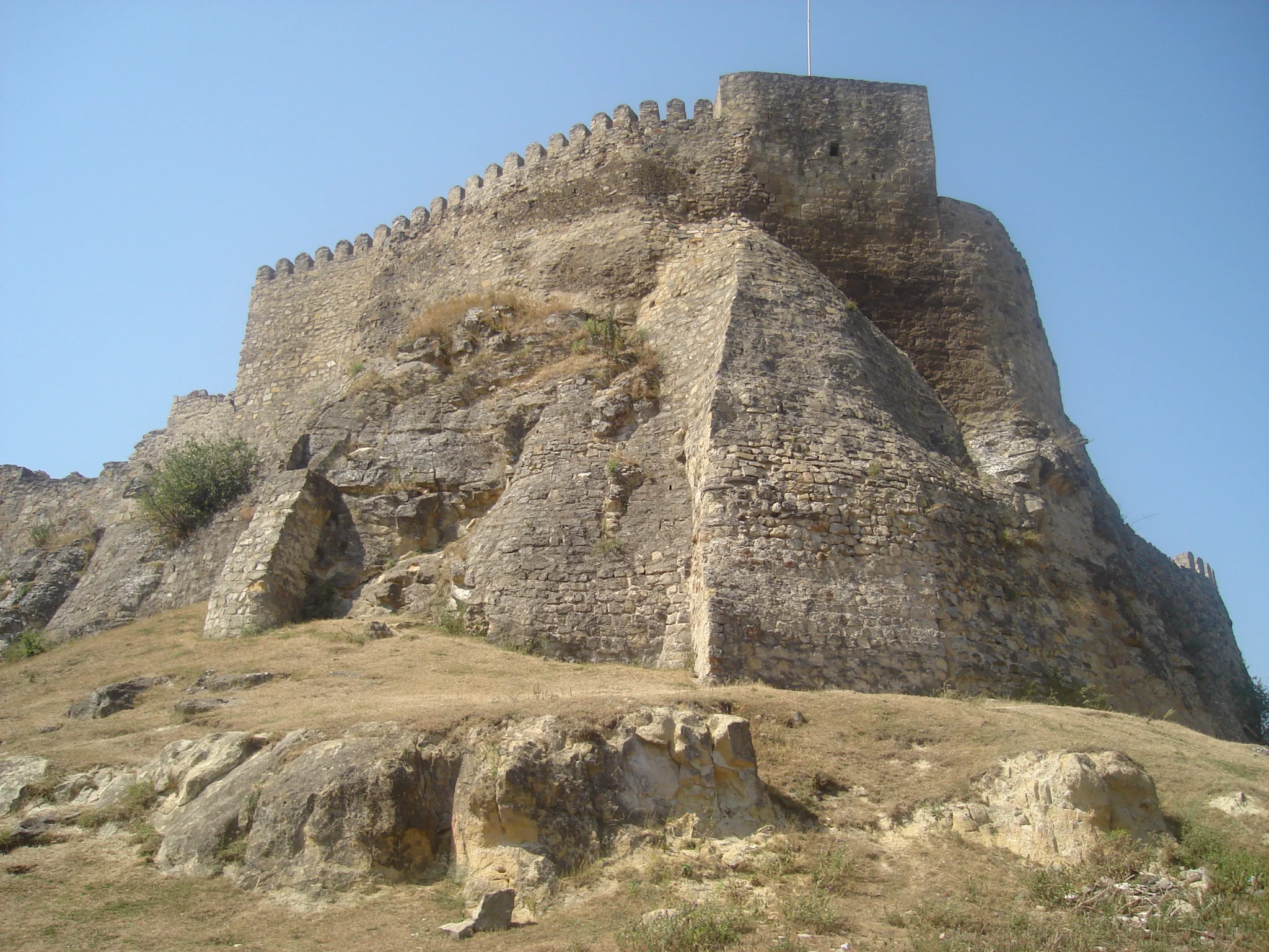
At 996 m in the Likhi Range, western and eastern Georgia meet. The old pass road winds through deciduous forest, then you roll down to Surami.
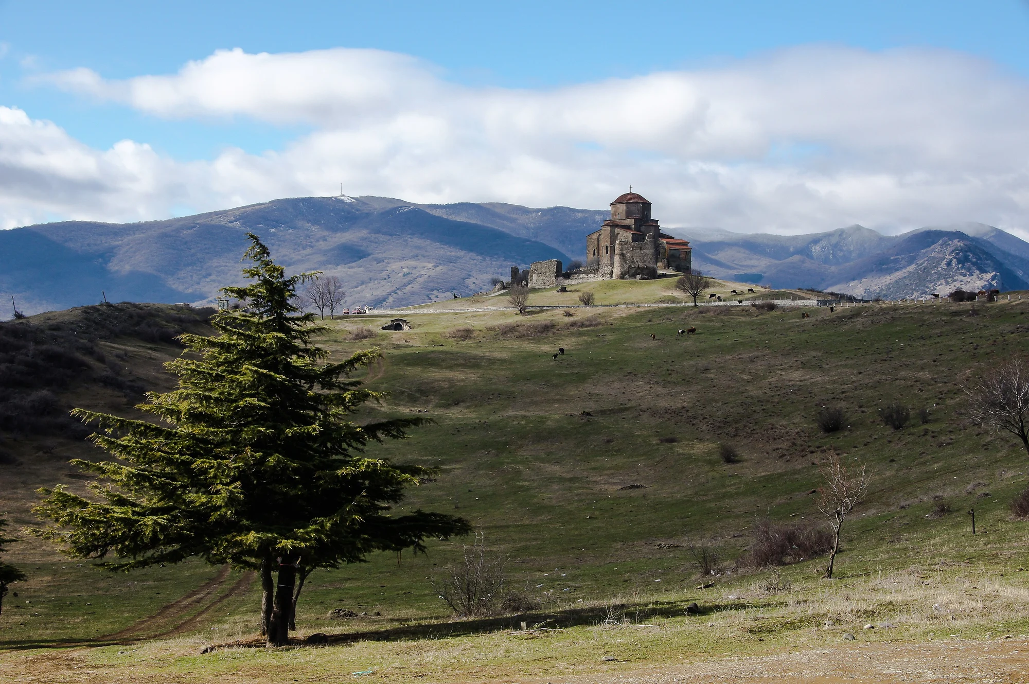
The goal of day 6, just before Tbilisi. Jvari Monastery stands on the hill above the town.
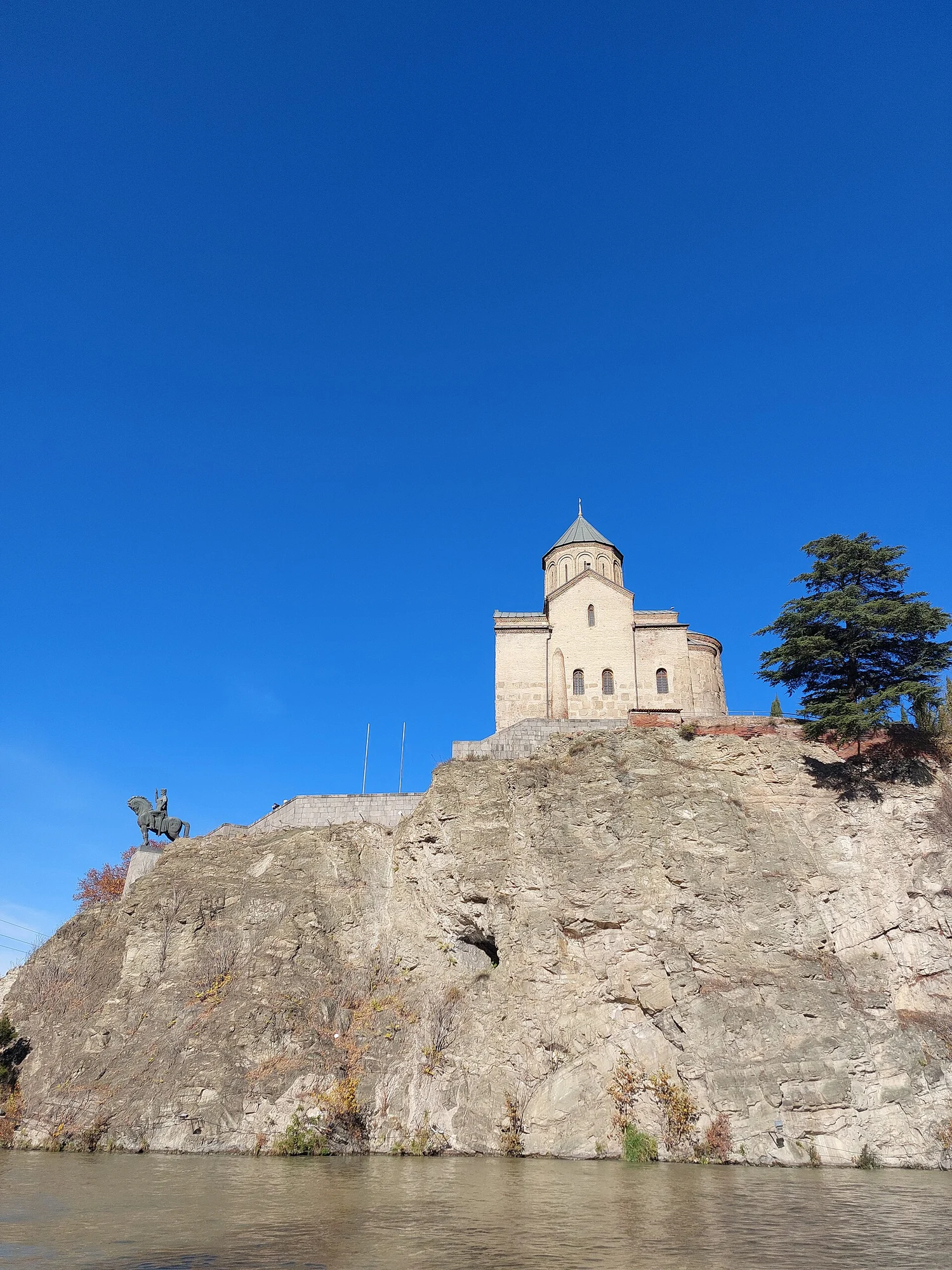
According to tradition the city grew up because of its hot sulphur springs. In the small core of the old town the domed baths from the 17th century still stand, with Narikala Fortress above them.
No guarantee. What applies at a border can change. Check with the official sources before you set off.
No guarantee. Roadworks, closures and ferries change, current notes are published by the cycle route's operators.
Open in Pedalglobe Download route as GPX
“Open in Pedalglobe” takes you to the trip in the app. If you stay in Safari, tap “Open” in the banner at the top or download the tour file. The app splits the days by your pace, so the daily stops may differ from the stages here.
Open the GPX file with Pedalglobe and choose “Keep exactly (1:1)”. The route is then under “Tours”. With “Add to Trip …” you turn it into your own trip with days, climate and entry rules for your travel dates.
Plan it yourself: This trip and everything here: planned in Pedalglobe in a few minutes, with elevation profile, climate for every day and what applies at each border.
You can also find new bike trips and short videos about them on Instagram, TikTok and YouTube.
Checked on 7 November 2026. Maps © OpenStreetMap contributors. Relief: © Mapterhorn and its sources
Difficulty: moderateNew
Difficulty: easyNew
333 km in seven riding days down the Danube, from Vienna via Bratislava and Győr through the Danube Bend to Budapest.
Photo: Philipp Weigell, CC BY 3.0, cropped, with text
Difficulty: easyNew


