Diese Seite gibt es auch auf Deutsch.

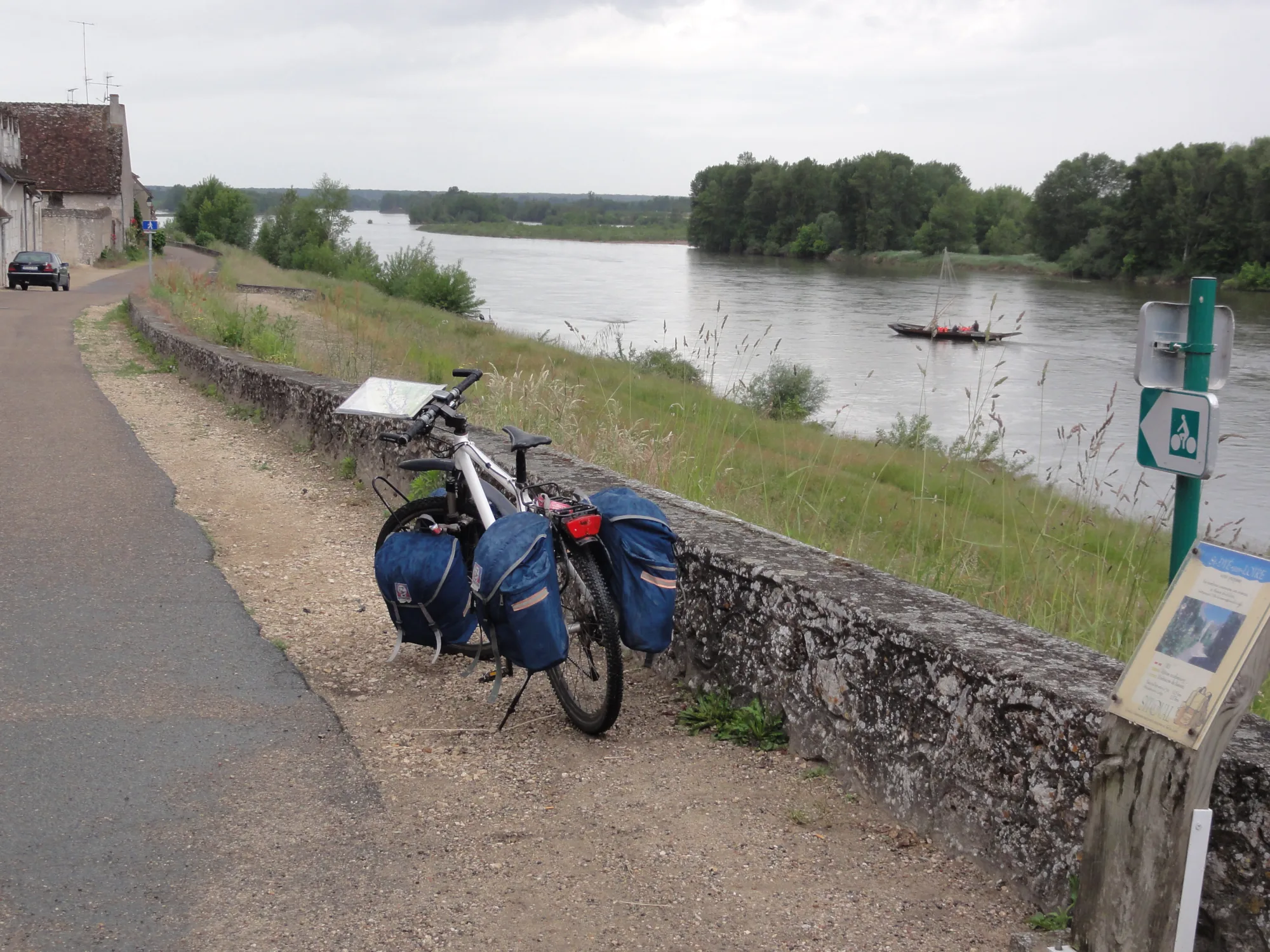
A loaded bike with blue panniers leans against a riverside wall, behind it the wide Loire with a flat wooden boat and wooded islands, a green cycle route sign on the right

Your next bike trip?

Loire Cycle Route: Orléans – Saint-Brevin-les-Pins

453 km in nine riding days down the Loire, from Orléans past châteaux to the Atlantic.

  • Touring bikeBike
  • FranceCountry

Photo: Havang(nl), CC0 1.0, cropped, with text

  • 453 kmDistance
  • 500 mClimbing
  • 9Days
  • 50 kmper riding day
  • 85 %Paved
  • June, SeptemberBest months

The route

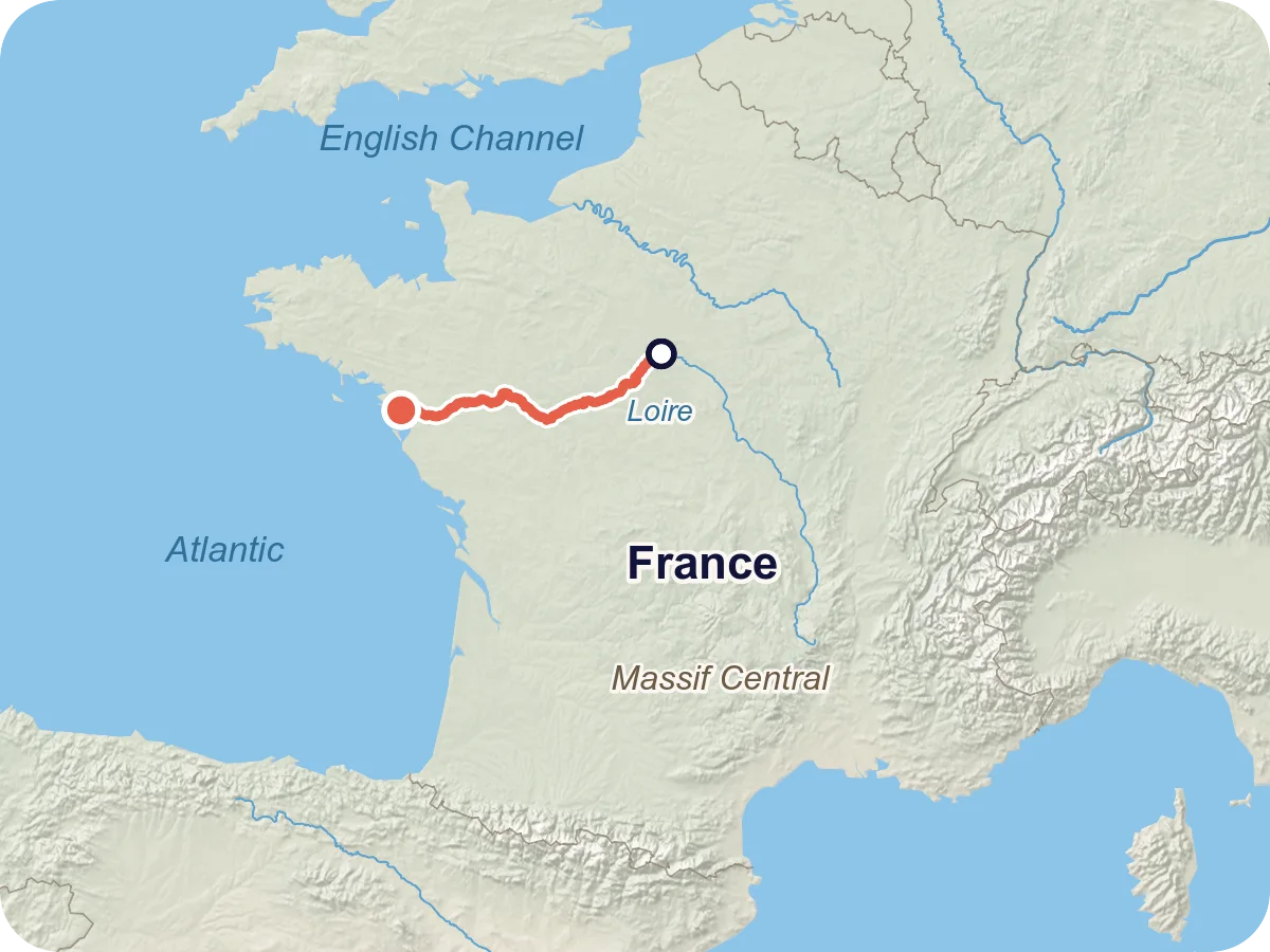
Map of the route from Orléans via Muides-sur-Loire, Blois, Amboise, Villandry, Saumur, Angers, Saint-Florent-le-Vieil and Nantes to Saint-Brevin-les-Pins on the Atlantic
Locator map: the Orléans – Saint-Brevin-les-Pins route in western France, along the Loire to the Atlantic.
  • Asphalt 383 km
  • Compacted gravel 49 km
  • Loose surface 10 km
  • Paved 8 km
  • Cobblestones 3 km

Map © OpenStreetMap contributors, OpenFreeMap, OpenMapTiles. Relief: Mapterhorn. Locator map: Natural Earth

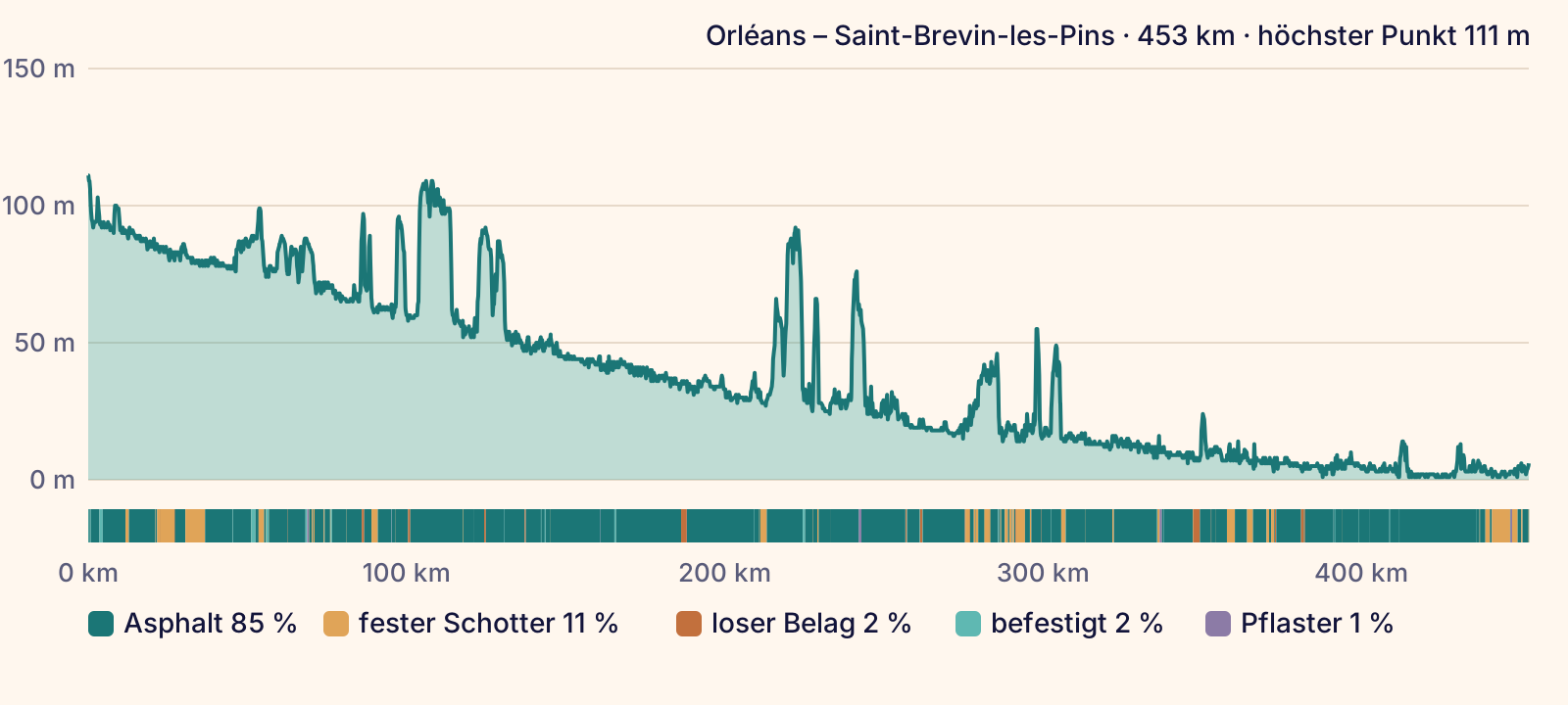
The trip starts in Orléans, and from there the Loire keeps you company all the way to the sea. You ride downstream via Beaugency, take the detour to Chambord château on day 2 and reach Tours via Blois and Amboise. After that you follow the Cher to Villandry, then ride via Saumur and Angers to Nantes. On the last day you cross the Loire by ferry between Couëron and Le Pellerin and reach the Atlantic at Saint-Brevin-les-Pins. The highest point comes right at the start, 111 m in the elevation profile.

The route follows the Loire Cycle Route (La Loire à Vélo). It is signposted in both directions and part of EuroVelo 6. Officially the cycle route starts further upstream at Cuffy near Nevers, and this trip only joins it in Orléans. From here to Nantes a train with a bike compartment runs along the river, and the well-known châteaux lie in this part. The official website gives about 900 km for the whole cycle route, which includes all variants and loops.

Length and ascent come from the route calculation in Pedalglobe: 452.6 km and 500 m of climbing. The line follows the cycle route as the map (OpenStreetMap) records it, with the detours via Chambord and Angers. After Le Pellerin the map does not record the cycle route continuously, so the route there is our own calculation. There is no guarantee that the way is passable. Read the route notes before you plan.

Plan it yourself: This trip and everything here: planned in Pedalglobe in a few minutes, with elevation profile, climate for every day and what applies at each border.

Pedalglobe on the App Store

Stage by stage

  • Day 1: Orléans – Muides-sur-Loire

    47 km · 9 m of climbing

    111 m
    • Asphalt 32 km
    • Compacted gravel 13 km
    • Paved 2 km

    Flat along the river via Meung-sur-Loire and Beaugency. You start at 111 m, the highest point of the trip, and finish at 76 m. Before and after Beaugency the map shows about 6 km of compacted track each, and almost all the rest is asphalt. Along the way lie the old town of Orléans, the château of Meung-sur-Loire and Beaugency with its 11th-century keep.

  • Day 2: Muides-sur-Loire – Blois

    28 km · 33 m of climbing

    99 m
    • Asphalt 22 km
    • Paved 3 km
    • Compacted gravel 3 km
    • Cobblestones 0.5 km
    • Loose surface 0.1 km

    The shortest day leaves time for the château. Via Saint-Dyé-sur-Loire, the former port for the building of Chambord, you leave the river and ride through the forest to the château, which you reach after a good 9 km. Then it goes back to the Loire and on to Blois with its royal château. According to the map 22 of the 28 km are asphalt, with just under 2 km of compacted track shortly before Chambord.

  • Day 3: Blois – Amboise

    42 km · 114 m of climbing

    109 m
    • Asphalt 38 km
    • Compacted gravel 2 km
    • Loose surface 1 km
    • Paved 0.5 km
    • Cobblestones 0.1 km

    On the south bank via Chaumont-sur-Loire with its château and garden festival. With 114 m of climbing this is the day with the most ascent, spread over three short climbs of 30 to 40 m: after about 10 km, right after Chaumont and about 10 km before the finish. There you reach the day's highest point at 109 m and roll down to Amboise at 58 m. In Blois the day starts with half a kilometre on a busy road.

  • Day 4: Amboise – Villandry

    47 km · 52 m of climbing

    92 m
    • Asphalt 46 km
    • Loose surface 0.9 km
    • Paved 0.3 km
    • Compacted gravel 0.1 km
    • Cobblestones 0.1 km

    Through wine villages to Tours, which you reach after 27 km. After a good 8 km the route climbs briefly to 92 m, otherwise the day stays flat. The way out of Tours has many junctions, then you ride along the south bank of the Cher to Villandry. Almost all asphalt, about half of it on separate cycle paths. At the finish the château gardens in French style await, with an ornamental garden made of vegetable beds.

  • Day 5: Villandry – Saumur

    62 km · 91 m of climbing

    93 m
    • Asphalt 56 km
    • Compacted gravel 2 km
    • Loose surface 2 km
    • Paved 1 km

    The longest day. According to the map you ride the first 20 km on roads, via Bréhémont and past Rigny-Ussé with its château. After about 46 km you reach Candes-Saint-Martin where the Vienne flows into the Loire, followed by Montsoreau and cave dwellings on the riverbank. Shortly before Saumur the route climbs from about 30 to a good 90 m and then drops into the town.

  • Day 6: Saumur – Angers

    60 km · 110 m of climbing

    76 m
    • Asphalt 52 km
    • Compacted gravel 5 km
    • Loose surface 2 km
    • Cobblestones 0.8 km
    • Paved 0.3 km

    On small roads along the south bank to Gennes, with two short climbs: right after Saumur and near Gennes, there up to 76 m. Near Saint-Rémy-la-Varenne you cross the Loire after 29 km. Then it stays flat, and only the last kilometres rise gently to Angers at 44 m. Before the city the map shows two stretches of just under 2 km on compacted track. Along the way lie the church of Cunault, the old port of Le Thoureil and the slate quarries of Trélazé, and at the finish the fortress of Angers.

  • Day 7: Angers – Saint-Florent-le-Vieil

    50 km · 58 m of climbing

    57 m
    • Asphalt 42 km
    • Compacted gravel 8 km
    • Loose surface 0.3 km
    • Paved 0.3 km

    From Angers you ride down the Maine to Bouchemaine, where it flows into the Loire. On these first 10 km or so the map shows a good 5 km of compacted track. Two short climbs to a good 50 m follow, then it is flat via Chalonnes-sur-Loire to Montjean-sur-Loire. Just before Chalonnes there are 1.5 km on a busy road. From Montjean you ride the last 12 km on the levee road with a cycle lane and car traffic.

  • Day 8: Saint-Florent-le-Vieil – Nantes

    58 km · 16 m of climbing

    24 m
    • Asphalt 47 km
    • Compacted gravel 7 km
    • Loose surface 4 km
    • Cobblestones 0.7 km
    • Paved 0.3 km

    According to the route calculation the flattest of the long days, with 16 m of climbing and the highest point at 24 m. The line stays down by the river and does not climb to Champtoceaux, which sits on the height above the Loire. After about 16 km there are a good 2 km on a busy road. A little over 10 km are unsealed, in several short pieces. From Mauves-sur-Loire the map shows mostly cycle paths and riverside paths into Nantes.

  • Day 9: Nantes – Saint-Brevin-les-Pins

    59 km · 17 m of climbing

    14 m
    • Asphalt 49 km
    • Compacted gravel 9 km
    • Cobblestones 0.5 km
    • Paved 0.1 km

    Leaving Nantes you ride on the north bank, with just under 2 km on a busy road and, according to the notices, roadworks until the end of 2027. After 15 km comes Couëron, and shortly after it the ferry to Le Pellerin: free, every 20 minutes. On the south bank quiet roads lead to Paimbœuf with its colourful houses. Beyond Le Pellerin the surface gets rougher, the tourist boards give about 14 km for this part. The last 15 km mostly follow cycle paths, a good 9 km of them on compacted track, all the way to the Atlantic.

The ground under your tyres

Elevation profile, from 111 m in Orléans with a few short rises up to about 110 m, falling slowly to almost sea level at the estuary

According to the map (OpenStreetMap) you ride 85 % on asphalt, 11 % on compacted tracks and 2 % on loose gravel, with a small rest of paving. Most of the unsealed stretches are on day 1 (about 12 km between Meung-sur-Loire and Muides-sur-Loire), on day 8 (a little over 10 km in several short pieces) and on the last day (a little over 9 km after Paimbœuf).

On traffic: 78 % of the route runs on signposted cycle routes. According to the map you ride 22 % on separate cycle paths, 37 % on quiet roads, 16 % on tracks and paths, 22 % on ordinary roads and just under 2 % on busy roads. These roughly 7 km with heavy traffic are short pieces: in Blois (0.5 km), in Tours (0.4 km), just before Chalonnes-sur-Loire (1.5 km), between Saint-Florent-le-Vieil and Champtoceaux (2.1 km), on the way out of Nantes (1.8 km) and after Paimbœuf (0.4 km). Longer stretches on ordinary roads come after Villandry (about 20 km), between Saumur and Saint-Rémy-la-Varenne (about 18 km) and between Montjean-sur-Loire and Saint-Florent-le-Vieil (about 12 km, a levee road with a cycle lane and car traffic).

On the last day a ferry is part of the route: between Couëron and Le Pellerin you cross the Loire, half a kilometre without pedalling in the elevation profile. What the surface is really like changes with weather, floods and roadworks.

Difficulty and who it suits

Overall: easy. Flat, downstream and a good three quarters on signposted cycle routes. Only about 7 km run on busy roads.

  • Distance50 km per riding day, the longest day has 62 km
  • Climbingabout 110 m per 100 km, almost flat
  • Surface85 % asphalt according to the map, about 13 % compacted track or gravel
  • TrafficJust under 2 % on busy roads (7 km), 78 % on signposted cycle routes
  • Self-sufficiencyTowns and villages along the way almost every day, more than 800 businesses with the label for cycle tourers

The Pedalglobe scale: the same five features and levels 1 to 5 for every trip.

An easy trip, also for a first longer tour with luggage. Nine days averaging 50 km, the longest with 62 km, the shortest with 28 km. The route follows the river, with short rises between Blois and Angers. Pedalglobe counts about 500 m of climbing over 453 km. The stage pages of the tourist boards add up to about 1,580 m, because they count every small rise. About 78 % runs on signposted cycle routes, only about 7 km on busy roads. You ride west and so often into the wind, which here mostly comes from the sea. If you would rather not, ride the trip upstream from the Atlantic.

For a good fifth of the route you share ordinary roads with cars. According to the tourism bodies traffic gets denser on the way out of Tours, on the levee road after Montjean-sur-Loire and on the north bank in Nantes. If you ride with children, plan for these places. The train with a bike compartment stops in Blois, Amboise, Tours, Saumur, Angers and Nantes, so you can shorten stages.

Who it suits

  • anyone riding several days with luggage for the first time
  • families, with shorter days and a plan for the few places with denser traffic
  • anyone who likes châteaux, old towns and calm days by the river
  • with a trailer or tandem only up to a point: the official website advises against them on a few narrow riverside paths

When to go

Best months: June, September

×Jan×Feb×Mar!Apr✓May✓Jun✓Jul✓Aug✓Sep!Oct×Nov×Dec8°9°13°16°20°23°26°26°22°17°11°8°3°2°4°6°9°13°14°14°11°9°5°3°
  • ✓good
  • !marginal
  • ×poor
  • Day °C
  • Night °C
  • Precipitation (mm)

The best start is in June or in September. Mean daily highs are then 22 to 24 degrees, nights 11 to 13 degrees. You can ride from May to September. May is pleasant at about 20 degrees, but in Orléans it is the wettest month of the year. July and August are the warmest months and the driest on the lower Loire.

The climate changes little along the route, and towards the sea it gets a little milder and wetter. Orléans gets about 640 mm of precipitation a year, Tours about 680 mm and Nantes about 820 mm. In autumn the coast gets much wetter: in Nantes precipitation rises from 60 mm in September to 89 mm in October and 94 to 101 mm in November and December.

The table shows Tours, which you reach on day 4 after 143 of 453 km. Daily highs, lows and precipitation are long-term means for 1991 to 2020 from Météo-France, rounded to whole degrees and millimetres.

For the trip home the train with a bike compartment matters too. In 2026 it ran all year, and from 1 May to 27 September a bike reservation was compulsory every day. For 2027 the only announcement so far is that this rule returns from May to September. In winter and spring floods can close riverside paths. The values are means over many years and say nothing about a single day.

All values as a table

Climate by month (long-term average)

MonthDayNightPrecipitationFor cycling
January8 °C3 °C63 mmpoor
February9 °C2 °C52 mmpoor
March13 °C4 °C49 mmpoor
April16 °C6 °C53 mmmarginal
May20 °C9 °C58 mmgood
June23 °C13 °C53 mmgood
July26 °C14 °C47 mmgood
August26 °C14 °C44 mmgood
September22 °C11 °C52 mmgood
October17 °C9 °C66 mmmarginal
November11 °C5 °C69 mmpoor
December8 °C3 °C72 mmpoor
  • Summer heat: in July and August mean daily highs are about 26 degrees. Orléans and Tours then have a little over 5 days a month with at least 30 degrees on average, and the station records are 40 to 42 degrees.
  • Rain on the coast in autumn: Nantes gets a mean of 89 mm in October and 94 to 101 mm in November and December. If you ride in October, you reach the wet part of the trip last.
  • Cool nights in May and September: in Orléans mean lows are about 9 degrees in May and a little over 10 degrees in September. Pack for that if you camp.
  • Floods in winter and spring: after heavy rain in February 2026 parts of the cycle route were flooded, and at the end of March some were still closed.
Month by month

January

Winter, not cycling season. In Tours a mean of 8 degrees by day and 3 at night. Nantes gets 88 mm of precipitation.

February

Still winter, 9 degrees by day and 2 at night. In February 2026 floods after heavy rain covered parts of the cycle route.

March

The first mild days at 13 degrees, 4 at night. At the end of March 2026 a few stretches were still closed after the floods.

April

16 degrees by day, nights still fresh at 6 degrees. Along the route 47 to 58 mm fall. From 1 May 2026 a bike needed a reservation on the train every day.

May

Pleasant at about 20 degrees, 9 at night. In Orléans May is the wettest month of the year with 63 mm.

June

Best time. 23 degrees by day, 13 at night, with 49 to 53 mm of precipitation along the route.

July

The warmest month, 26 degrees by day and 14 at night. Tours has a little over 5 days with at least 30 degrees on average. Dry on the lower Loire, Nantes 44 mm.

August

As warm as July, 26 degrees by day. With 44 mm Tours gets less precipitation than in any other month. At the finish the minibus across the bridge only ran until 30 August in 2026.

September

Best time. 22 degrees by day, 11 at night, with 51 to 60 mm of precipitation. In September 2026 there was no minibus across the bridge at the finish any more, so sort out your trip home beforehand.

October

Still 17 degrees by day, 9 at night. It gets wetter towards the sea, Nantes gets 89 mm.

November

Short days and a lot of rain. In Tours 11 degrees by day and 69 mm, in Nantes 94 mm.

December

Winter, not cycling season. 8 degrees by day, and with 101 mm the wettest month of the year in Nantes.

Variants

Finish in Nantes · 394 km

Days 1 to 8, about 394 km. The train with a bike compartment stops in Nantes every day. You then don't need the Saint-Nazaire bridge, but the trip doesn't end at the sea.

Châteaux in a week: Orléans – Saumur · 225 km

Days 1 to 5, about 225 km, with Chambord, Blois, Amboise and Villandry. You go back on the train with a bike compartment.

From Cuffy, the official start

Officially the cycle route starts at Cuffy, where the Allier flows into the Loire. From Nevers station, 13 km before it, Orléans is about 200 km and four riding days further, via La Charité-sur-Loire, Sancerre, Briare and Gien. This part is quieter. According to the official website there are few places to stay between Cuffy and Sancerre, so book ahead there. The train with a bike compartment does not run east of Orléans. The kilometres come from the tourism bodies, and this part is not calculated in Pedalglobe.

With Azay-le-Rideau and Chinon · 86 km

Between Villandry and Saumur a loop south of the Loire leads via Azay-le-Rideau and Chinon. The official website splits it into three short days of 28, 22 and 36 km, so you need one more day.

South bank from Nantes

Via Trentemoult and La Montagne to Le Pellerin, without the ferry. According to the official website it is quieter than the north bank, but longer and hillier.

Getting there and back by train

Getting there

The trip starts in Orléans. The train with a bike compartment also starts at the station there and follows the Loire to Nantes.

From Paris the regional train leaves Austerlitz station and reaches Orléans in less than an hour. In 2026 bikes travelled free there from Monday to Friday, and for 1 euro with a reservation on Saturdays, Sundays and public holidays. For trains between Germany and France the French railway only mentions bikes taken apart or folded and in a cover. The German railway lists no direct connection to France with bike spaces. We have not checked the change between stations in Paris.

Getting back

Saint-Brevin-les-Pins has no railway station. The nearest is in Saint-Nazaire, beyond the bridge over the estuary, which is more than 3 km long. Cycling across the bridge is not recommended.

In 2026 there were three ways across. In summer a minibus with a bike trailer ran daily from 4 July to 30 August, 9 trips each way, with room for 8 people and 8 bikes, 5 euros per person, no tandems or cargo bikes. All year round bus line 317 (Aléop) runs to Saint-Nazaire station in 15 to 20 minutes. Your bike only comes along if you register it by phone the day before at the latest. The trip costs 2.90 euros in cash, and there are 6 spaces for e-bikes or 8 for ordinary bikes, trailers are not carried. There is also a taxi with a bike rack for up to 4 people and 4 bikes, on request. The dates for 2027 have not been published yet, as of 18 November 2026. Outside those summer weeks only the bus with registration and the taxi remain.

The train with a bike compartment takes you back to the start: Orléans – Blois – Amboise – Saint-Pierre-des-Corps – Tours – Saumur – Angers – Ancenis – Nantes, and at weekends on via Saint-Nazaire to Le Croisic. In 2026 it ran all year, with up to 3 trips each way between Orléans and Nantes from Monday to Friday and 2 each way between Orléans and Le Croisic at weekends, except during engineering works. So at weekends it stops in Saint-Nazaire, and on weekdays it starts in Nantes. Help with loading was offered on 14 weekends between 1 May and 30 August. The 2027 timetable has not been published yet.

If you want to avoid the bridge, end the trip in Nantes, see the variants.

Your bike on the train

Depending on the train and the season, the train with a bike compartment has 9 to 50 bike spaces. In 2026 a bike reservation was compulsory every day from 1 May to 27 September, 1 euro per bike and trip on top of the ticket. Ordinary bikes and e-bikes are allowed. Tandems and folded trailers only travel in the dedicated bike compartment, 240 cm long at most, and cargo bikes not at all. Take your bags off before loading and keep your ticket and reservation ready.

On the French long-distance trains TGV INOUI and Intercités only some trains have spaces for bikes that are not taken apart. You book the space together with your ticket, and it cannot be added later. Taken apart or folded in a cover of up to 90 × 130 × 50 cm, a bike travels free and without a reservation. Tandems, recumbents, tricycles, cargo bikes and trailers are excluded. From 13 December 2026, bikes longer than 185 cm overall or with tyres wider than 6 cm, fatbikes and bikes with more than two wheels are also banned there. As of 13 November 2026.

Food and places to sleep

The route passes through towns and villages almost every day. More than 800 businesses along the route carry the national label for cycle tourers (“Accueil Vélo”): places to stay, bike rentals, repair shops, tourist offices, sights and restaurants. They lie no more than 5 km from the route and give information for cycle tourers.

Food and shopping

Tourist offices and restaurants with the label hand out drinking water for free. Restaurants with the label offer a quick meal at least from 11:30 to 14:30 and a place to charge batteries.

Places to sleep

Along the way there are hotels, guest rooms, holiday flats and campsites. Places to stay with the label have a secure room for your bike, a repair kit and a way to wash and dry clothes. Book ahead in season, above all in the small overnight stops Muides-sur-Loire, Villandry and Saint-Florent-le-Vieil.

Bike shops and water

Along the route there are repair shops and bike rentals with the label, plus luggage transfer, lockers for luggage and bikes, and car parks for longer stays. The research did not read details or prices.

Along the way

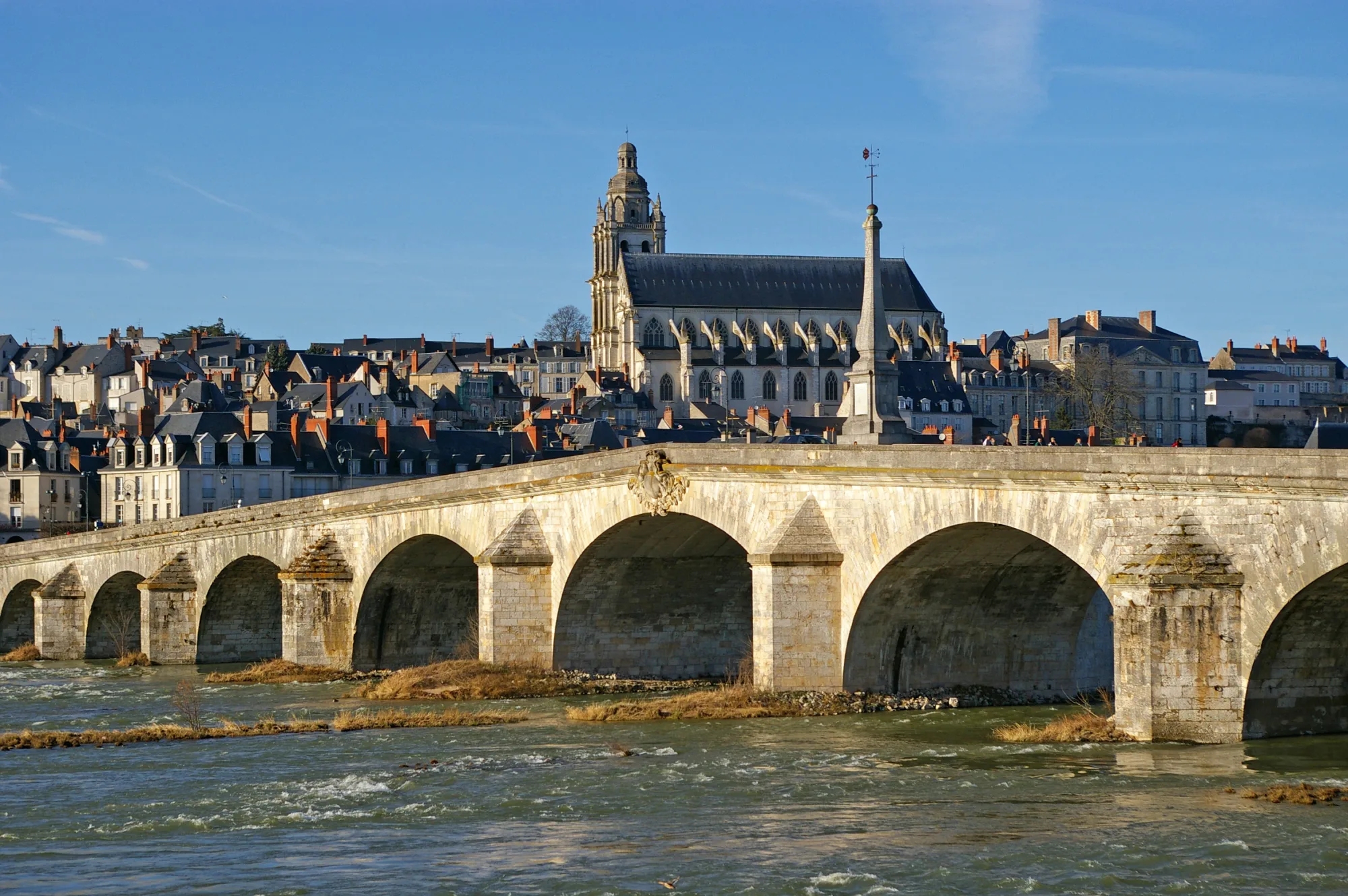
  • An old stone bridge with many arches over the Loire, behind it the roofs of the old town and a large church with a tower under a blue sky
    Photo: Daniel Jolivet, CC BY 2.0
    Chambord and Blois

    On day 2 the route leaves the river and leads through the forest to Chambord château. Building began in 1519, and the château comes with an estate of 5,440 hectares behind a wall 32 km long. In the evening you reach Blois, where the old town with the royal château lies above the river.

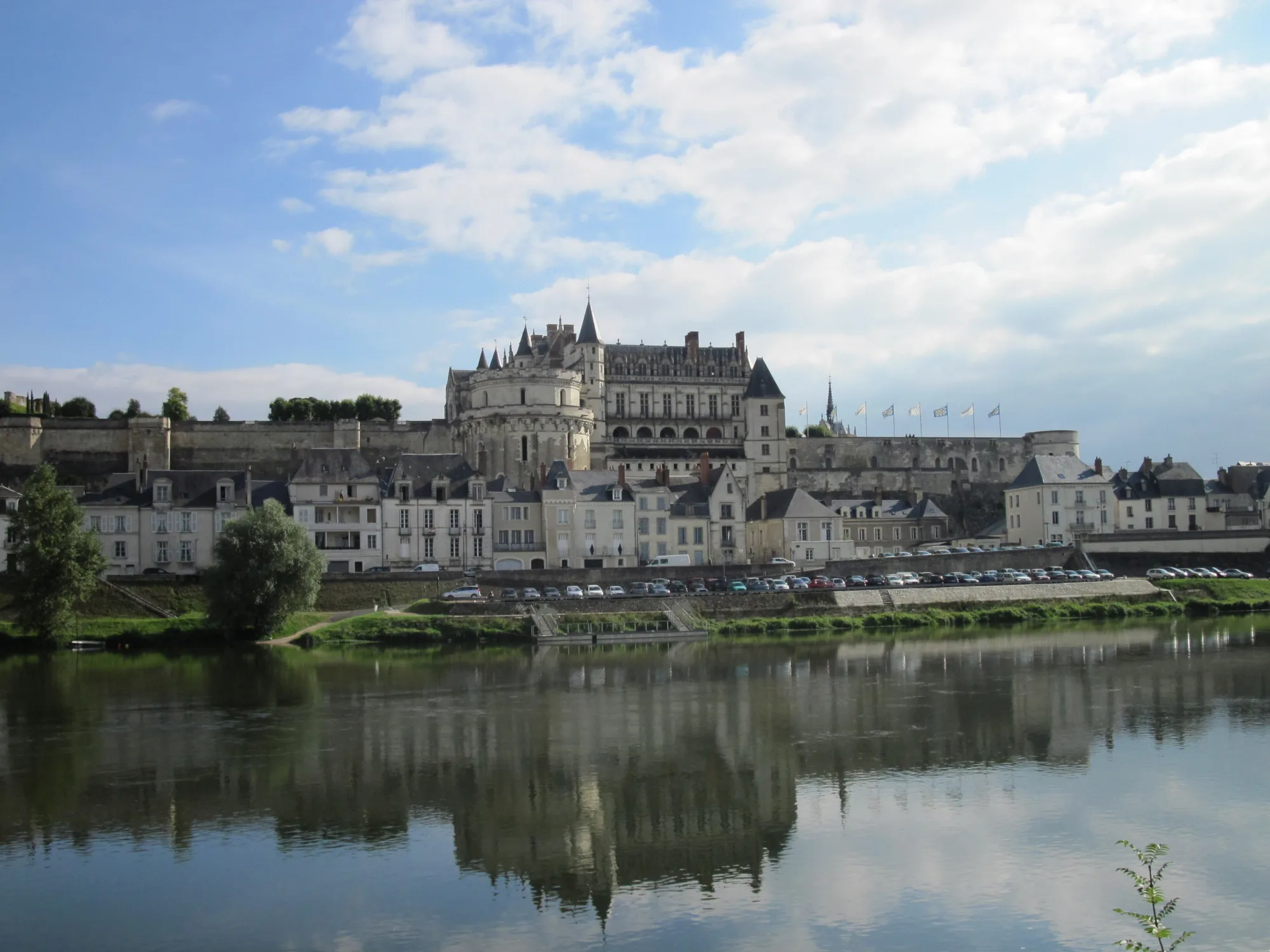
  • A château with round towers above a row of houses on the riverbank, in front the Loire reflecting the château and the clouds
    Photo: Владимир Шеляпин, CC0 1.0
    Amboise

    The goal of day 3. The château stands above the houses on the riverbank. On the way there lies Chaumont-sur-Loire with its château and garden festival.

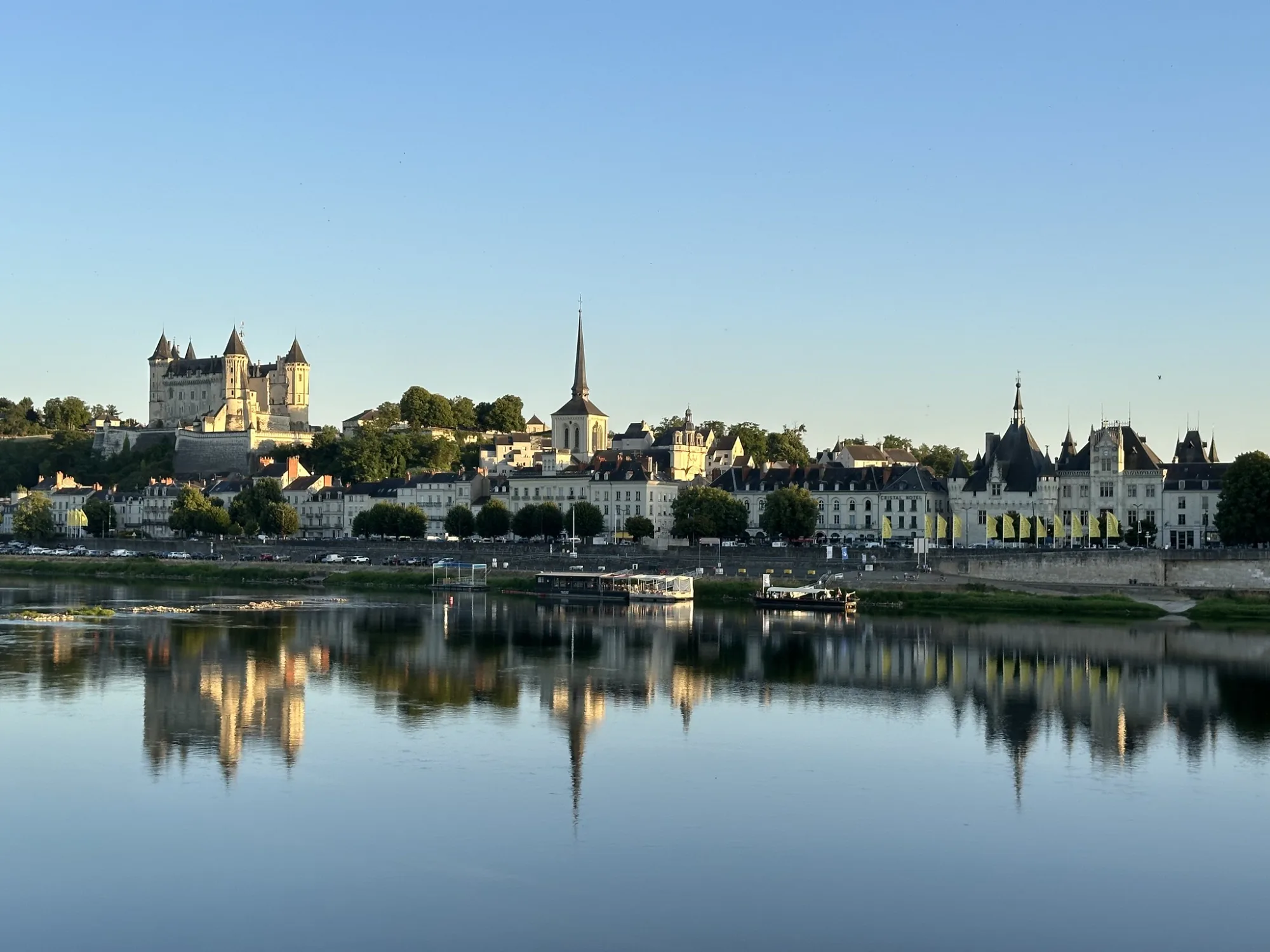
  • A château with pointed towers on the hill above the town, the houses on the riverbank reflected in the calm river
    Photo: Sergei Gussev, CC BY 4.0
    Saumur and Angers

    In Saumur the château stands above the old town, and the longest day of the trip ends here. A day later the fortress of Angers awaits with the Apocalypse Tapestry.

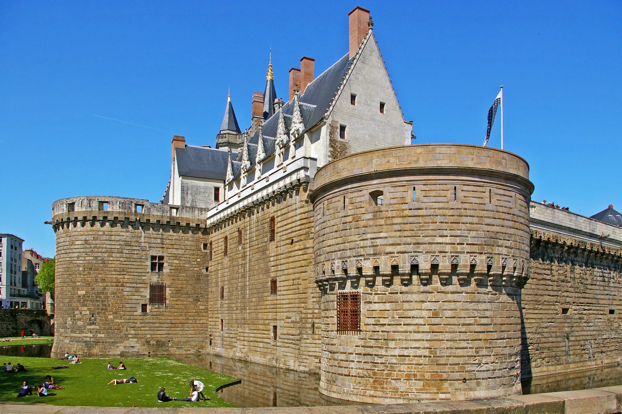
  • Round defensive towers and high walls of light stone, behind them a steep slate roof with gables, a lawn by the moat in front
    Photo: Daniel Jolivet, CC BY 2.0
    Nantes

    At the end of day 8. In the city the ducal castle and the machines on the island await.

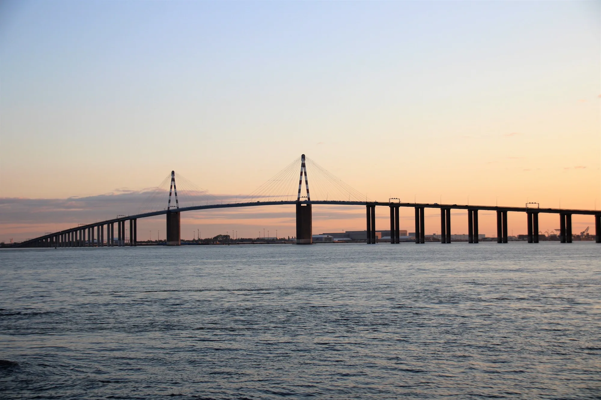
  • A long cable-stayed bridge with two red and white pylons over the wide estuary, the sky orange and blue
    Photo: Olivier Letourneux, CC BY 2.0
    The estuary

    The last day takes you across the Loire by ferry and past artworks on the riverbank to the sea. The bridge to Saint-Nazaire, more than 3 km long, spans the estuary. You don't ride across it by bike, see Getting back.

Across the borders

  • France: No visa for German passports, France is part of the Schengen area. You enter with a valid passport or national ID card, and the temporary documents and the child's passport are accepted too. Every traveller needs their own document, including children. France carries out spot checks at its land borders, and Germany temporarily does so as well. Keep your ID handy. As of 13 November 2026, without guarantee, valid for German passports. (as of 13 November 2026)

No guarantee. What applies at a border can change. Check with the official sources before you set off.

Notes on the route

  • Ferry Couëron – Le Pellerin: on the last day you cross the Loire by ferry after just under 18 km. It is free and runs every 20 minutes. The research did not check the exact operating hours with the Loire-Atlantique department, so look them up before the last day. Without the ferry you take the south bank from Nantes, see the variants.
  • Saint-Nazaire bridge: at the finish, don't ride across the bridge by bike. You get to Saint-Nazaire station by bus or taxi, see Getting back.
  • Floods: after heavy rain in February 2026 parts of the cycle route were flooded, and on 31 March 2026 some were still closed with signposted diversions. Riverside paths can be under water during floods. According to the pages read there is no fixed winter closure.
  • Traffic: according to the tourism bodies traffic gets denser on the way out of Tours with its many junctions, on the levee road after Montjean-sur-Loire and on the north bank in Nantes. Ride there with lights and stay visible.
  • Trailers and tandems: on a few narrow riverside paths the official website advises against trailers and tandems, for example on the riverside path after La Pointe near Angers.
  • Wildfire risk: from 7 to 9 July 2026 an orange alert with restrictions in forests applied in the departments of Loire-Atlantique and Maine-et-Loire. Days like this happen in high summer.

No guarantee. Roadworks, closures and ferries change, current notes are published by the cycle route's operators.

Ride it yourself

Download route as GPX

Open the GPX file with Pedalglobe and choose “Keep exactly (1:1)”. The route is then under “Tours”. With “Add to Trip …” you turn it into your own trip with days, climate and entry rules for your travel dates.

Plan it yourself: This trip and everything here: planned in Pedalglobe in a few minutes, with elevation profile, climate for every day and what applies at each border.

Pedalglobe on the App Store

You can also find new bike trips and short videos about them on Instagram, TikTok and YouTube.

Sources

Sources and check dates
  1. La Loire à Vélo, official website of the cycle route (Centre-Val de Loire and Pays de la Loire regions), checked on 13 November 2026
  2. La Loire à Vélo, suggested trip Cuffy – Blois, checked on 13 November 2026
  3. La Loire à Vélo, suggested trip Blois – Saumur, checked on 13 November 2026
  4. La Loire à Vélo, suggested trip Saumur – Atlantic, checked on 13 November 2026
  5. La Loire à Vélo, route notices, checked on 13 November 2026
  6. La Loire à Vélo, train with a bike compartment, checked on 13 November 2026
  7. Centre-Val de Loire and Pays de la Loire regions, leaflet on the train with a bike compartment (2026 edition), checked on 13 November 2026
  8. La Loire à Vélo, Saint-Nazaire bridge, checked on 13 November 2026
  9. La Loire à Vélo, label for cycle tourers (“Accueil Vélo”), checked on 13 November 2026
  10. La Loire à Vélo, travelling along the route (repairs, rental, luggage), checked on 13 November 2026
  11. La Loire à Vélo, suggestions and places to stay, checked on 13 November 2026
  12. Cycle touring portal of the French tourism bodies, La Loire à Vélo (stages, length, surface), checked on 13 November 2026
  13. Cycle touring portal of the French tourism bodies, stage Nantes – Le Pellerin (ferry), checked on 13 November 2026
  14. Cycle touring portal of the French tourism bodies, Saint-Nazaire bridge, checked on 13 November 2026
  15. EuroVelo 6, Atlantic – Black Sea, checked on 13 November 2026
  16. Météo-France, climate sheet for Tours, means 1991 to 2020, checked on 13 November 2026
  17. Météo-France, climate sheet for Orléans, means 1991 to 2020, checked on 13 November 2026
  18. Météo-France, climate sheet for Nantes-Bouguenais, means 1991 to 2020, checked on 13 November 2026
  19. SNCF, taking your bike on the train, checked on 13 November 2026
  20. Service Public (France), new rules for bikes on long-distance trains from 13 December 2026, checked on 13 November 2026
  21. Château de Chambord, history, checked on 13 November 2026
  22. Federal Foreign Office (Germany), France: travel and safety advice, checked on 13 November 2026
  23. OpenStreetMap contributors, ways, surfaces and cycle routes along the route (route calculation of 13 November 2026), checked on 13 November 2026

Photos

Checked on 18 November 2026. Maps © OpenStreetMap contributors. Relief: © Mapterhorn and its sources

All trip ideas

More cycling trips

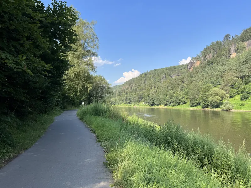
A narrow asphalt cycle path between trees and tall grass on the bank of the Elbe, opposite wooded slopes with sandstone cliffs under a blue sky

Difficulty: easyNew

Elbe and Vltava: Dresden – Prague

  • 232 kmDistance
  • 4 daysDays
  • May, June, SeptemberBest months
  • Germany, CzechiaCountries

232 km in four riding days up the Elbe, through the Elbe Sandstone Mountains and the Central Bohemian Uplands, past Mělník and up the Vltava to Prague.

Photo: Lukas Beck, CC BY 4.0, cropped, with text

See all cycling trips

ContentsPedalglobe on the App Store