


Difficulty: easyNew
Alpe-Adria: cycle route Salzburg – Grado
- 374 kmDistance
- 8 daysDays
- June, SeptemberBest months
- Austria, ItalyCountries
Your next bike trip?
770 km and 16 days from the Danube over the Fernpass and the Reschenpass to Venice.
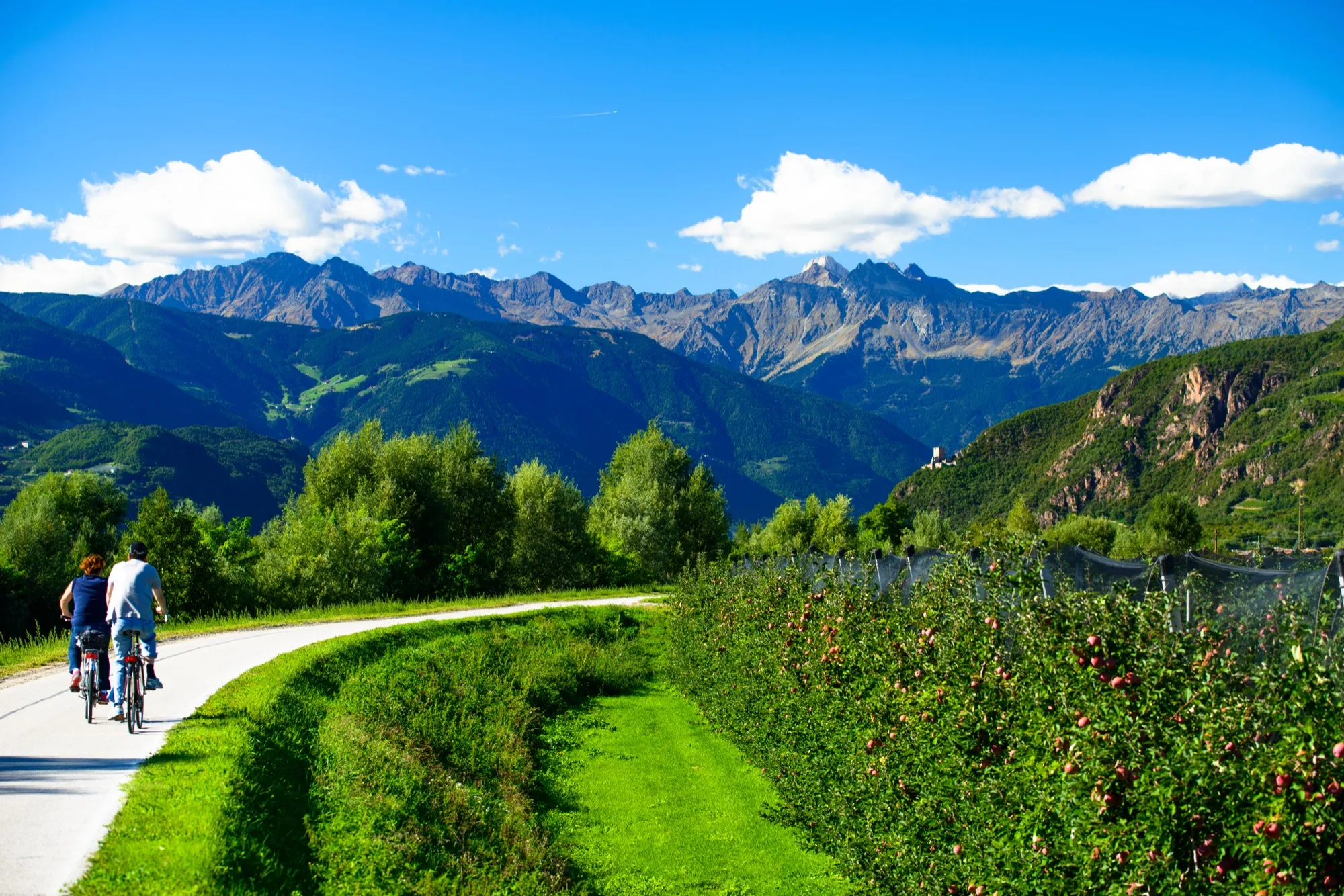
Photo: Siegfried Rabanser, CC BY 2.0, cropped, with text

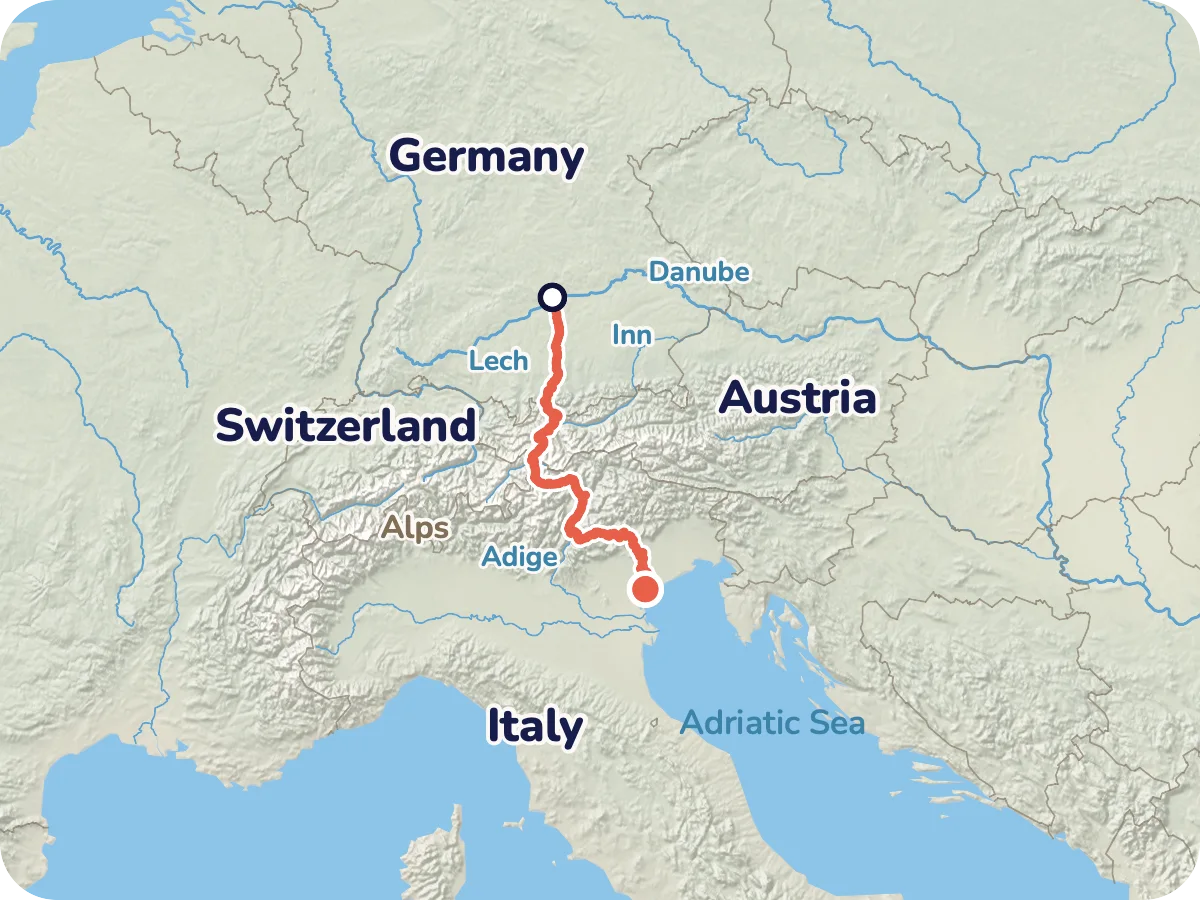
Map © OpenStreetMap contributors, OpenFreeMap, OpenMapTiles. Relief: Mapterhorn. Locator map: Natural Earth
From Donauwörth you ride via Augsburg and up the Lech to Landsberg and Füssen, then over Reutte and the Fernpass to Imst and Landeck. Next come Pfunds, Martina and the Norbertshöhe to Nauders, over the Reschenpass past Lake Reschen and through the Vinschgau valley to Merano and Bolzano. At Trento the Via Claudia Augusta splits. You follow the Altinate branch through the Valsugana and over the Tesino high valley to Lamon, over the Croce d'Aune to Feltre and over the Passo Praderadego to Follina. Via Treviso you reach Altino on the lagoon, the official end of the cycle route. The last day takes you via Mestre and the cycle path on the Ponte della Libertà into Venice, as far as Piazzale Roma.
Two passes lie on the way: the Fernpass at about 1,200 m and the Reschenpass at about 1,500 m. The calculated route reaches its highest point at 1,543 m just beyond the pass at Lake Reschen. The day with the most climbing is the 13th from Feltre to Follina with 1,145 m up, closely followed by the 11th with 1,109 m.
Length and climbing come from the route calculation in Pedalglobe: 770 km, 6,229 m up and 6,572 m down, with heights from a terrain model. To Altino our route is 742 km. The Via Claudia Augusta website gives about 700 km from Donauwörth to Altino, ÖAMTC 717 km, the Trentino tourism board 752 km to Venice. Why our route is longer than the official figures we have not cleared up, probably because of variants. The official site gives no total for the climbing and other sources contradict each other, so the figure here is the one from our calculation. We checked days 11 to 15 against the official description of the Altinate branch (sections 34a to 41a) and the places match. Day 16 from Altino to Venice is not part of the signed Via Claudia Augusta, it comes from our route calculation. There is no guarantee that the route is passable. Read the notes on the route first.
Plan it yourself: This trip and everything here: planned in Pedalglobe in a few minutes, with elevation profile, climate for every day and what applies at each border.
45 km · 120 m of climbing
The start is on the Danube at 404 m, from here you head south. The way is mostly asphalt on cycle paths and quiet roads, before Augsburg the map shows about 5 km of firm gravel. Augsburg's water management system has been a UNESCO World Heritage site since 6 July 2019.
40 km · 99 m of climbing
A quiet day along the Lech with no real climbing. According to the map about 8 of 40 km are firm gravel, the rest asphalt. In Landsberg the triangular main square with the Schmalzturm is worth a look.
71 km · 412 m of climbing
The longest day, 71 km and 412 m up to 823 m, almost entirely asphalt. The Forggensee lies on the way, the Via Claudia Augusta website mentions a boat across the reservoir, whether it takes bikes is not documented. In Füssen the Lech spills over the weir of the Lechfall.
39 km · 445 m of climbing
Over the border into Austria and on to Reutte, at the end the climb to Biberwier up to 1,128 m. According to the map only about 2 km are gravel. Above Reutte towers the ruin of Ehrenberg Castle. The Via Claudia Augusta names the Ausserfernbahn Reutte – Heiterwang-Plansee, about 9 minutes, bikes in the car behind the railcar.
54 km · 433 m of climbing
The Fernpass at about 1,200 m, ridden on the old gravel track. According to the map the day has about 12 of 54 km without a firm surface, of which about 8 km loose. Loose ground is difficult downhill, the bus to Fernstein is an alternative, no e-bikes. After that you ride over Imst to Landeck, 640 m downhill.
52 km · 790 m of climbing
The first hard climbing day, 790 m up in 52 km. Over Pfunds, Martina and the Norbertshöhe at 1,409 m you ride to Nauders at 1,330 m. A cycling ban with a signed diversion applies here on the B 180, see the notes. The map shows about 4 km without a firm surface.
51 km · 281 m of climbing
Over the Reschenpass at about 1,500 m, at Lake Reschen with the tower of Alt-Graun, the highest point of the route at 1,543 m. Then 921 m downhill through the Vinschgau valley to Schlanders, almost entirely asphalt.
69 km · 33 m of climbing
Almost all downhill, 69 km through the Adige valley via Merano to Bolzano. In Merano lie the Gardens of Trauttmansdorff Castle with four garden worlds. A rest day follows: behind you lie two passes, ahead from day 11 three days with over 600 m of climbing each. Bolzano or Merano are suitable for the rest.
63 km · 123 m of climbing
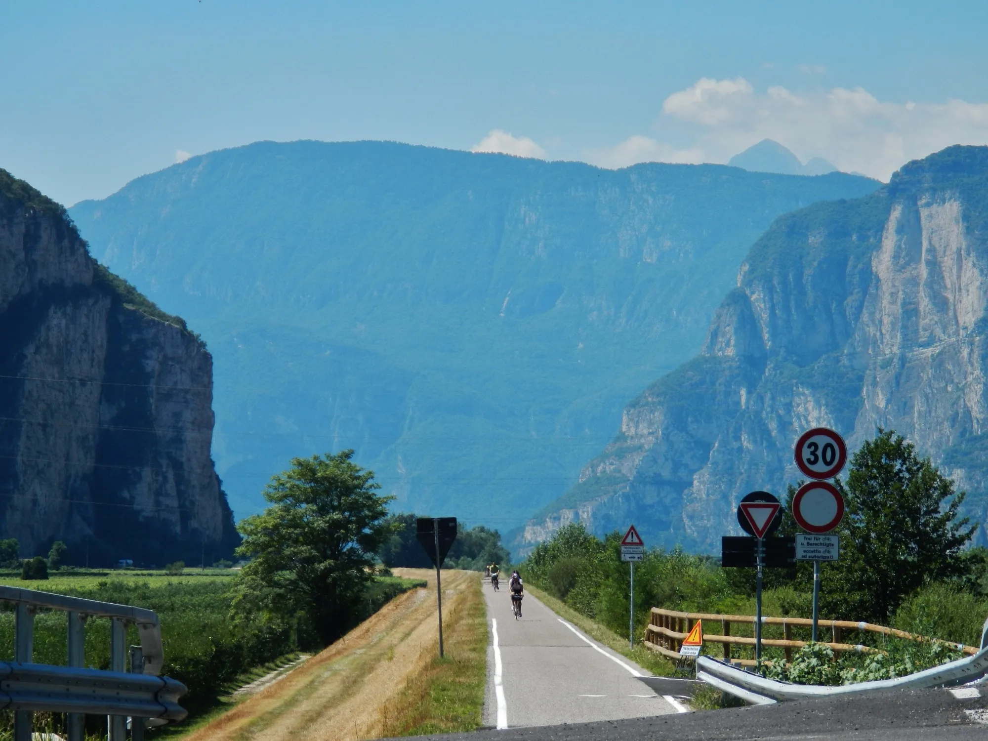
A flat day on the Adige cycle path, 63 km and only 123 m up. Almost entirely asphalt. At Trento the Via Claudia Augusta splits, you follow the Altinate branch.
41 km · 438 m of climbing
From Trento through the Valsugana, 438 m up in 41 km. The train Trento – Pergine saves the first big climb. The surface is mostly asphalt.
45 km · 1,109 m of climbing
The way leads up into the Tesino high valley via Bieno and Castello Tesino, with 1,109 m up and 1,065 m down in 45 km, highest point 927 m. The Via Claudia Augusta website names Bieno as the end of the hardest climb. The shuttle to Tesino ended in 2024, according to the site the route is quite rideable on your own. Between Lamon and San Donato there is a gravel variant.
25 km · 617 m of climbing
Short and hard: 25 km, 617 m up to the Croce d'Aune at up to 1,020 m, then winding down to Feltre. The shuttle from Ponte Oltra ended in 2024. It is flatter via Fonzaso. In Feltre lies the Piazza Maggiore.
48 km · 1,145 m of climbing
The day with the most climbing, 1,145 m up in 48 km. Through the Valbelluna via Cesiomaggiore and Lentiai to Bardies, where the climb to the Passo Praderadego begins, the highest point of the day is at 920 m. The shuttle from Piazze di Mel only runs with online booking. A winding descent leads into the Valmareno to Follina.
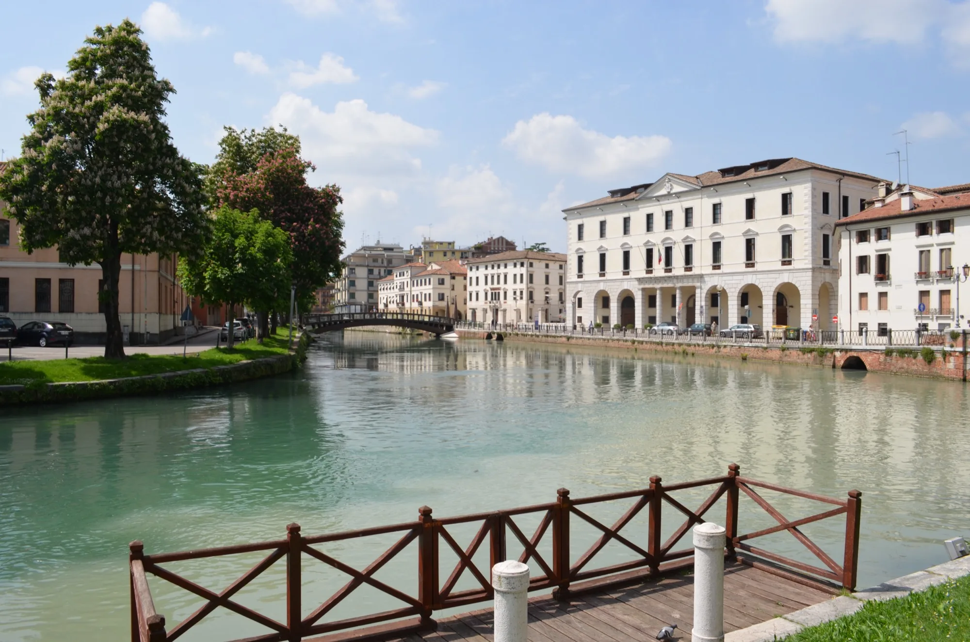
60 km · 164 m of climbing
A day through the Prosecco hills. The official description names Pieve di Soligo, Collalto Castle, Susegana and the crossing of the Piave at Ponte della Priula. According to the map you ride almost entirely on asphalt, 322 m downhill. In Treviso the Sile flows through the town.
39 km · 8 m of climbing
Flat, over Silea, Roncade and Quarto d'Altino according to the official description. According to the map about 18 of 39 km are without a firm surface. In Altino the signed cycle route ends on the lagoon, the remains of the Roman port town of Altinum lie in the museum and the excavation.
28 km · 8 m of climbing
The last day, 28 km and flat, is no longer part of the signed Via Claudia Augusta. According to the map you ride about 1.7 km on a busy road without a cycle path after Altino, then on minor roads and cycle paths to Mestre. Around Piazza Ferretto there is about 0.6 km of pedestrian zone. From Mestre a cycle path leads past Forte Marghera and Parco San Giuliano onto the Ponte della Libertà, a good 4 km across the lagoon to Piazzale Roma. That is where it ends, cycling is banned in Venice's old town.
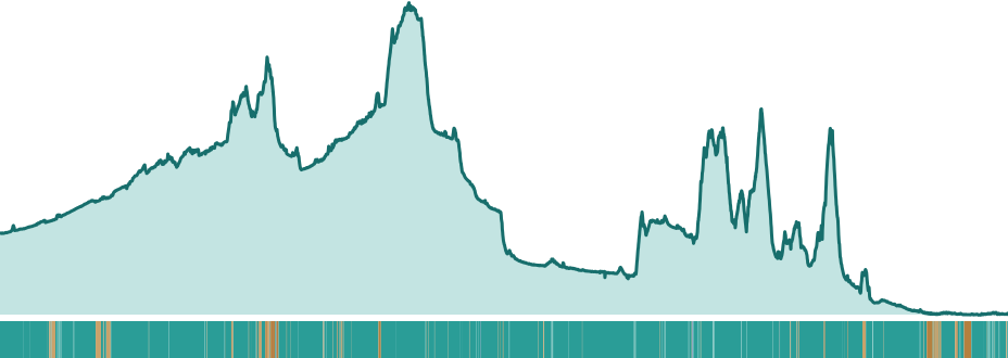
According to the map (OpenStreetMap) you ride 91 % on asphalt and 4 % on firm gravel, plus 3 % loose ground and a small remainder of cobbles and smooth paving. The Via Claudia Augusta website describes mostly asphalted cycle paths and quiet minor roads with few gravel sections.
The map shows the most gravel on the second-to-last day between Treviso and Altino, about 18 of 39 km without a firm surface, then at the Fernpass with about 12 of 54 km, of which around 8 km are loose ground. On the second day before Landsberg it is about 8 of 40 km.
On traffic: according to the map 34 % of the route is on cycle paths, 24 % on quiet roads, 16 % on tracks and paths and 26 % on roads (21 %) and busy roads (5 %). 84 % of the route runs on signed cycle routes. What the surface is really like changes with the season and roadworks.
Overall: medium. Sixteen days averaging about 48 km, two passes, up to 1,145 m of climbing in a day and two features on level 3.
The Pedalglobe scale: the same five features and levels 1 to 5 for every trip.
A trip for anyone who rides several days in a row with luggage and does not shy away from passes: sixteen days averaging about 48 km and up to 1,145 m of climbing in a day. The sources disagree. The Via Claudia Augusta says “no harder than a river cycle route”, ÖAMTC rates the route medium with demanding sections, the Trentino tourism board hard. By the values on this page it is medium, because climbing and traffic are each on level 3.
A trekking bike is fine, wider tyres help on gravel. A road bike is unsuited to the gravel stretches, and at the Fernpass the official site recommends the bus for road bikes.
Best months: June, September
The best time is June or September. Then daytime highs in Landeck average 24 and 20 degrees in the long-term mean, and nights stay mild at the pass: in Nauders, about 170 m below the Reschenpass, the mean of the lows is 7.8 degrees in June and 6.1 in September. In September it rains far less there, 64 mm against 115 mm in August. May works with reservations (Nauders averages 16 degrees by day and 4.6 at night), and so does early October (Nauders 11.7 and 2.3 degrees).
July and August are the wettest months in the Alps: Landeck gets 105 mm in July and 125 mm in August, Nauders 98 and 115 mm, Augsburg 94 mm in July. In the south it gets hot, in Venice the daytime high in July averages 27.7 degrees (mean 1971 to 2000, a different period, probably warmer today). Around 15 August finding a room in popular holiday areas is difficult.
The table shows the Landeck station (796 m, long-term mean 1991 to 2020, source: GeoSphere Austria, official monthly values). It lies after 250 of 770 km in the first third of the route. It is colder at the pass: Nauders sits at 1,330 m and the Reschenpass is higher still.
If you want to cross the Fernpass and the Reschenpass before mid-May, expect frost and snow, in Nauders the mean of the lows is minus 3.3 degrees in March and 0.4 in April. The Via Claudia Augusta website says you experience three seasons on one tour in late April and early May. It has a menu item “in every season”, there is no official cycling season, and according to the climate means the pass route is not for cycle touring in winter. The values are long-term means, not a weather forecast.
| Month | Day | Night | Precipitation | For cycling |
|---|---|---|---|---|
| January | 3 °C | -4 °C | 54 mm | poor |
| February | 6 °C | -3 °C | 41 mm | poor |
| March | 12 °C | 1 °C | 51 mm | poor |
| April | 16 °C | 4 °C | 38 mm | poor |
| May | 20 °C | 8 °C | 65 mm | marginal |
| June | 24 °C | 11 °C | 96 mm | good |
| July | 26 °C | 13 °C | 105 mm | marginal |
| August | 25 °C | 13 °C | 125 mm | marginal |
| September | 20 °C | 9 °C | 70 mm | good |
| October | 15 °C | 5 °C | 59 mm | marginal |
| November | 8 °C | 1 °C | 52 mm | poor |
| December | 3 °C | -3 °C | 59 mm | poor |
Winter. In Landeck on average 3 degrees by day and minus 4 at night, in Nauders about zero by day and minus 8 at night. No time for the pass.
Winter. In Landeck on average 6 degrees by day and minus 3 at night, in Nauders 2 and minus 7.
Still winter at the pass: in Nauders on average 7 degrees by day and minus 3 at night, in Landeck 12 and 1.
Still frosty at the pass: in Nauders on average 12 degrees by day and 0 at night, in Landeck 16 and 4.
Green, but still fresh at the pass: in Nauders on average 16 degrees by day and 5 at night, in Landeck 20 and 8.
Best time. In Landeck on average 24 degrees by day and 11 at night, in Nauders 7.8 at night. Landeck gets 96 mm.
Warm and wet: in Landeck on average 26 degrees by day and 105 mm of rain, in the south in Venice 27.7 degrees by day (mean 1971 to 2000).
Warm and the wettest month: in Landeck 25 degrees by day and 125 mm, in Nauders 115 mm. Around 15 August finding a room is difficult.
Best time. In Landeck on average 20 degrees by day and 9 at night, in Nauders 6.1 at night. Nauders gets 64 mm against 115 in August.
Cooler: in Landeck on average 15 degrees by day and 5 at night, in Nauders 12 and 2. Early October is fine, later it gets cold at the pass.
Cold and damp: in Landeck on average 8 degrees by day and 1 at night, in Nauders 5 and minus 2.
Winter. In Landeck on average 3 degrees by day and minus 3 at night, in Nauders about zero by day and minus 6 at night.
Donauwörth has a railway station on the line. We did not check getting there with a bike, so read the timetable and the rules for taking a bike with the railway beforehand.
In Venice the ride ends at Piazzale Roma. Cycling is banned in the old town, pushing too. According to the City of Venice the only exception is pushing the bike on the short way from Piazzale Roma over the Ponte della Costituzione to Santa Lucia station and on to the Ponte degli Scalzi. According to the city there are bike boxes in the municipal car park at Piazzale Roma. If you stop in Altino, regional trains from Quarto d'Altino take about 26 to 35 minutes to Venice (as of 10 November 2026).
Back to Germany: the Via Claudia Augusta website lists a bike shuttle Italy to Germany on six weekdays, not on Saturdays, booked through its site. By rail, according to Deutsche Bahn the EC over the Brenner takes bikes with a bike ticket and a seat reservation, booked at the travel centre. From Venice you go first to Verona, on a regional train with a bike symbol. Check this carefully before you travel, the railway's information on larger bikes is not clear.
On Italian regional trains only a train with a bike symbol takes bikes, according to the Italian state railway for a 3.50 euro surcharge, we did not check the Veneto page separately. The Valsugana train Trento – Pergine saves the first big climb after Trento. The Ausserfernbahn Reutte – Heiterwang-Plansee takes about 9 minutes, bikes travel in the car behind the railcar (Via Claudia Augusta).
The route passes through villages almost every day. Where exactly there are shops and water the research did not check, nor whether wild camping is allowed, ask locally. Before the passes (Fernpass, Reschenpass, Croce d'Aune, Praderadego) take water and food for the climb.
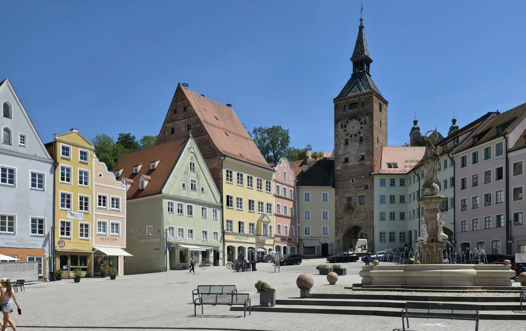
The main square has an unusual triangular shape. At its edge stands the Schmalzturm from the 13th century, and the Bayertor of 1425 was the eastern entrance to the town on the salt road.
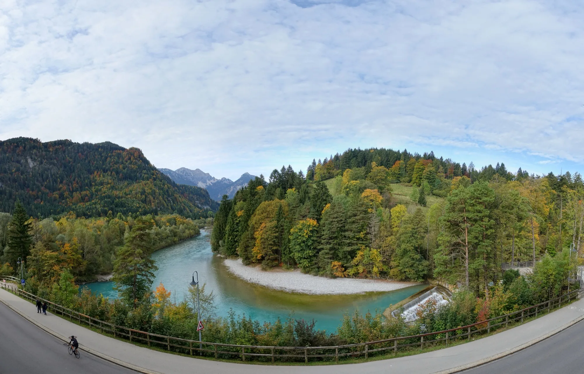
The Lechfall is not a natural waterfall but a weir built from 1784 to 1787. Here the Lech drops about 8 m into a short gorge on the southern edge of Füssen.
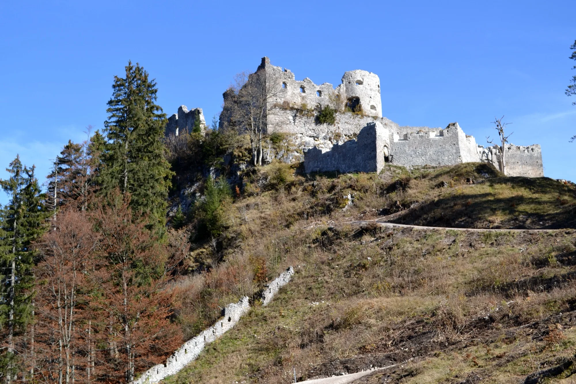
High above Reutte stands the ruin of Ehrenberg Castle, probably built around 1290. The Klause at the foot of the rock, a barrier on the road, is first mentioned in 1317.
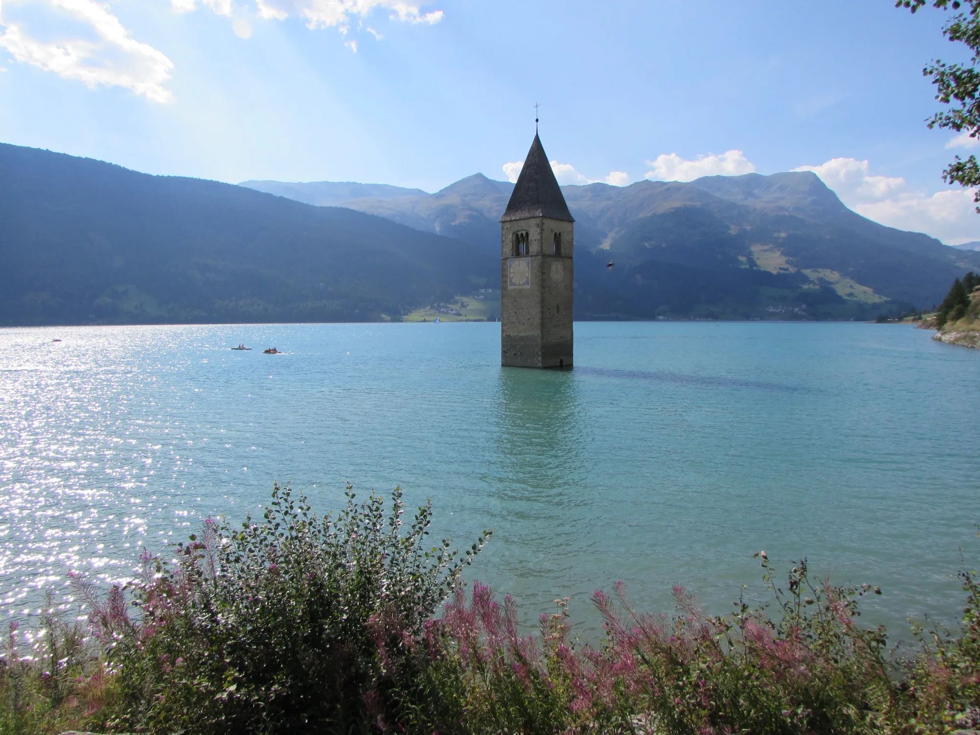
The tower of the church of Alt-Graun from the 14th century rises from the lake, the other houses were flooded for the reservoir in the summer of 1950. The lake level is at 1,498 m.
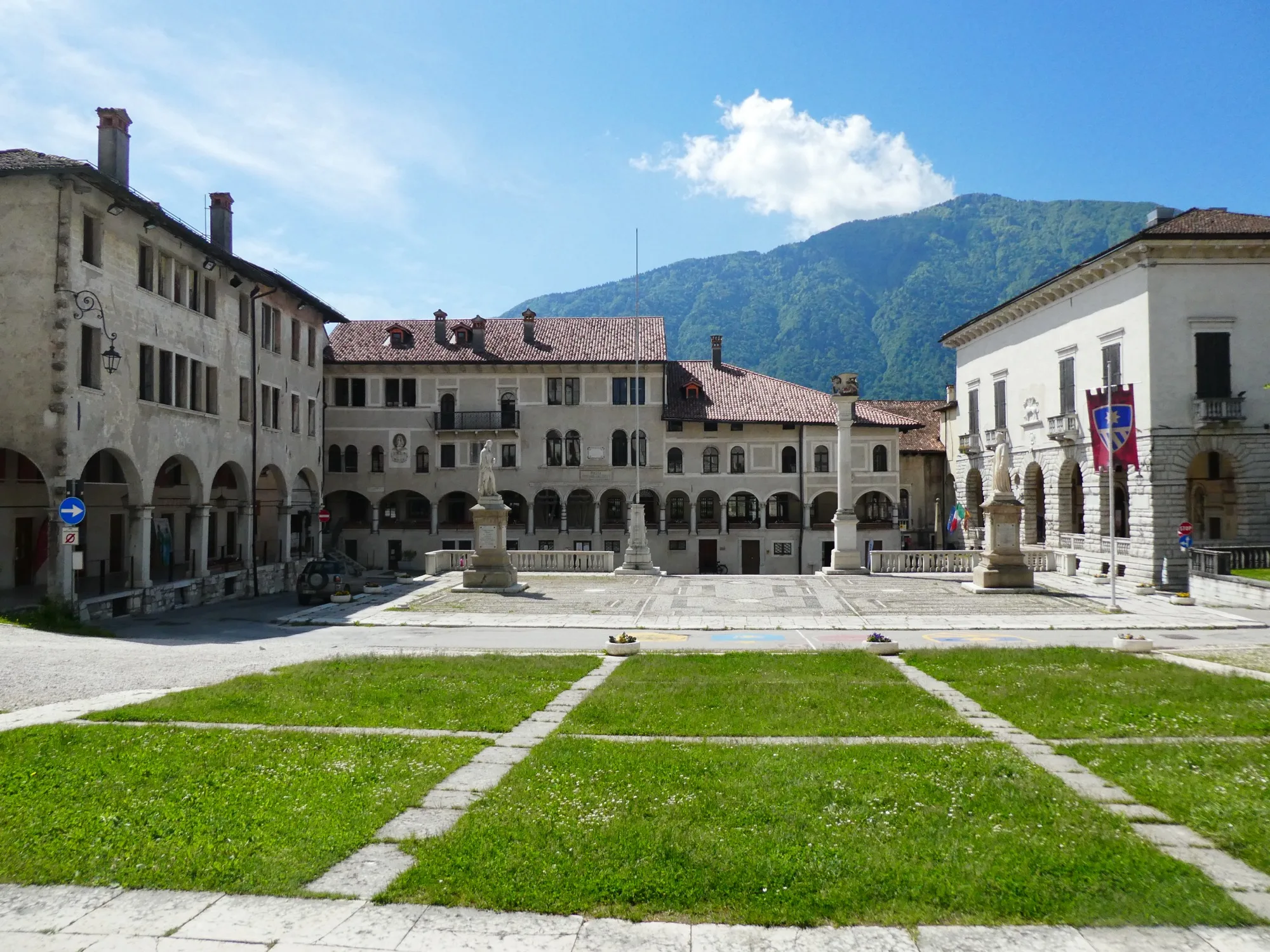
Feltre lies at 325 m. In the War of the League of Cambrai, which began in 1509, the town was almost entirely destroyed and then rebuilt as an old town in the Renaissance style. The main square is the Piazza Maggiore.
No guarantee. What applies at a border can change. Check with the official sources before you set off.
No guarantee. Roadworks, closures and ferries change, current notes are published by the cycle route's operators.
Open in Pedalglobe Download route as GPX
“Open in Pedalglobe” takes you to the trip in the app. If you stay in Safari, tap “Open” in the banner at the top or download the tour file. The app splits the days by your pace, so the daily stops may differ from the stages here.
Open the GPX file with Pedalglobe and choose “Keep exactly (1:1)”. The route is then under “Tours”. With “Add to Trip …” you turn it into your own trip with days, climate and entry rules for your travel dates.
Plan it yourself: This trip and everything here: planned in Pedalglobe in a few minutes, with elevation profile, climate for every day and what applies at each border.
You can also find new bike trips and short videos about them on Instagram, TikTok and YouTube.
Checked on 10 November 2026. Maps © OpenStreetMap contributors. Relief: © Mapterhorn and its sources
Difficulty: easyNew
Difficulty: moderateNew
Difficulty: easyNew
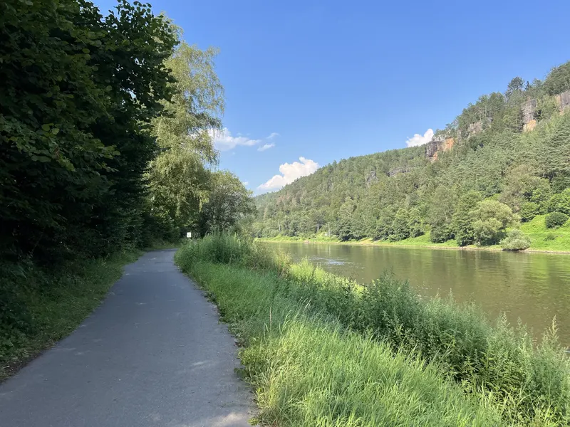
232 km in four riding days up the Elbe, through the Elbe Sandstone Mountains and the Central Bohemian Uplands, past Mělník and up the Vltava to Prague.
Photo: Lukas Beck, CC BY 4.0, cropped, with text


